Lêer:Bl-map.png
From Wikipedia, the free encyclopedia
Bl-map.png (327 × 350 piksels, lêergrootte: 12 KG, MIME-tipe: image/png)
Hierdie lêer kom vanaf Wikimedia Commons en kan ook in ander projekte gebruik word. Die beskrywing op die lêer se inligtingsblad word hieronder weergegee.

|
This locator map image could be re-created using vector graphics as an SVG file. This has several advantages; see Commons:Media for cleanup for more information. If an SVG form of this image is available, please upload it and afterwards replace this template with
{{vector version available|new image name}}.
It is recommended to name the SVG file “Bl-map.svg”—then the template Vector version available (or Vva) does not need the new image name parameter. |
Opsomming
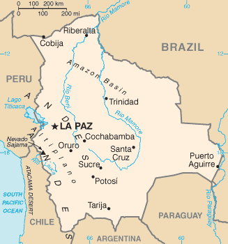
| BeskrywingBl-map.png | Bolivia map from CIA World Factbook (since 2 Junie 2004), converted from original GIF format |
| Datum | |
| Bron |
CIA World Factbook |
| Outeur | United States Central Intelligence Agency |
| Ander weergawes |
Lisensiëring
| Public domainPublic domainfalsefalse |
This image is in the public domain because it contains materials that originally came from the United States Central Intelligence Agency's World Factbook.
Bahasa Indonesia ∙ čeština ∙ Deutsch ∙ eesti ∙ English ∙ español ∙ Esperanto ∙ français ∙ galego ∙ hrvatski ∙ italiano ∙ Nederlands ∙ norsk nynorsk ∙ polski ∙ português ∙ sicilianu ∙ slovenščina ∙ suomi ∙ Türkçe ∙ Zazaki ∙ беларуская (тарашкевіца) ∙ македонски ∙ русский ∙ српски / srpski ∙ українська ∙ ქართული ∙ বাংলা ∙ தமிழ் ∙ മലയാളം ∙ 한국어 ∙ 日本語 ∙ 中文 ∙ 中文(简体) ∙ 中文(繁體) ∙ العربية ∙ +/− |
 |
Derivative works
-
 Bl-map mk.png
македонски -
 Bolivie carte.gif
français -
 Bolivyaharita.jpg
Türkçe -
 Ka Bolivia-Map.png
ქართული


Captions
Items portrayed in this file
uitbeelding
2 Junie 2004
media type Engels
image/png
checksum Engels
a9a81b224ef15e71f74968a044cbd2bba564d997
data size Engels
12 464 greep
height Engels
350 pieksel
width Engels
327 pieksel
Lêergeskiedenis
Klik op die datum/tyd om te sien hoe die lêer destyds gelyk het.
| Datum/Tyd | Duimnael | Dimensies | Gebruiker | Opmerking | |
|---|---|---|---|---|---|
| huidig | 09:15, 17 Junie 2008 | | 327 × 350 (12 KG) | Sevela.p | Remove black line on the left side |
| 17:52, 27 Februarie 2005 |  | 328 × 350 (12 KG) | Alfio | CIA map of Bolivia |
Lêergebruik
Die volgende 7 bladsye gebruik dié lêer:
Globale lêergebruik
Die volgende ander wiki's gebruik hierdie lêer:
- Gebruik in ar.wikipedia.org
- Gebruik in ast.wikipedia.org
- Gebruik in ay.wikipedia.org
- Gebruik in be.wikipedia.org
- Gebruik in bn.wikipedia.org
- Gebruik in bn.wikibooks.org
- Gebruik in bo.wikipedia.org
- Gebruik in ca.wikipedia.org
- Gebruik in cs.wikipedia.org
- Gebruik in da.wikipedia.org
- Gebruik in de.wikibooks.org
- Gebruik in de.wikinews.org
- Gebruik in dsb.wikipedia.org
- Gebruik in dz.wikipedia.org
- Gebruik in el.wikipedia.org
- Gebruik in en.wikipedia.org
- List of islands of South America
- Talk:Geography of Bolivia
- Outline of Bolivia
- Irrigation in Bolivia
- Water resources management in Bolivia
- Agriculture in Bolivia
- Module:Location map/data/Bolivia/doc
- Module:Location map/data/Bolivia
- User:Gonzalezmwalter/Bolivia and the International Monetary Fund
- User:Gonzalezmwalter/IMF Bolivia
- Bolivia and the International Monetary Fund
- Gebruik in en.wikibooks.org
- Gebruik in en.wikinews.org
- Gebruik in en.wikisource.org
- Gebruik in eo.wikipedia.org
- Gebruik in es.wikipedia.org
- Gebruik in es.wikibooks.org
Wys meer globale gebruik van die lêer.