File:DCongoManiema.png
From Wikipedia, the free encyclopedia
No higher resolution available.
DCongoManiema.png (600 × 600 pixels, file size: 88 KB, MIME type: image/png)
| This is a file from the Wikimedia Commons. Information from its description page there is shown below. Commons is a freely licensed media file repository. You can help. |
Summary
| DescriptionDCongoManiema.png |
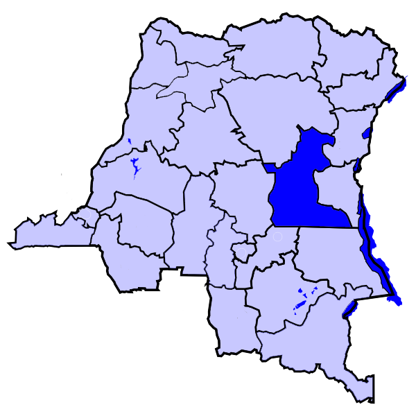
Svenska: DR Kongo, karta, från engelska Wikipedia. |
| Date | 27 October 2005 (original upload date) |
| Source | No machine-readable source provided. Own work assumed (based on copyright claims). |
| Author | No machine-readable author provided. Eruedin assumed (based on copyright claims). |
Licensing
| Public domainPublic domainfalsefalse |
| I, the copyright holder of this work, release this work into the public domain. This applies worldwide. In some countries this may not be legally possible; if so: I grant anyone the right to use this work for any purpose, without any conditions, unless such conditions are required by law. |
Captions
Add a one-line explanation of what this file represents
Items portrayed in this file
depicts
27 October 2005
image/png
871476dfec0a03f9b97e14b5308d3ddf814f280e
90,077 byte
600 pixel
600 pixel
File history
Click on a date/time to view the file as it appeared at that time.
| Date/Time | Thumbnail | Dimensions | User | Comment | |
|---|---|---|---|---|---|
| current | 09:38, 28 February 2006 | | 600 × 600 (88 KB) | Themalau | Locator map for the Province of Maniema, in the Democratic Republic of the Congo. {{PD-self}} |
| 10:32, 27 October 2005 |  | 200 × 197 (16 KB) | Eruedin |
File usage
The following pages on the English Wikipedia use this file (pages on other projects are not listed):
Global file usage
The following other wikis use this file:
- Usage on be.wikipedia.org
- Usage on he.wikipedia.org
- Usage on hu.wikipedia.org
- Usage on kg.wikipedia.org
- Usage on ln.wikipedia.org
- Usage on ms.wikipedia.org
- Usage on pt.wikipedia.org
- Usage on ro.wikipedia.org
- Usage on war.wikipedia.org
- Usage on wa.wikipedia.org
Retrieved from "https://en.wikipedia.org/wiki/File:DCongoManiema.png"