File:IranKhuzestan.png
From Wikipedia, the free encyclopedia
Size of this preview: 648 × 599 pixels. Other resolutions: 260 × 240 pixels | 519 × 480 pixels | 879 × 813 pixels.
Original file (879 × 813 pixels, file size: 25 KB, MIME type: image/png)
| This is a file from the Wikimedia Commons. Information from its description page there is shown below. Commons is a freely licensed media file repository. You can help. |
Summary

|
File:IranKhuzestan-SVG.svg is a vector version of this file. It should be used in place of this PNG file.
File:IranKhuzestan.png → File:IranKhuzestan-SVG.svg
For more information, see Help:SVG.
|
 |
- Created by Morwen
Licensing
| This file is licensed under the Creative Commons Attribution-Share Alike 3.0 Unported license. Subject to disclaimers. | ||
| ||
| This licensing tag was added to this file as part of the GFDL licensing update.http://creativecommons.org/licenses/by-sa/3.0/CC BY-SA 3.0Creative Commons Attribution-Share Alike 3.0truetrue |

|
Permission is granted to copy, distribute and/or modify this document under the terms of the GNU Free Documentation License, Version 1.2 or any later version published by the Free Software Foundation; with no Invariant Sections, no Front-Cover Texts, and no Back-Cover Texts. A copy of the license is included in the section entitled GNU Free Documentation License. Subject to disclaimers.http://www.gnu.org/copyleft/fdl.htmlGFDLGNU Free Documentation Licensetruetrue |
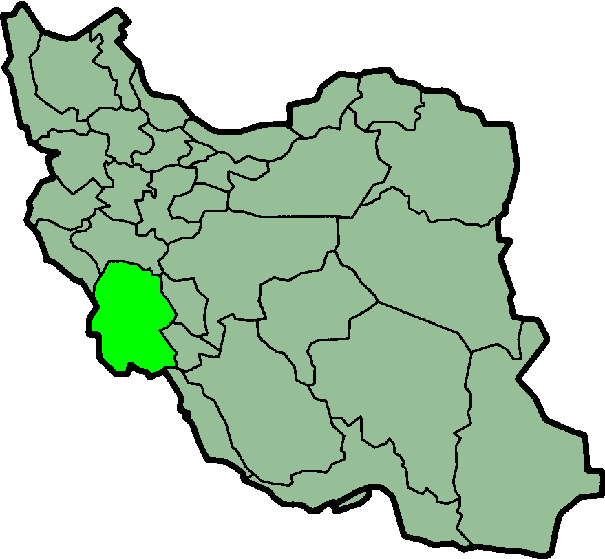
| DescriptionIranKhuzestan.png |
Province of Khuzestan, Iran Suomi: Khuzestanin sijainti Iranissa
Nederlands: Locatie van Khuzestan |
| Date | (UTC) |
| Source | http://en.wikipedia.org/wiki/Image:IranKhuzestan.png |
| Author | Morven |
| Permission (Reusing this file) |
GFDL |
Captions
Add a one-line explanation of what this file represents
Items portrayed in this file
depicts
30 January 2004
File history
Click on a date/time to view the file as it appeared at that time.
| Date/Time | Thumbnail | Dimensions | User | Comment | |
|---|---|---|---|---|---|
| current | 23:58, 23 June 2013 | | 879 × 813 (25 KB) | BasilLeaf | بروزرسانی مرز بین استانهای یزد و خراسان جنوبی، تهران و البرز، فارس و یزد و اصفهان |
| 11:51, 12 November 2010 |  | 879 × 813 (41 KB) | M samadi | Border of some provinces updated. | |
| 12:59, 13 October 2010 |  | 697 × 614 (117 KB) | Amin19850 | Tehran & Alborz Province is divided | |
| 22:52, 10 March 2007 |  | 697 × 614 (94 KB) | KureCewlik81 | ||
| 08:06, 8 November 2006 |  | 200 × 185 (10 KB) | Raymond | transparent background, improved colour palette | |
| 08:46, 15 September 2005 |  | 200 × 185 (20 KB) | Kotoito | Province of Khuzestan, Iran Created by Morwen |
File usage
More than 100 pages use this file. The following list shows the first 100 pages that use this file only. A full list is available.
- 2005 Ahvaz unrest
- Abadan Island
- Aghajari
- Ahwaz Ridge
- Alvan, Iran
- Alvar-e Garmsiri District
- Andika County
- Andimeshk County
- Armish
- Arvandkenar
- Arvandkenar District
- Bagh-e Malek
- Bagh-e Malek County
- Bakhtegan
- Bandar-e Emam Khomeyni District
- Bavi County
- Behbahan County
- Bostan, Iran
- Central District (Abadan County)
- Central District (Aghajari County)
- Central District (Ahvaz County)
- Central District (Andimeshk County)
- Central District (Bavi County)
- Central District (Behbahan County)
- Central District (Izeh County)
- Central District (Khorramshahr County)
- Central District (Mahshahr County)
- Chamran, Iran
- Darb
- Dasht-e Azadegan County
- Dehdez
- Dehdez District
- Dezful Airport
- Emam Reza
- Gotvand
- Gotvand County
- Haftkel
- Haftkel County
- Hamidiyeh
- Hamidiyeh District
- Hanzaleh
- Hendijan
- Hendijan County
- Horr, Iran
- Hoseyniyeh, Khuzestan
- Hoveyzeh
- Hoveyzeh County
- Izeh
- Izeh County
- Jarahi River
- Jayezan
- Khamas, Khuzestan
- Khorramshahr County
- Khuzestan Plain
- Lali, Iran
- Lali County
- Mahshahr Airport
- Mahshahr County
- Marun River
- Masjed Soleyman County
- Mianrud
- Minu District
- Minu Island
- Minushahr
- Mollasani
- Moqavemat
- Nâseri
- Omidiyeh
- Omidiyeh County
- Politics of Khuzestan province
- Qaleh-ye Khvajeh
- Qaleh Tall
- Qasem Soleimani International Airport
- Rafi, Iran
- Ramhormoz
- Ramhormoz County
- Ramshir
- Ramshir County
- Safiabad, Khuzestan
- Saland, Iran
- Sardasht, Khuzestan
- Seydun
- Shadegan
- Shadegan County
- Shahr-e Emam
- Shahrdari Mahshahr C.S.C.
- Shalamcheh
- Sharu
- Sheyban, Iran
- Shirin Shahr
- Shush, Iran
- Shush County
- Shushtar County
- Susangerd
- Taryana
- Tashan District
- Veys
- Veys District
- Zahreh
- Zeydun District
View more links to this file.
Global file usage
The following other wikis use this file:
- Usage on ar.wikipedia.org
- Usage on bn.wikipedia.org
- Usage on ca.wikipedia.org
- Usage on ceb.wikipedia.org
- Usage on ckb.wikipedia.org
- Usage on cy.wikipedia.org
- Usage on da.wikipedia.org
- Usage on el.wikipedia.org
- Usage on fa.wikinews.org
- Usage on glk.wikipedia.org
- الگو:خوزستان
- خۊزستان ٚ اۊستان
- شهرستان آبادان
- شهرستان امیدیه
- شهرستان اندیمشک
- شهرستان اهواز
- شهرستان ایذه
- شهرستان باغ ملک
- شهرستان بندر ماهشهر
- شهرستان بهبهان
- شهرستان خرمشهر
- شهرستان دزفول
- شهرستان دشت آزادگان
- شهرستان رامشیر
- شهرستان رامهرمز
- شهرستان شادگان
- شهرستان شوش
- شهرستان شوشتر
- شهرستان گتوند
- شهرستان لالی
- شهرستان مسجد سلیمان
- شهرستان هندیجان
- Usage on hi.wikipedia.org
- Usage on hr.wikipedia.org
- Usage on id.wikipedia.org
- Usage on incubator.wikimedia.org
- Usage on it.wikipedia.org
View more global usage of this file.
Metadata
This file contains additional information, probably added from the digital camera or scanner used to create or digitize it.
If the file has been modified from its original state, some details may not fully reflect the modified file.
| Horizontal resolution | 37.79 dpc |
|---|---|
| Vertical resolution | 37.79 dpc |
Retrieved from "https://en.wikipedia.org/wiki/File:IranKhuzestan.png"