File:Near_East_1400_BCE.png
From Wikipedia, the free encyclopedia
Size of this preview: 750 × 600 pixels. Other resolutions: 300 × 240 pixels | 600 × 480 pixels | 785 × 628 pixels.
Original file (785 × 628 pixels, file size: 146 KB, MIME type: image/png)
| This is a file from the Wikimedia Commons. Information from its description page there is shown below. Commons is a freely licensed media file repository. You can help. |

|
This historical map image could be re-created using vector graphics as an SVG file. This has several advantages; see Commons:Media for cleanup for more information. If an SVG form of this image is available, please upload it and afterwards replace this template with
{{vector version available|new image name}}.
It is recommended to name the SVG file “Near East 1400 BCE.svg”—then the template Vector version available (or Vva) does not need the new image name parameter. |
Summary
| DescriptionNear East 1400 BCE.png |
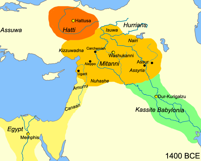
English: Map of the near east circa 1400 BCE.
עברית: מפת אזור המזרח הקרוב חלוקה לאימפריות בשנת 1400 לפנה"ס |
| Date | |
| Source |
Own work
|
| Author | Javierfv1212 |
| Other versions |
[edit]
|


Licensing
| Public domainPublic domainfalsefalse |
| This work has been released into the public domain by its author, Javierfv1212 at English Wikipedia. This applies worldwide. In some countries this may not be legally possible; if so: Javierfv1212 grants anyone the right to use this work for any purpose, without any conditions, unless such conditions are required by law.Public domainPublic domainfalsefalse |
Original upload log
The original description page was here. All following user names refer to en.wikipedia.
- 2010-03-21 22:10 Javierfv1212 785×628× (149438 bytes) {{Information |Description = Map of the near east circa 1400 BCE. |Source = I (~~~) created this work entirely by myself. Source: Cambridge Ancient History Vol II Middle East & Aegean Region 1800-1300. I. E. S. EDWARDS (Ed) et al. |Date
Captions
Add a one-line explanation of what this file represents
Items portrayed in this file
depicts
21 March 2010
File history
Click on a date/time to view the file as it appeared at that time.
| Date/Time | Thumbnail | Dimensions | User | Comment | |
|---|---|---|---|---|---|
| current | 15:41, 3 July 2010 | | 785 × 628 (146 KB) | Hanay | {{Information |Description={{en|1=Map of the near east circa 1400 BCE. }} {{he|1=מפת אזור המזרח הקרוב חלוקה לאימפריות בשנת 1400 לפנה"ס}} |Source=http://en.wikipedia.org/wiki/File:Near_East_1400_BCE.png |Author=[[Use |
File usage
The following pages on the English Wikipedia use this file (pages on other projects are not listed):
Global file usage
The following other wikis use this file:
- Usage on af.wikipedia.org
- Usage on ast.wikipedia.org
- Usage on azb.wikipedia.org
- Usage on az.wikipedia.org
- Usage on be-tarask.wikipedia.org
- Usage on bg.wikipedia.org
- Usage on bn.wikipedia.org
- Usage on ca.wikipedia.org
- Usage on ceb.wikipedia.org
- Usage on cs.wikipedia.org
- Usage on cv.wikipedia.org
- Usage on da.wikipedia.org
- Usage on el.wikipedia.org
- Usage on en.wiktionary.org
- Usage on et.wikipedia.org
- Usage on fa.wikipedia.org
- Usage on fr.wikipedia.org
- Usage on he.wikipedia.org
- Usage on hr.wikipedia.org
- Usage on hy.wikipedia.org
- Usage on hyw.wikipedia.org
- Usage on incubator.wikimedia.org
- Usage on it.wikipedia.org
- Usage on ja.wikipedia.org
- Usage on ja.wikibooks.org
- Usage on kk.wikipedia.org
- Usage on ko.wikipedia.org
- Usage on ku.wikipedia.org
View more global usage of this file.
Retrieved from "https://en.wikipedia.org/wiki/File:Near_East_1400_BCE.png"