File:Ordnance_Survey_1-250000_-_TF.jpg
From Wikipedia, the free encyclopedia

Size of this preview: 600 × 600 pixels. Other resolutions: 240 × 240 pixels | 480 × 480 pixels | 768 × 768 pixels | 1,024 × 1,024 pixels | 2,048 × 2,048 pixels | 4,000 × 4,000 pixels.
Original file (4,000 × 4,000 pixels, file size: 6.07 MB, MIME type: image/jpeg)
| This is a file from the Wikimedia Commons. Information from its description page there is shown below. Commons is a freely licensed media file repository. You can help. |
Summary
| DescriptionOrdnance Survey 1-250000 - TF.jpg |
Español: Un mapa de la Ordnance Survey de la zona TF del sistema de referencia británico, en una escala de 1:250.000. Français : Une carte de l'Ordnance Survey de la zone TF dans le système de référence britanique, à l'échelle 1:250.000. Italiano: Una carta della Ordnance Survey della zona TF nella sistema di referenza britannica, con la scala 1:250.000.     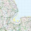     |
| Date | 6 June 2010 (upload date) |
| Source | Ordnance Survey OpenData 1:250 000 Scale Colour Raster. Converted from File:Ordnance Survey 1-250000 - TF.tif to jpg |
| Author | Ordnance Survey |
Licensing
This file is licensed by the Ordnance Survey of the United Kingdom under their OS OpenData License Ordnance Survey OpenData LicenceOS OpenDatahttps://www.ordnancesurvey.co.uk/business-and-government/licensing/using-creating-data-with-os-products/os-opendata.htmltrue
In short: you are free to distribute and modify the file as long as you attribute (including year), the Ordnance Survey. Attribution: Contains Ordnance Survey data © Crown copyright and database right (year) Note: Derivative works can be licensed under any Creative Commons Attribution 3.0 Licence. |
.svg)
|
This file is licensed under the United Kingdom Open Government Licence v3.0. |
See also: Meta for information on usage on Wikimedia wikis. Open Government License 3OGL 3http://www.nationalarchives.gov.uk/doc/open-government-licence/version/3true
|
Captions
Add a one-line explanation of what this file represents
Items portrayed in this file
depicts
File history
Click on a date/time to view the file as it appeared at that time.
| Date/Time | Thumbnail | Dimensions | User | Comment | |
|---|---|---|---|---|---|
| current | 19:49, 6 June 2010 | | 4,000 × 4,000 (6.07 MB) | OrdnanceSurveyBot | {{subst:Commons:Batch uploading/Ordnance Survey/Template |subst=subst: |square=TF |scale=250.000 |sourcename=1:250 000 Scale Colour Raster |basefilename=Ordnance Survey 1-250000 - |extension=jpg |nw_square=SE |n_square=TA |ne_square= |w_square=SK |e_squa |
File usage
The following pages on the English Wikipedia use this file (pages on other projects are not listed):
- Metrication in the United Kingdom
- Ordnance Survey
- Ordnance Survey National Grid
- User:Cmglee/Ordnance Survey 1:250 000 Scale Colour Raster map
- User:Peter Mercator/Draft for OS national grid
- Wikipedia:Featured picture candidates/April-2010
- Wikipedia:Featured picture candidates/National Grid square TF at 1 in 250 000 scale.jpg
Global file usage
The following other wikis use this file:
- Usage on cy.wikipedia.org
- Usage on fr.wikipedia.org
- Usage on id.wikipedia.org
- Usage on nl.wikipedia.org
- Usage on pl.wikipedia.org
Metadata
This file contains additional information, probably added from the digital camera or scanner used to create or digitize it.
If the file has been modified from its original state, some details may not fully reflect the modified file.
| _error | 0 |
|---|
Retrieved from "https://en.wikipedia.org/wiki/File:Ordnance_Survey_1-250000_-_TF.jpg"