Portal:U.S. roads
Wikipedia portal for content related to U.S. roads / From Wikipedia, the free encyclopedia
Portal maintenance status: (June 2018)
|
The U.S. Roads Portal
The highway system of the United States is a network of interconnected state, U.S., and Interstate highways. Each of the fifty states, the District of Columbia, Puerto Rico, American Samoa, Guam, the Northern Mariana Islands, and the U.S. Virgin Islands own and maintain a part of this vast system, including U.S. and Interstate highways, which are not owned or maintained at the federal level.


Interstate Highways have the highest speed limits and the highest traffic numbers. Interstates are numbered in a grid: even-numbered routes for east–west routes (with the lowest numbers along Mexico and the Gulf of Mexico), and odd-numbered routes are north–south routes (with the lowest numbers along the Pacific Ocean). Three-digit Interstates are, generally, either beltways or spurs of their parent Interstates (for example, Interstate 510 is a spur into the city of New Orleans, Louisiana, and is connected to Interstate 10).


U.S. Numbered Highways are the original interstate highways, dating back to 1926. U.S. Highways are also numbered in a grid: even numbered for east–west routes (with the lowest numbers along Canada) and odd numbered for north–south routes (with the lowest numbers along the Atlantic Ocean). Three-digit highways, also known as "child routes," are branches off their main one- or two-digit "parents" (for example, U.S. Route 202 is a branch of U.S. Route 2). However, US 101, rather than a "child" of US 1, is considered a "mainline" U.S. Route.


State highways are the next level in the hierarchy. Each state and territory has its own system for numbering highways, some more systematic than others. Each state also has its own design for its highway markers; the number in a circle is the default sign, but many choose a different design connected to the state, such as an outline of the state with the number inside. Many states also operate a system of county highways.


Scenic byways can be designated over any classification of road in the United States. There are the National Scenic Byways, National Forest Scenic Byways and Bureau of Land Management Back Country Byways at the national level. Most states have their own system for designating byways, some more systematic than others. Native American tribes may designate byways as well.
 Featured articles - load new batch
 Image 1
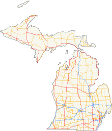
The State Trunkline Highway System consists of all the state highways in Michigan, including those designated as Interstate, United States Numbered (US Highways), or State Trunkline highways. In their abbreviated format, these classifications are applied to highway numbers with an I-, US, or M- prefix, respectively. The system is maintained by the Michigan Department of Transportation (MDOT) and comprises 9,669 miles (15,561 km) of trunklines in all 83 counties of the state on both the Upper and Lower peninsulas (UP, LP), which are linked by the Mackinac Bridge. Components of the system range in scale from 10-lane urban freeways with local-express lanes to two-lane rural undivided highways to a non-motorized highway on Mackinac Island where cars are forbidden. The longest highway is nearly 400 miles (640 km) long, while the shortest is about three-quarters of a mile (about 1.2 km). Some roads are unsigned highways, lacking signage to indicate their maintenance by MDOT; these may be remnants of highways that are still under state control whose designations were decommissioned or roadway segments left over from realignment projects.
Predecessors to today's modern highways include the foot trails used by Native Americans in the time before European settlement. Shortly after the creation of the Michigan Territory in 1805, the new government established the first road districts. The federal government aided in the construction of roads to connect population centers in the territory. At the time, road construction was under the control of the township and county governments. The state government was briefly involved in roads until prohibited by a new constitution in 1850. Private companies constructed plank roads and charged tolls. Local township roads were financed and constructed through a statute labor system that required landowners to make improvements in lieu of taxes. Countywide coordination of road planning, construction and maintenance was enacted in the late 19th century. (Full article...)- Image 2Interstate 805 (I-805) is a major north–south auxiliary Interstate Highway in Southern California. It is a bypass auxiliary route of I-5, running roughly through the center of the Greater San Diego region from San Ysidro (part of the city of San Diego) near the Mexico–U.S. border to near Del Mar. The southern terminus of I-805 at I-5 in San Ysidro is less than 1 mi (1.6 km) north of the Mexican border. I-805 then traverses the cities of Chula Vista and National City before reentering San Diego. The freeway passes through the San Diego neighborhoods of North Park, Mission Valley, Clairemont, and University City before terminating at I-5 in the Sorrento Valley neighborhood near the Del Mar city limit.
Planning for I-805 began in 1956, and the route was officially designated in 1959 before it was renumbered in the 1964 state highway renumbering. Starting in 1967, the freeway was built in phases, with the northern part of the freeway finished before the southern part. I-805 was completed and open to traffic in 1975. Named the Jacob Dekema Freeway after the longtime head of the regional division of the California Department of Transportation (Caltrans), I-805 has been frequently cited for its complex engineering and architecture, including near I-8 on the Mission Valley Viaduct. Since then, several construction projects have taken place, including the construction of carpool lanes. (Full article...) - Image 3Interstate 75 (I-75) is a part of the Interstate Highway System that runs north–south from Miami, Florida, to Sault Ste. Marie in the Upper Peninsula of the US state of Michigan. I-75 enters the state from Ohio in the south, north of Toledo, and runs generally northward through Detroit, Pontiac and Bay City, crosses the Mackinac Bridge, and ends at the Canadian border in Sault Ste. Marie. The freeway runs for approximately 396 miles (637 km) on both of Michigan's major peninsulas. The landscapes traversed by I-75 include Southern Michigan farmland, northern forests, suburban bedroom communities, and the urban core of Detroit. The freeway also uses three of the state's monumental bridges to cross major bodies of water. There are four auxiliary Interstates in the state related to I-75, as well as nine current or former business routes, with either Business Loop I-75 (BL I-75) or Business Spur I-75 (BS I-75) designations.
The freeway bears several names in addition to the I-75 designation. The southern segment was called the Detroit–Toledo Expressway during planning in the 1950s and 1960s. Through Detroit, I-75 is the Fisher Freeway or the Walter P. Chrysler Freeway, named for pioneers in the auto industry. Sections on either side of the Mackinac Bridge are the G. Mennen Williams Freeway or the Prentiss M. Brown Freeway, named for politicians who helped get the bridge built. Officially, the entire length is the American Legion Memorial Highway, after the organization of the same name. Various sections carry components of the four Great Lakes Circle Tours in the state. (Full article...) - Image 4US Highway 16 (US 16), also called Grand River Avenue for much of its length in the state, was one of the principal roads prior to the post-World War II construction of freeways in the state of Michigan. Before the creation of the United States Numbered Highway System in 1926, the highway had been designated as a state highway numbered M-16. The modern route of Grand River Avenue cuts across the Lower Peninsula in a northwest–southeast fashion from near Grand Rapids to Detroit. Before the late 1950s and early 1960s, US 16 followed other roads between Muskegon and Grand Rapids, and then Grand River Avenue through Lansing to Detroit. In the years immediately preceding the creation of the Interstate Highway System, US 16 was shifted from older roads to newer freeways. Later, it was co-designated as an Interstate. When the gap in the freeway was filled in around Lansing, the US 16 designation was decommissioned in the state. The freeway was solely designated Interstate 96 (I-96) east of Grand Rapids and I-196 west of that city.
The original pathway along the Grand River Avenue corridor was an Indian trail, a footpath used by the native population. The first European settlers to the area now known as Michigan also used this trail and in some areas enlarged it for the passage of wagons. In Detroit, Grand River is one of five major avenues (along with Woodward, Michigan, Gratiot, and Jefferson) planned by Judge Augustus Woodward in 1805 that extended from Downtown Detroit in differing radial directions; Grand River Avenue extends northwesterly from the city's downtown. In the middle of the 19th century, the trail was expanded into a plank road that formed the basis for one of the first state trunkline highways as M-16 in the early 20th century. Later, the highway was rerouted to replace M-126 and create M-104. Current segments of the roadway are still part of the state highway system as sections of M-5, M-11, M-43 or business loops off I-96. The portion of Grand River Avenue in Detroit between I-96 and the intersection with Cass Avenue and Middle Street in Downtown Detroit is an unsigned state trunkline, sometimes referred to as Old Business Spur I-96 (Old BS I-96). (Full article...) - Image 5M-28 is an east–west state trunkline highway that traverses nearly all of the Upper Peninsula of the U.S. state of Michigan, from Wakefield to near Sault Ste. Marie in Bruce Township. Along with US Highway 2 (US 2), M-28 forms a pair of primary highways linking the Upper Peninsula from end to end, providing a major access route for traffic from Michigan and Canada along the southern shore of Lake Superior. M-28 is the longest state trunkline in Michigan numbered with the "M-" prefix at 290.373 miles (467.310 km). The entire highway is listed on the National Highway System, while three sections of M-28 are part of the Lake Superior Circle Tour. M-28 also carries two memorial highway designations along its route.
Throughout its course across the Upper Peninsula, M-28 passes through forested woodlands, bog swamps, urbanized areas, and along the Lake Superior shoreline. Sections of roadway cross the Ottawa National Forest and both units of the Hiawatha National Forest. Some of the other landmarks accessible from M-28 include the Seney Stretch, Seney National Wildlife Refuge and several historic bridges. (Full article...) - Image 6The Capitol Loop was a state trunkline highway running through Lansing, Michigan, in the United States that was commissioned on October 13, 1989. It formed a loop route off Interstate 496 (I-496) through downtown near the Michigan State Capitol complex, home of the state legislature and several state departments. The Michigan Department of Transportation (MDOT) had labeled it as Capitol Loop I-496 or CL I-496 on some maps, similar to the Business Loop Interstate nomenclature. However, unlike other business loops in Michigan, it had unique reassurance markers—the signs that served as regular reminders of the name and number of the highway. It was known internally at MDOT as Connector 496 for inventory purposes. The route followed a series of one-way and two-way streets through downtown Lansing, directing traffic downtown to the State Capitol and other government buildings. Unlike the other streets downtown, the seven streets comprising the Capitol Loop were under state maintenance and jurisdiction.
The loop was originally proposed in 1986 as part of a downtown revitalization effort. Almost from the beginning before the highway was commissioned in 1989, it was affected by controversial proposals. Several suggestions by community leaders to rename city streets in honor of Martin Luther King Jr. were rejected. In the end, Logan Street was given a second name, Martin Luther King Jr. Boulevard, and the original name was eventually dropped. (Full article...) - Image 7Interstate 82 (I-82) is an Interstate Highway in the Pacific Northwest region of the United States that travels through parts of Washington and Oregon. It runs 144 miles (232 km) from its northwestern terminus at I-90 in Ellensburg, Washington, to its southeastern terminus at I-84 in Hermiston, Oregon. The highway passes through Yakima and the Tri-Cities, and is also part of the link between Seattle and Salt Lake City, Utah. I-82 travels concurrently with U.S. Route 97 (US 97) between Ellensburg and Union Gap; US 12 from Yakima to the Tri-Cities; and US 395 from Kennewick to Umatilla, Oregon.
I-82 primarily serves the Yakima Valley agricultural region, following the Yakima and Columbia rivers southeastward to the Tri-Cities. The highway enters the valley from the north by crossing the Manastash Ridge, which separates Yakima from the Kittitas Valley. I-82 bypasses the Tri-Cities by traveling southwest around Richland and Kennewick and then turns south to cross the Columbia River on the Umatilla Bridge. Its only auxiliary route, I-182, connects the highway to Richland and Pasco in the Tri-Cities. (Full article...) - Image 8US Highway 141 (US 141) is a north–south United States Numbered Highway in the states of Wisconsin and Michigan. The highway runs north-northwesterly from an interchange with Interstate 43 (I-43) in Bellevue, Wisconsin, near Green Bay, to a junction with US 41/M-28 near Covington, Michigan. In between, it follows city streets in Green Bay and has a concurrent section with US 41 in Wisconsin. North of Green Bay, US 141 is either a freeway or an expressway into rural northern Wisconsin before downgrading to an undivided highway. In Michigan, US 141 is an undivided highway that runs through rural woodlands. The highway has two segments in each state; after running through Wisconsin for about 103 miles (166 km), it crosses into Michigan for approximately another eight miles (13 km). After that, it crosses back into Wisconsin for about 14+1⁄2 miles (23 km) before crossing the state line one last time. The northernmost Michigan section is about 43+1⁄2 miles (70 km), making the overall length about 169 miles (272 km).
When the US Highway System was formed on November 11, 1926, US 141 ran from Milwaukee to Green Bay, and one segment of the modern highway in Michigan was originally designated US Highway 102 (US 102). This other designation was decommissioned in 1928 when US 141 was extended north from Green Bay into Michigan. Michigan has rebuilt the highway in stages over the years to smooth out sharp curves in the routing. Since the 1960s, the section south of Green Bay has been converted into a freeway in segments. US 141 has ended southeast of Green Bay in Bellevue since the 1980s—the southern freeway segment was redesignated as I-43. The section north of Abrams, Wisconsin, was converted to a freeway in the opening years of the 21st century, with an additional divided-highway section opening a few years later. (Full article...) - Image 9State Route 128 (SR-128) is a 44.564-mile-long (71.719 km) state highway in the U.S. state of Utah. The entire length of the highway has been designated the Upper Colorado River Scenic Byway, as part of the Utah Scenic Byways program. This road also forms part of the Dinosaur Diamond Prehistoric Highway, a National Scenic Byway. Residents of Moab frequently refer to SR-128 as "the river road", after the Colorado River, which the highway follows.
The highway was originally constructed to connect rural cities in eastern Utah with Grand Junction, Colorado, the largest city in the region. Part of the highway was merged into the Utah state highway system in 1931; the rest was taken over by the state and assigned route number 128 in 1933. Today, the highway is used as a scenic drive for visitors to the area. (Full article...) - Image 10Interstate 196 (I-196) is an auxiliary Interstate Highway that runs for 80.6 miles (129.7 km) in the US state of Michigan. It is a state trunkline highway that links Benton Harbor, South Haven, Holland, and Grand Rapids. In Kent, Ottawa, and Allegan counties, I-196 is known as the Gerald R. Ford Freeway, or simply the Ford Freeway, after President Gerald Ford, who was raised in Grand Rapids and served Michigan in the House of Representatives for 25 years. This name generally refers only to the section between Holland and Grand Rapids. I-196 changes direction; it is signed as a north–south highway from its southern terminus to the junction with US Highway 31 (US 31) just south of Holland, and as an east–west trunkline from this point to its eastern terminus at an interchange with I-96, its parent highway. There are three business routes related to the main freeway. There are two business loops (BL I-196) and one business spur (BS I-196) that serve South Haven, Holland and the Grand Rapids areas. Another business spur for Muskegon had been designated relative to the I-196 number.
The freeway numbered I-196 is the second in the state to bear the number. Originally to be numbered as part of the I-94 corridor in the state, the Benton Harbor–Grand Rapids freeway was given the I-96 number in the 1950s while another Interstate between Muskegon and Grand Rapids was numbered I-196. That I-196 was built in the late 1950s and completed in the early 1960s. The first segment of the current I-196 was opened as I-96 near Benton Harbor in 1962. Michigan officials requested a change in 1963 which reversed the two numbers, and the subsequent segments of freeway opened northward to Holland and from Grand Rapids westward under the current number. The gap between Holland and Grandville was filled in the 1970s, and a section of freeway that runs through downtown Grand Rapids was rebuilt as a wider freeway in 2010. (Full article...) - Image 11State Route 67 (SR 67) is a state highway in San Diego County, California, United States. It begins at Interstate 8 (I-8) in El Cajon and continues to Lakeside as the San Vicente Freeway before becoming an undivided highway through the eastern part of Poway. In the town of Ramona, the route turns into Main Street before ending at SR 78. SR 67 provides direct access from the city of San Diego to the East County region of San Diego County, including Ramona and Julian.
The route has existed as a railroad corridor since the turn of the 20th century. A highway known as the Julian road was built by 1913, and was designated as Legislative Route 198 in the state highway system by 1935. Route 198 was renumbered SR 67 in the 1964 state highway renumbering. A freeway south of Lakeside was built in the late 1960s, and opened to traffic in 1970. Since then, the portion of the highway north of Lakeside has become known for a high number of traffic accidents and related fatalities. The California Department of Transportation (Caltrans) has made several attempts to remedy the problem and make the road safer. (Full article...) - Image 12

View of the route, 1920
The Ridge Route, officially the Castaic–Tejon Route and colloquially known as the Grapevine, was a two-lane highway between Los Angeles County and Kern County, California. Opened in 1915 and paved with concrete between 1917 and 1921, the road was the first paved highway directly linking the Los Angeles Basin with the San Joaquin Valley (southern Central Valley) over the Tejon Pass and the rugged Sierra Pelona Mountains ridge south of Gorman. Much of the old road runs through the Angeles National Forest, and passes many historical landmarks, including the National Forest Inn, Reservoir Summit, Kelly's Half Way Inn, Tumble Inn, and Sandberg's Summit Hotel. North of the forest, the Ridge Route passed through Deadman's Curve before ending at Grapevine.
The road was bypassed by the three-lane Ridge Route Alternate, then U.S. Route 99 (US 99), to handle increased traffic and remove curves; the Alternate in Los Angeles County was completed in 1933, and Kern County line to Grapevine in 1936. The four-lane US 99 was completed in 1953 and replaced by an eight-lane freeway, Interstate 5 (I-5) in 1960-70. The portion of the road in the Angeles National Forest was added to the National Register of Historic Places in 1997, by the efforts of Harrison Scott. Much of the road has been closed by the U.S. Forest Service; other remnants are used by local traffic. (Full article...) - Image 13New York State Route 311 (NY 311) is a state highway located entirely within Putnam County, New York, in the United States. It begins at NY 52 in Lake Carmel, and intersects Interstate 84 (I-84) shortly thereafter. It crosses NY 164 and NY 292 as it heads into the northeastern part of the county, finally curving east to reach its northern terminus at NY 22 just south of the Dutchess County line. The route passes several historical sites.
Part of modern-day Route 311 was originally the Philipstown Turnpike, a road built in 1815 to overcome a lack of transportation when the Hudson River froze during the winter months. The turnpike was a large business center for the county, though it was abandoned due to insufficient tolls to maintain it. Another section was constructed in the early 1900s, from the Patterson Baptist Church near the modern-day intersection of Route 311 and Route 164 to the Village of Patterson, by a group of Italian immigrants. (Full article...) - Image 14Interstate 68 (I-68) is a 113.15-mile (182.10 km) Interstate Highway in the U.S. states of West Virginia and Maryland, connecting I-79 in Morgantown, West Virginia, east to I-70 in Hancock, Maryland. I-68 is also Corridor E of the Appalachian Development Highway System (ADHS). From 1965 until the freeway's construction was completed in 1991, it was designated as U.S. Route 48 (US 48). In Maryland, the highway is known as the National Freeway, an homage to the historic National Road, which I-68 parallels between Keysers Ridge and Hancock. The freeway mainly spans rural areas and crosses numerous mountain ridges along its route. A road cut at Sideling Hill exposed geological features of the mountain and has become a tourist attraction.
US 219 and US 220 overlap I-68 in Garrett County and Cumberland, respectively, and US 40 overlaps with the freeway from Keysers Ridge to the eastern end of the freeway at Hancock. (Full article...) - Image 15Maryland Route 36 (also known as MD 36 or Route 36) is a 29.43-mile (47.36 km) state highway located in Allegany County, Maryland, United States. MD 36's southern terminus is at the West Virginia Route 46 (WV 46) bridge in Westernport and its northern terminus at U.S. Route 40 Alternate (US 40 Alt.) near Cumberland. Between Westernport and Frostburg, it is known as Georges Creek Road, and from Frostburg to Cumberland it is known as Mount Savage Road. Like the majority of Maryland state highways, MD 36 is maintained by the Maryland State Highway Administration (MDSHA).
MD 36 serves as the main road through the Georges Creek Valley, a region which is historically known for coal mining, and has been designated by MDSHA as part of the Coal Heritage Scenic Byway. MD 36 is the main road connecting the towns of Westernport, Lonaconing, and Midland in southwestern Allegany County, as well as Frostburg, Mount Savage, and Corriganville in northwestern Allegany County. (Full article...)


.jpg)
 Good articles - load new batch
- Image 1State Route 532 (SR 532) is a short Washington state highway in Island and Snohomish counties, located in the United States. It connects Camano Island and Stanwood to a junction with Interstate 5 (I-5) northwest of Arlington.
The eastern section of the road was constructed in 1887 and was connected to Camano Island by a cable ferry, which was replaced by a bridge opened in 1909. The highway was paved in 1916 and acquired by the state government in 1945, becoming Secondary State Highway 1Y (SSH 1Y). The state funded new bridges across the Stillaguamish River and Davis Slough and later renumbered the highway as SR 532 in 1964, a few years before the highway was moved to a new roadway. From to 2009 to 2010, major sections of the highway were rebuilt, including a new bridge over the Stillaguamish River. (Full article...) - Image 2Maryland Route 355 (MD 355) is a 36.75-mile (59.14 km) north–south road in western central Maryland in the United States. The southern terminus of the route is in Bethesda in Montgomery County, where Wisconsin Avenue meets the county's border with Washington, D.C. The northern terminus is just north of a bridge over Interstate 70 (I-70)/U.S. Route 40 (US 40) in the city of Frederick in Frederick County, where the road continues north as Market Street through Frederick towards MD 26.
MD 355 serves as a major thoroughfare through Frederick and Montgomery counties, passing through Bethesda, Rockville, Gaithersburg, Germantown, Clarksburg, Hyattstown, Urbana, and Frederick, roughly parallel to I-270. The southern portion of the route from the Washington, D.C., border to Germantown is a suburban four- to six-lane divided highway lined with many businesses. North of Germantown, the route is predominantly a two-lane rural road until it reaches Frederick, where it passes through commercial areas in the southern part of the city. The road changes names along its route: from south to north, it is called Wisconsin Avenue, Rockville Pike, Hungerford Drive, Frederick Road, and Urbana Pike. (Full article...) - Image 3U.S. Route 50 or U.S. Highway 50 (US 50) is a major east–west route of the U.S. Highway system, stretching 3,019 miles (4,859 km) from Interstate 80 (I-80) in West Sacramento, California, to Maryland Route 528 (MD 528) in Ocean City, Maryland, on the Atlantic Ocean. Until 1972, when it was replaced by Interstate Highways west of the Sacramento area, it extended (by way of Stockton, the Altamont Pass, and the Bay Bridge) to San Francisco, near the Pacific Ocean. The Interstates were constructed later and are mostly separate from this route. It generally serves a corridor south of I-70 and I-80 and north of I-64 and I-40.
The route runs through mostly rural desert and mountains in the western United States, with the section through Nevada known as "The Loneliest Road in America". In the Midwest, US 50 heads through mostly rural areas of farms as well as a few large cities including Kansas City, Missouri; St. Louis, Missouri; and Cincinnati, Ohio. (Full article...) - Image 4Delaware Route 17 (DE 17) is a two-lane undivided state highway located in Sussex County, Delaware. The route runs in a northeast-southwest direction between DE 54 in Selbyville and DE 26 west of Millville, crossing DE 20 in Roxana. It is called Bethany Road within Selbyville and Roxana Road for the remainder of its length. The route passes through rural areas of southeastern Sussex County. DE 17 serves to connect Selbyville with the Bethany Beach area. The route was built as a state highway in the 1920s and received the DE 17 designation by 1938. (Full article...)
- Image 5New York State Route 420 (NY 420) is a north–south state highway in St. Lawrence County, New York, in the United States. The southern terminus of the route is at an intersection with U.S. Route 11 (US 11) in the town of Stockholm. Its northern terminus is at a junction with NY 37 in the village of Massena. NY 420 passes through undeveloped regions of St. Lawrence County for most of its routing and briefly overlaps with NY 11C in the hamlet of Winthrop.
NY 420 was originally part of Route 32, an unsigned legislative route created by the New York State Legislature in 1908. The Winthrop–Massena portion of Route 32 became part of the signed NY 56 in the mid-1920s; however, NY 56 was realigned in 1927 to follow a new alignment well to the south of Winthrop. The former routing of NY 56 between Winthrop and Massena was redesignated as NY 420 as part of the 1930 renumbering of state highways in New York. NY 420 was extended southward to its current terminus south of Winthrop in 1980. (Full article...) - Image 6New York State Route 31 (NY 31) is a state highway that extends for 208.74 miles (335.93 km) across western and central New York in the United States. The western terminus of the route is at an intersection with NY 104 in the city of Niagara Falls. Its eastern terminus is at a traffic circle with NY 26 in Vernon Center, a hamlet within the town of Vernon. Over its routing, NY 31 spans 10 counties and indirectly connects three major urban areas in Upstate New York: Buffalo–Niagara Falls, Rochester, and Syracuse. The route is one of the longest routes in New York State, paralleling two similarly lengthy routes, NY 104 to the north and NY 5 to the south, as well as the Erie Canal, as it proceeds east.
Much of NY 31 west of Jordan was originally designated as part of a legislative route from the late 1900s to the early 1920s. NY 31 itself was assigned in the mid-1920s, utilizing all of legislative Route 30 (modern NY 31, NY 429, and NY 104) west of Rochester and much of its current alignment from Rochester to Lenox. At Lenox, NY 31 turned southeast to follow what is now NY 316 and NY 46 to NY 5 in Oneida. It was realigned by 1929 to continue west to Lewiston on Ridge Road and altered in the 1930 renumbering of state highways in New York to continue east to Utica via Verona. With the advent of U.S. Route 104 (US 104) c. 1935, NY 31 was realigned west of Rochester to follow most of its modern routing. (Full article...) - Image 7New York State Route 64 (NY 64) is a north–south state highway in the Finger Lakes region of New York in the United States. Its southern terminus is at an intersection with NY 21 in the hamlet of Bristol Springs within the town of South Bristol, Ontario County. The northern terminus is at a junction with NY 96 and NY 252 in the village of Pittsford, Monroe County. NY 64 is a mostly two-lane highway that primarily serves as a connector between the southeastern suburbs of the city of Rochester and the Canandaigua Lake area, home to Bristol Mountain Ski Resort. Near the midpoint of the route, NY 64 has an overlap with U.S. Route 20 (US 20) and NY 5 that takes the route through the village of Bloomfield.
The majority of what is now NY 64 was originally designated as part of Route 14, an unsigned legislative route, by the New York State Legislature in 1908. In the vicinity of Bloomfield, however, Route 14 initially followed what later became NY 20C in order to access Holcomb. The alignment of Route 14 through Bloomfield was modified in 1921 to use modern NY 64 instead. When the first set of posted routes in New York were assigned in 1924, the portion of Route 14 between Mendon and Pittsford became part of NY 15. In the 1930 renumbering of state highways in New York, NY 15 was realigned to follow a new routing to the east while the Mendon–Pittsford segment of its former routing became the basis for NY 64, a new route that extended southward over the post-1921 routing of legislative Route 14 to South Bristol. (Full article...) - Image 8

State Route 409 (SR 409) is a short Washington state highway in Wahkiakum County. The highway runs north from the Wahkiakum County Ferry on Puget Island to SR 4 in the county seat of Cathlamet over a distance of 3.84 miles (6.18 km). The route connects Westport, Oregon, which is served by the county ferry, and Cathlamet. The highway was referred to as Secondary State Highway 12F (SSH 12F) from 1943 until 1964.
SR 409 crosses the Cathlamet Channel on the Julia Butler Hansen Bridge, completed in August 1939. The bridge is named after former U.S. representative Julia Butler Hansen, who served from 1960 until 1974 representing the third congressional district including Wahkiakum County. (Full article...) - Image 9Maryland Route 222 (MD 222) is a state highway in the U.S. state of Maryland. The highway runs 11.36 miles (18.28 km) from MD 7 in Perryville north to U.S. Route 1 (US 1) near Conowingo. MD 222 connects Perryville, Port Deposit, and Conowingo along its route paralleling the Susquehanna River in western Cecil County. Due to limitations in the highway in Port Deposit, including a steep hill and a low-clearance railroad bridge, trucks are directed to use MD 275, MD 276, and US 1 through Woodlawn and Rising Sun to connect Interstate 95 (I-95) with US 222 in Conowingo.
MD 222 was built as MD 268, a number presently assigned to North Street in Elkton. The state highway was paved from Perryville to Port Deposit in the late 1910s and early 1920s. MD 268 was extended north to Conowingo in the early 1930s. In 1938, MD 268 was superseded when US 222 was extended south from US 1 in Conowingo to US 40 in Perryville. US 222 was widened from Perryville to Port Deposit in the early 1940s and rebuilt around 1960. The highway was moved for the construction of I-95 interchange in the early 1960s and rebuilt south to Perryville in the late 1960s. MD 222 was established in 1972 on the portion of US 222 between MD 7 and US 40. The designation was extended from Perryville to Conowingo in 1995 when US 222 was rolled back to its former and present terminus at US 1 in Conowingo. (Full article...) - Image 10State Route 530 (SR 530) is a state highway in western Washington, United States. It serves Snohomish and Skagit counties, traveling 50.52 miles (81.30 km) from an interchange with Interstate 5 (I-5) southwest of Arlington past SR 9 in Arlington and Darrington to end at SR 20 in Rockport. Serving the communities of Arlington, Arlington Heights, Oso, Darrington and Rockport, the roadway travels parallel to a fork of the Stillaguamish River from Arlington to Darrington, the Sauk River from Darrington to Rockport and the Whitehorse Trail from Arlington to Darrington.
The first segment of SR 530 to appear on a map was a road extending from Arlington to Oso in 1899. The first segment to be state-maintained was Secondary State Highway 1E (SSH 1E), which ran from Conway to Arlington. SSH 1E was extended to Darrington in 1957 and later renumbered to SR 530 in 1964; the road was extended to Rockport in 1983 and later the route from Conway to I-5 was removed from the system in 1991. A section of the highway was destroyed in the 2014 Oso landslide and was rebuilt; a longer portion of SR 530 was designated the Oso Slide Memorial Highway in 2019. (Full article...) - Image 11Route 81 is a freeway in the U.S. state of New Jersey. The route is a connector between exit 13A of the New Jersey Turnpike (Interstate 95) and U.S. Route 1/9 near Newark Liberty International Airport. It runs for 1.18 miles (1.90 km), entirely within the city of Elizabeth in Union County. A freeway called Route S100 was initially proposed on the current alignment of Route 81 in 1938; it, along with its parent Route 100, was never built. The current route was conceived in the 1960s as a freeway replacement for Route 164, which followed Humboldt Avenue, a surface road. It was to be designated Route 76, but was renumbered to Route 81 when Interstate 76 was created in New Jersey.
It was legislated in 1966 to run parallel to the New Jersey Turnpike from exit 13 until North Avenue, where it would turn northwest and intersect U.S. Route 1/9 near the airport. The routing was eventually shifted to begin from a new interchange along the New Jersey Turnpike. A total of $50 million in funding was allocated for the road and the Port Authority of New York and New Jersey was responsible for designing the road. The state had wanted the port authority to pay for construction; however it was ruled that they could not build the road. Construction on Route 81 took place between 1979 and 1982. (Full article...) - Image 12New York State Route 33 (NY 33) is an east–west state highway in western New York in the United States. The route extends for just under 70 miles (113 km) from NY 5 in Buffalo in the west to NY 31 in Rochester in the east. It is, in fact, the only state highway that directly connects both cities, although it is rarely used today for that purpose. The westernmost 10 miles (16 km) of NY 33 in Buffalo and the neighboring town of Cheektowaga have been upgraded into the Kensington Expressway. This section of NY 33 is one of several freeways leading out of downtown and serves as a main route to the Buffalo Niagara International Airport.
On the Rochester end, NY 33 primarily serves as a paralleling local route to Interstate 490 (I-490), of less importance to the area's traffic patterns. Between the two cities, it is mostly a rural two-lane highway. The largest location on this stretch is the Genesee County city of Batavia, where NY 33 reconnects to NY 5 and crosses NY 63 and NY 98, two regionally important north–south highways. NY 33 overlaps with all three routes at one point or another as it traverses Batavia. A southerly alternate route, designated NY 33A, leaves NY 33 northeast of Batavia in Bergen and rejoins its parent in Rochester. (Full article...) - Image 13

Death Valley and access roads to State Route 190 at Hells Gate
State Route 190 (SR 190) is a state highway in the U.S. state of California that is split into two parts by the Sierra Nevada. The western portion begins at Tipton at a junction with State Route 99 and heads east towards Porterville before ending at Quaking Aspen in the Sequoia National Forest. The eastern portion begins at US 395 at Olancha, heads east through Death Valley National Park, and ends at State Route 127 at Death Valley Junction. The 43.0-mile (69.2 km) portion over the Sierra Nevada remains unconstructed, and the California Department of Transportation (Caltrans) has no plans to build it through the wilderness areas. SR 190 is a National Scenic Byway known as the Death Valley Scenic Byway. (Full article...) - Image 14Route 173 is a state highway in New Jersey, United States that is a designation for an old section of U.S. Route 22 (US 22). The route runs 14.62 mi (23.53 km) from Interstate 78 (I-78) and US 22 in Pohatcong Township, Warren County to County Route 626 (CR 626, Beaver Avenue) in Clinton Township, Hunterdon County, just east of an interchange with Route 31. Route 173 parallels I-78 and US 22 for its entire length through rural areas of Warren and Hunterdon counties, passing through the towns of Bloomsbury and Clinton along the way. At one point just to the west of Clinton, Route 173 runs concurrent with I-78 and US 22.
The route was originally part of pre-1927 Route 9 from 1916 until 1927, when it became part of US 22 and Route 28. The Route 28 designation was removed from this portion of road in 1953. When I-78 was being built between exits 11 and 13 in the 1950s and 1960s, it was decided that part of US 22 would be used for the new highway. The eastbound lanes of US 22 became the westbound lanes of the new highway, the eastbound lanes of the new highway were newly constructed, and the westbound lanes of US 22 were turned into a two-lane road. In 1969, US 22 was moved to the alignment of I-78 between Pohatcong Township and Clinton Township and Route 173 was designated along most of the former alignment of US 22. (Full article...) - Image 15Mississippi Highway 504 (MS 504) is a state highway in central Mississippi. The route starts at MS 15 south of Newton and travels southeastward. The road turns east at a county road near Garlandville and travels to its eastern terminus at MS 503 in the unincorporated area of Hero. The route was designated around 1956, from MS 15 to MS 503, and has not changed significantly since. (Full article...)


Topics
Subcategories

WikiProjects
- Interstate Highways
- U.S. Routes
- Auto trails
- US 66
- and task forces for each state...
Related portals
U.S. Roads news
- October 1:The Bella Vista Bypass is opened to traffic, making Interstate 49 complete from Kansas City, Missouri to Fort Smith, Arkansas.[1]
- April 6: Work begins on covering the abandoned section of Pennsylvania Route 61 in Centralia, known as "Graffiti Highway", with dirt in order to block public access.[2][3]
- October 3: Nevada Department of Transportation begins renumbering the exits along Interstate 580, which originally reflected mileage along concurrent U.S. Route 395, to reflect mileage along the Interstate designation.[4]
- June 1: The first portion of the I-77 Express HOT lanes along Interstate 77 in North Carolina opened between Hambright Road in Huntersville and NC 150 in Mooresville.[5]
- February 4: A new highway tunnel opens in downtown Seattle to carry a section of Washington State Route 99, replacing the recently-closed Alaskan Way Viaduct. It cost $3.3 billion to construct and took over five years due to delays with its tunnel boring machine, Bertha.[6]
- January 10: The U.S. Route 301 toll road in Delaware between the Maryland border southwest of Middletown and Delaware Route 1 in Biddles Corner opens to traffic. The toll road is the first in Delaware to use all-electronic tolling, with tolls paid by E-ZPass or toll-by-plate.[7]
- November 21: The U.S. Route 219 freeway between Meyersdale and Somerset in Somerset County, Pennsylvania opens to traffic.[8]
- November 7: The section of Texas State Highway Loop 49 bypassing Lindale from Interstate 20 north to U.S. Route 69 opens to traffic.[9]
- October 13: A groundbreaking ceremony is held for the realignment of U.S. Route 219 between Interstate 68 and Old Salisbury Road in Garrett County, Maryland, with Governor Larry Hogan in attendance.[10]
Things you can do
Nominations and votes for selected articles and selected pictures are always needed. Anyone can nominate an article, and anyone can vote for an article. You can also recommend items for Did you know?. If you have news related to U.S. roads, you can add it to the news section above.
See also Wikipedia:WikiProject U.S. Roads/to do, Category:U.S. road articles needing attention and individual state highway project to-do lists.
References and notes
- "I-49 Missouri-Arkansas Connector Project completed after more than 40 years". Retrieved January 4, 2022.
- Strawser, Justin (April 6, 2020). "Graffiti Highway to be closed by owners". The Daily Item. Retrieved April 6, 2020.
- Reed, J. (April 6, 2020). "Work Begins on Centralia's Graffiti Highway; State Police Enforce". Skook News. Retrieved April 6, 2020.
- Munsun, Jeff (October 3, 2019). "Exit numbers to change on Carson City Freeway beginning this weekend". Carson Now. Retrieved October 3, 2019.
- Marusak, Joe (May 31, 2019). "First part of I-77 toll lanes finally opened Saturday. Here's what you need to know". The Charlotte Observer. Retrieved June 1, 2019.
- Lindblom, Mike (February 4, 2019). "New tunnel? No problem? It was an easy, light-traffic day Monday on Highway 99". The Seattle Times. Retrieved February 6, 2019.
- Smith, Jerry (January 10, 2019). "U.S. 301 Mainline toll road opens Thursday to cheers and jeers". The News Journal. Wilmington, DE. Retrieved January 10, 2019.
- "Route 219 extension opens". The Tribune-Democrat. Johnstown, PA. November 21, 2018. Retrieved November 22, 2018.
- Campbell, LouAnna (November 7, 2018). "Lindale relief route open, Toll 49 extended from I-20 to US Highway 69, north of Lindale". Tyler Morning Telegraph. Retrieved January 31, 2019.
- "Hogan Administration Announces Long-Awaited US 219 Realignment Construction Project in Garrett County" (Press release). Maryland State Highway Administration. October 13, 2018. Retrieved October 13, 2018.


