Fichier:Karte_Aut_Ooe_BR.png
De Wikipedia, l'encyclopédie encyclopedia
Pas de plus haute résolution disponible.
Karte_Aut_Ooe_BR.png (300 × 265 pixels, taille du fichier : 4 kio, type MIME : image/png)
Ce fichier et sa description proviennent de Wikimedia Commons.
Description
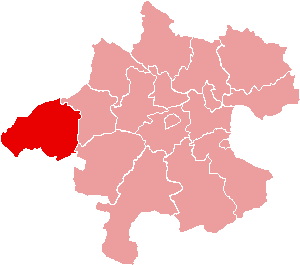
| DescriptionKarte Aut Ooe BR.png | Location of Bezirk Braunau am Inn within the Land of Upper Austria |
| Date | |
| Source | de:Bild:Karte Aut Ooe BR.png |
| Auteur | de:Benutzer:Plp |
| Autorisation (Réutilisation de ce fichier) |
GFDL-author (licence from German Wikipedia) |
| Autres versions | de:Bild:Karte Aut Ooe BR.png |
Conditions d’utilisation

|
Vous avez la permission de copier, distribuer et modifier ce document selon les termes de la GNU Free Documentation License version 1.2 ou toute version ultérieure publiée par la Free Software Foundation, sans sections inaltérables, sans texte de première page de couverture et sans texte de dernière page de couverture. Un exemplaire de la licence est inclus dans la section intitulée GNU Free Documentation License.http://www.gnu.org/copyleft/fdl.htmlGFDLGNU Free Documentation Licensetruetrue |
| Ce fichier est disponible selon les termes de la licence Creative Commons Attribution – Partage dans les Mêmes Conditions 3.0 (non transposée). | ||
| ||
| Ce bandeau de licence a été ajouté à ce fichier dans le cadre de la procédure de mise à jour des licences des images sous GFDL.http://creativecommons.org/licenses/by-sa/3.0/CC BY-SA 3.0Creative Commons Attribution-Share Alike 3.0truetrue |
Légendes
Ajoutez en une ligne la description de ce que représente ce fichier
Éléments décrits dans ce fichier
dépeint
image/png
Historique du fichier
Cliquer sur une date et heure pour voir le fichier tel qu'il était à ce moment-là.
| Date et heure | Vignette | Dimensions | Utilisateur | Commentaire | |
|---|---|---|---|---|---|
| actuel | 23 juin 2006 à 16:58 | | 300 × 265 (4 kio) | Physchim62 | {{Information |Description=Location of Bezirk Braunau am Inn within the Land of Upper Austria |Source=de:Bild:Karte Aut Ooe BR.png |Date=2004 |Author=[[:de:Benutzer:Plp |Permis |
Utilisation du fichier
Les 48 pages suivantes utilisent ce fichier :
- Altheim (Autriche)
- Aspach (Autriche)
- Auerbach (Autriche)
- Braunau am Inn
- Burgkirchen (Autriche)
- District de Braunau am Inn
- Eggelsberg
- Feldkirchen bei Mattighofen
- Franking (Autriche)
- Geretsberg
- Gilgenberg am Weilhart
- Haigermoos
- Handenberg
- Helpfau-Uttendorf
- Hochburg-Ach
- Höhnhart
- Jeging
- Kirchberg bei Mattighofen
- Lengau
- Lochen
- Maria Schmolln
- Mattighofen
- Mauerkirchen
- Mining (Autriche)
- Moosbach (Autriche)
- Moosdorf
- Munderfing
- Neukirchen an der Enknach
- Ostermiething
- Palting
- Perwang am Grabensee
- Pfaffstätt
- Pischelsdorf am Engelbach
- Polling im Innkreis
- Roßbach (Autriche)
- Sankt Georgen am Fillmannsbach
- Sankt Johann am Walde
- Sankt Pantaleon (Autriche)
- Sankt Peter am Hart
- Sankt Veit im Innkreis
- Schalchen
- Schwand im Innkreis
- St. Radegund
- Tarsdorf
- Treubach
- Weng im Innkreis
- Überackern
- Modèle:Palette District de Braunau am Inn
Usage global du fichier
Les autres wikis suivants utilisent ce fichier :
- Utilisation sur ban.wikipedia.org
- Utilisation sur bs.wikipedia.org
- Utilisation sur cs.wikipedia.org
- Utilisation sur de.wikipedia.org
- Braunau am Inn
- Hochburg-Ach
- Höhnhart
- Maria Schmolln
- Altheim (Oberösterreich)
- Franking
- Haigermoos
- Mattighofen
- Mauerkirchen
- Mining
- Polling im Innkreis
- St. Johann am Walde
- Tarsdorf
- Treubach
- Überackern
- Weng im Innkreis
- Moosdorf
- Vorlage:Navigationsleiste Städte und Gemeinden im Bezirk Braunau am Inn
- Feldkirchen bei Mattighofen
- Schwand im Innkreis
- Aspach (Oberösterreich)
- Auerbach (Oberösterreich)
- Eggelsberg
- Gilgenberg am Weilhart
- Handenberg
- Helpfau-Uttendorf
- Jeging
- Kirchberg bei Mattighofen
- Lengau
- Lochen am See
- Moosbach (Oberösterreich)
- Munderfing
- Neukirchen an der Enknach
- Ostermiething
- Palting
- Perwang am Grabensee
- Pfaffstätt
- Pischelsdorf am Engelbach
- Roßbach (Oberösterreich)
- St. Georgen am Fillmannsbach
- St. Pantaleon (Oberösterreich)
- St. Peter am Hart
Voir davantage sur l’utilisation globale de ce fichier.
Ce document provient de « https://fr.wikipedia.org/wiki/Fichier:Karte_Aut_Ooe_BR.png ».