Fichier:Tularosa-Basin-NM-USGS-map_opaque.gif
De Wikipedia, l'encyclopédie encyclopedia
Taille de cet aperçu : 447 × 599 pixels. Autres résolutions : 179 × 240 pixels | 624 × 836 pixels.
Fichier d’origine (624 × 836 pixels, taille du fichier : 59 kio, type MIME : image/gif)
Ce fichier et sa description proviennent de Wikimedia Commons.
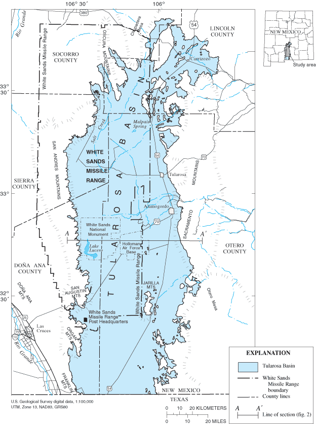
| DescriptionTularosa-Basin-NM-USGS-map opaque.gif | Location map of Tularosa Basin 2004. Huff, Glenn F. (2005) "Simulation of Ground-Water Flow in the Basin-Fill Aquifer of the Tularosa Basin, South-Central New Mexico, Predevelopment through 2040" Scientific Investigations Report 2004-5197, United States Geological Survey, Washongton, D.C., fig. 1. | ||||
| Date | |||||
| Source |
USGS (https://pubs.er.usgs.gov/usgspubs/sir/sir20045197) http://pubs.usgs.gov/sir/2004/5197/ http://pubs.usgs.gov/sir/2004/5197/images/fig1.gif |
||||
| Auteur | Huff, Glenn F. (United States Geological Survey) | ||||
| Autorisation (Réutilisation de ce fichier) |
|
||||
| Autres versions | Image:Tularosa-Basin-NM-USGS-map.gif (transparent version) |
Légendes
Ajoutez en une ligne la description de ce que représente ce fichier
Map of Tularosa Basin
Éléments décrits dans ce fichier
dépeint
Tularosa Basin anglais
Historique du fichier
Cliquer sur une date et heure pour voir le fichier tel qu'il était à ce moment-là.
| Date et heure | Vignette | Dimensions | Utilisateur | Commentaire | |
|---|---|---|---|---|---|
| actuel | 11 décembre 2007 à 14:50 | | 624 × 836 (59 kio) | AnonMoos | actual opaque version |
| 7 octobre 2007 à 07:55 |  | 624 × 836 (61 kio) | Balmung0731 | {{Information |Description=Location map of Tularosa Basin 2004. Huff, Glenn F. (2005) "Simulation of Ground-Water Flow in the Basin-Fill Aquifer of the Tularosa Basin, South-Central New Mexico, Predevelopment through 2040" Scientific Investigations Report |
Utilisation du fichier
La page suivante utilise ce fichier :
Usage global du fichier
Les autres wikis suivants utilisent ce fichier :
- Utilisation sur bg.wikipedia.org
- Utilisation sur en.wikipedia.org
- Utilisation sur fa.wikipedia.org
- Utilisation sur he.wikipedia.org
- Utilisation sur hu.wikipedia.org
- Utilisation sur ko.wikipedia.org
- Utilisation sur ru.wikipedia.org
- Utilisation sur sv.wikipedia.org
- Utilisation sur uk.wikipedia.org
- Utilisation sur vi.wikipedia.org
- Utilisation sur www.wikidata.org
- Utilisation sur zh.wikipedia.org
Ce document provient de « https://fr.wikipedia.org/wiki/Fichier:Tularosa-Basin-NM-USGS-map_opaque.gif ».