File:Amerikanska-medelhavet.png
De Wikipedia, l'encyclopédie encyclopedia
Taille de cet aperçu : 707 × 600 pixels. Autres résolutions : 283 × 240 pixels | 566 × 480 pixels | 905 × 768 pixels | 1 207 × 1 024 pixels | 2 410 × 2 045 pixels.
Fichier d’origine (2 410 × 2 045 pixels, taille du fichier : 4,57 Mio, type MIME : image/png)
Ce fichier et sa description proviennent de Wikimedia Commons.
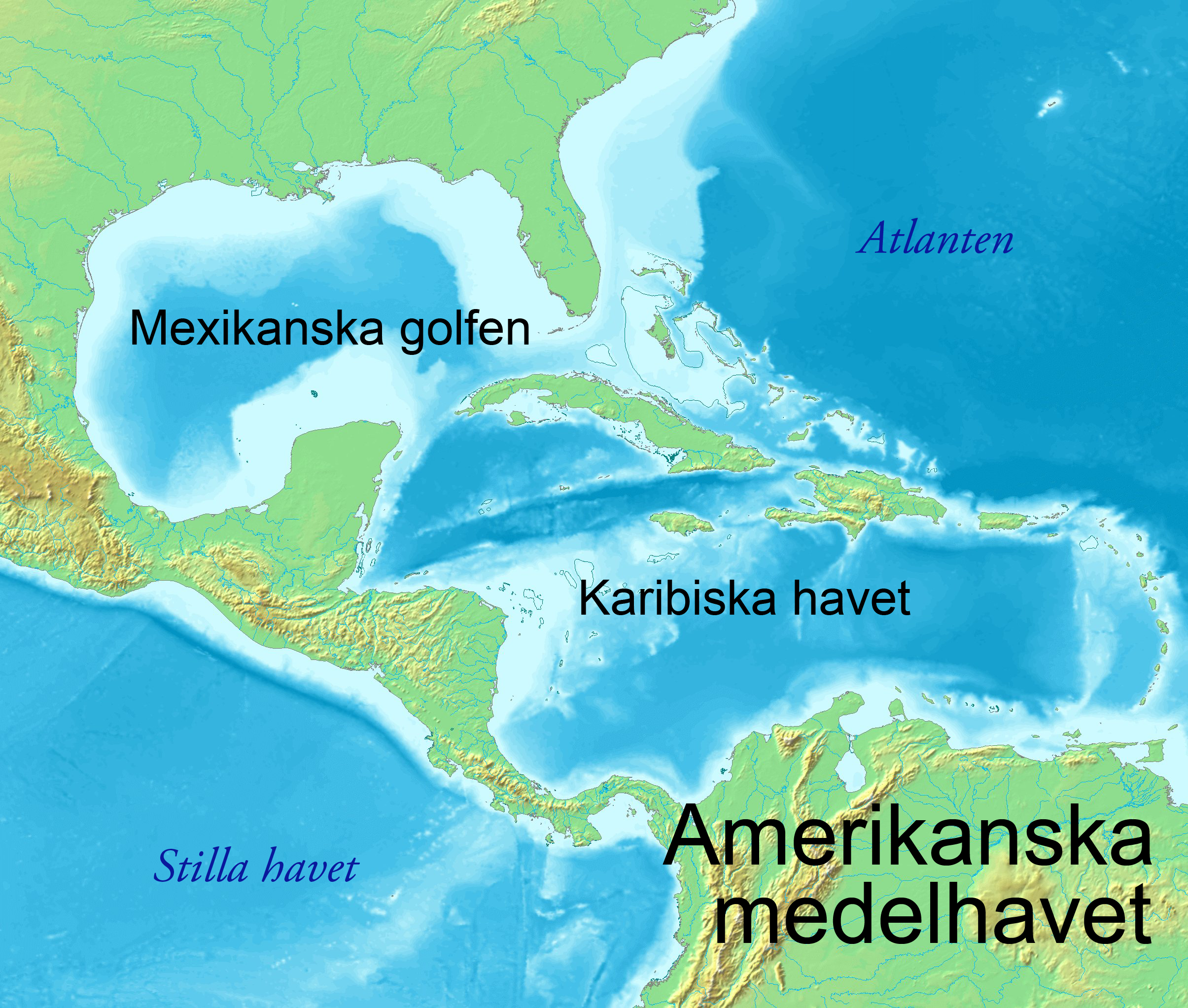
| DescriptionAmerikanska-medelhavet.png | Amerikanska medelhavet |
| Date | (UTC) |
| Source | |
| Auteur |
|
| Cette image a été retouchée, ce qui signifie qu'elle a été modifiée par ordinateur et est différente de l'image d'origine. L'image d'origine se trouve ici : Topographic30deg N0W60.png:
|
| Public domainPublic domainfalsefalse |
This image is in the public domain because it came from the site https://www.demis.nl/products/web-map-server/examples/ and was released by the copyright holder. Permission is granted to copy, distribute and/or modify this map since it is based on free of copyright images from: www.demis.nl. See also approval email on de.wp and its clarification.
Deutsch | English | македонски | മലയാളം | Nederlands | slovenščina | +/− |
| Public domainPublic domainfalsefalse |
| This work has been released into the public domain by its copyright holder, www.demis.nl. This applies worldwide. Dans certains pays, ceci peut ne pas être possible ; dans ce cas : www.demis.nl accorde à toute personne le droit d’utiliser cette œuvre dans n’importe quel but, sans aucune condition, sauf celles requises par la loi. Public domainPublic domainfalsefalse |
Journal des téléversements d’origine
This image is a derivative work of the following images:
- File:Topographic30deg_N0W60.png licensed with PD-Demis
- 2005-05-26T17:28:09Z Koba-chan 1800x1800 (926487 Bytes) ---- Map created from [http://www2.demis.nl/mapserver/mapper.asp DEMIS Mapserver], which are public domain. [[User:Koba-chan|Koba-chan]] {{GFDL}} [[Category:Topographic maps]] [[Category:Earth]]
Téléversé avec derivativeFX
Légendes
Ajoutez en une ligne la description de ce que représente ce fichier
Éléments décrits dans ce fichier
dépeint
19 août 2011
image/png
0b12c2e5d628624d28502a296d681df947d62e4c
4 796 376 octet
2 045 pixel
2 410 pixel
Historique du fichier
Cliquer sur une date et heure pour voir le fichier tel qu'il était à ce moment-là.
| Date et heure | Vignette | Dimensions | Utilisateur | Commentaire | |
|---|---|---|---|---|---|
| actuel | 19 août 2011 à 07:02 | | 2 410 × 2 045 (4,57 Mio) | Ysjyd | {{Information |Description=== Amerikanska medelhavet |Source=*File:Topographic30deg_N0W60.png |Date=2011-08-19 04:50 (UTC) |Author=*File:Topographic30deg_N0W60.png: PD-Demis *derivative work: Ysjyd |Permission= |other_versions= }} {{Retouched |
Utilisation du fichier
Aucune page n’utilise ce fichier.
Usage global du fichier
Les autres wikis suivants utilisent ce fichier :
- Utilisation sur sv.wikipedia.org
Ce document provient de « https://fr.wikipedia.org/wiki/Fichier:Amerikanska-medelhavet.png ».