Bestand:LocationBritishIsles.png
Uit Wikipedia, de vrije encyclopedia
Geen hogere resolutie beschikbaar.
LocationBritishIsles.png (414 × 516 pixels, bestandsgrootte: 9 kB, MIME-type: image/png)
| Dit is een bestand van Wikimedia Commons. Onderstaande beschrijving komt van de beschrijving van het bestand daar. |
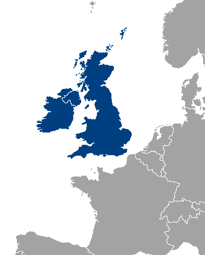
Location map of Great Britain and Ireland.
| Public domainPublic domainfalsefalse |
| |
Dit bestand is door Vardion op Wikimedia Commons, in het publieke domein geplaatst. Dit is wereldwijd van toepassing. In sommige landen is dit niet mogelijk; in die gevallen geldt: |
Bijschriften
Beschrijf in één regel wat dit bestand voorstelt
Британские острова на карте Европы
Items getoond in dit bestand
beeldt af
image/png
Bestandsgeschiedenis
Klik op een datum/tijd om het bestand te zien zoals het destijds was.
| Datum/tijd | Miniatuur | Afmetingen | Gebruiker | Opmerking | |
|---|---|---|---|---|---|
| huidige versie | 14 nov 2013 02:46 | | 414 × 516 (9 kB) | Fobos92 | . |
| 17 sep 2007 11:34 |  | 1.245 × 1.245 (52 kB) | Sony-youth | With the CI highlighted. | |
| 1 mei 2007 12:43 |  | 1.245 × 1.245 (33 kB) | Tene~commonswiki | Optimised (0) | |
| 21 aug 2006 04:51 |  | 1.245 × 1.245 (81 kB) | Hoshie | I have added Montenegro and removed Vojvodina, which is a part of Serbia | |
| 10 jul 2006 15:12 |  | 1.245 × 1.245 (81 kB) | MPF | new hi-res version | |
| 11 feb 2005 19:19 |  | 250 × 115 (3 kB) | Iota~commonswiki | Location map of Great Britain and Ireland. |
Bestandsgebruik
Dit bestand wordt op de volgende pagina gebruikt:
Globaal bestandsgebruik
De volgende andere wiki's gebruiken dit bestand:
- Gebruikt op als.wikipedia.org
- Gebruikt op an.wikipedia.org
- Gebruikt op bar.wikipedia.org
- Gebruikt op be-tarask.wikipedia.org
- Gebruikt op be.wikipedia.org
- Gebruikt op bh.wikipedia.org
- Gebruikt op bs.wikipedia.org
- Gebruikt op ca.wikipedia.org
- Gebruikt op ca.wiktionary.org
- Gebruikt op cy.wikipedia.org
- Gebruikt op da.wikipedia.org
- Gebruikt op de.wikipedia.org
- Gebruikt op el.wikipedia.org
- Gebruikt op en.wikipedia.org
- Category:British Isles
- User:Yorkshire Phoenix
- User:Owain/Userbox/British Isles
- User:Meshsa
- Talk:Ireland/Archive 5
- User:Matt Lewis/Nationality within the British Isles (including the United Kingdom and Ireland)
- User:Matt Lewis/Nationality labelling guide for the Republic of Ireland and the United Kingdom of Great Britain and Northern Ireland (including England, Scotland, Wales and the British Islands)
- User:D Dinneen/Userboxes
- Gebruikt op en.wiktionary.org
- Gebruikt op eo.wikipedia.org
- Gebruikt op es.wikipedia.org
- Gebruikt op eu.wikipedia.org
- Gebruikt op frr.wikipedia.org
- Gebruikt op fy.wikipedia.org
- Gebruikt op gl.wikipedia.org
- Gebruikt op gv.wikipedia.org
- Gebruikt op hr.wikipedia.org
- Gebruikt op hu.wikipedia.org
- Gebruikt op hy.wikipedia.org
- Gebruikt op id.wikipedia.org
- Gebruikt op incubator.wikimedia.org
- Gebruikt op is.wikipedia.org
- Gebruikt op is.wiktionary.org
- Gebruikt op it.wikipedia.org
- Gebruikt op ka.wikipedia.org
- Gebruikt op kk.wikipedia.org
- Gebruikt op ko.wikipedia.org
- Gebruikt op lb.wikipedia.org
- Gebruikt op lt.wikipedia.org
- Gebruikt op ms.wikipedia.org
Globaal gebruik van dit bestand bekijken.
Metadata
Dit bestand bevat metadata met EXIF-informatie, die door een fotocamera, scanner of fotobewerkingsprogramma toegevoegd kan zijn.
| Gebruikte software | |
|---|---|
| Horizontale resolutie | 37,8 dpc |
| Verticale resolutie | 37,8 dpc |
Overgenomen van "https://nl.wikipedia.org/wiki/Bestand:LocationBritishIsles.png"