Fitxer:Cartagena,_Mar_Menor,_i_Cap_de_Pals_(foto_satèl·lit).jpg
From Wikipedia, the free encyclopedia
Mida d'aquesta previsualització: 800 × 530 píxels. Altres resolucions: 320 × 212 píxels | 640 × 424 píxels | 1.024 × 678 píxels | 1.280 × 848 píxels | 3.032 × 2.008 píxels.
Fitxer original (3.032 × 2.008 píxels, mida del fitxer: 1,17 Mo, tipus MIME: image/jpeg)
| Aquest fitxer i la informació mostrada a continuació provenen del dipòsit multimèdia lliure Wikimedia Commons. |
Resum
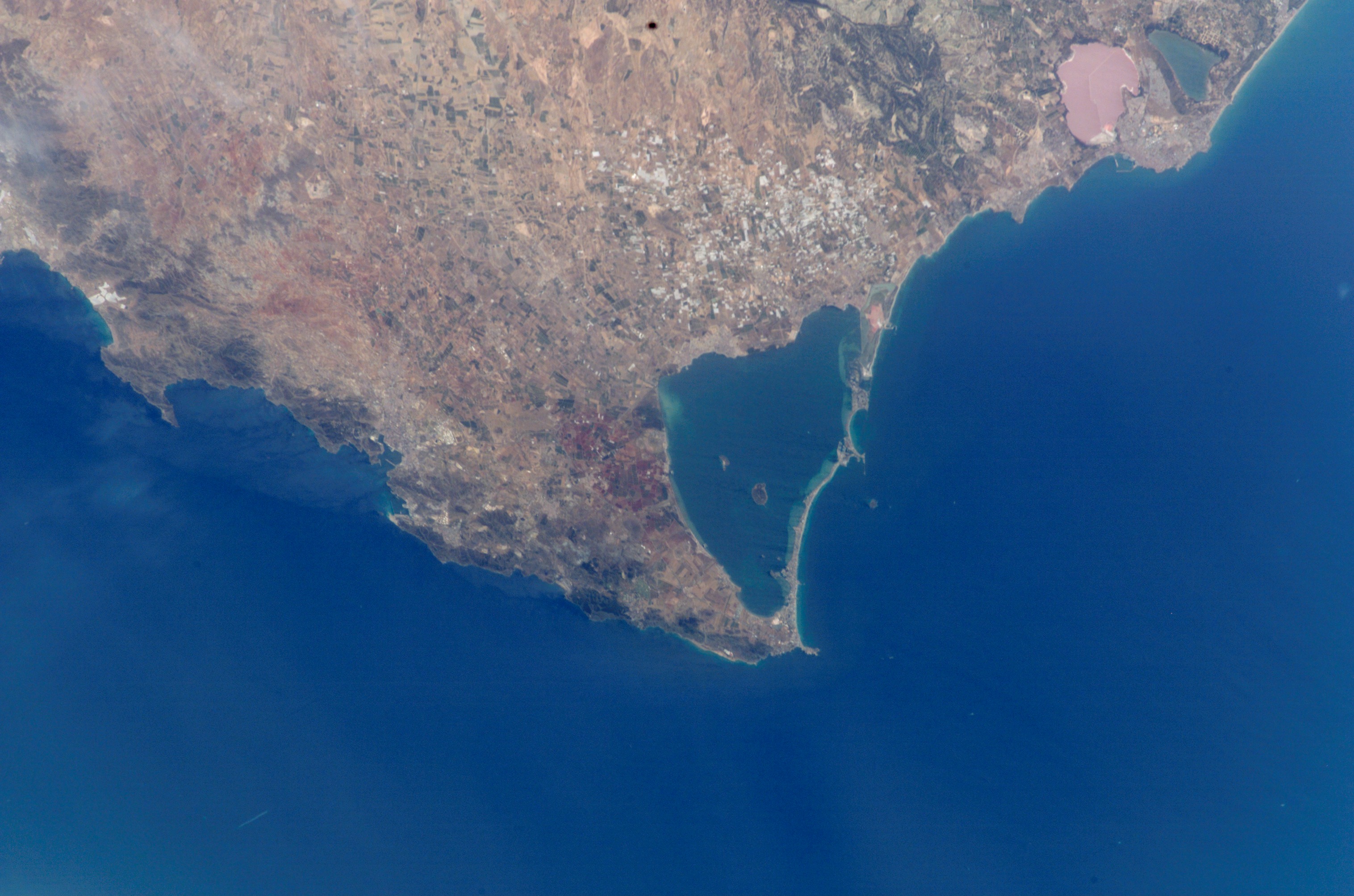
| DescripcióCartagena, Mar Menor, i Cap de Pals (foto satèl·lit).jpg |
English: Photo of Mar Menor as seen from International Space Station
Español: Vista por ISS del Mar Menor |
|||
| Data | Taken in 2002 | |||
| Font |
|
|||
| Autor | Image Science & Analysis Laboratory, of the NASA Johnson Space Center. | |||
| Permís (Com reutilitzar aquest fitxer) |
See above. | |||
| Altres versions | Derivative works of this file: La Manga del Mar Menor.jpg |
| Posició de l'objecte | 37° 42′ 00″ N, 0° 51′ 00″ O | Aquesta i altres imatges properes a: OpenStreetMap |
|---|
NASA location info: * Center Point Latitude: 37.5 * Center Point Longitude: -1.0 (Negative numbers indicate south for latitude and west for longitude)
Llegendes
Afegeix una explicació d'una línia del que representa aquest fitxer
Elements representats en aquest fitxer
representa l'entitat
37°42'0"N, 0°51'0"W
image/jpeg
f8f507a4e1a08839d309f8a8199f522bea6103d6
1.228.503 byte
2.008 píxel
3.032 píxel
Historial del fitxer
Cliqueu una data/hora per veure el fitxer tal com era aleshores.
| Data/hora | Miniatura | Dimensions | Usuari/a | Comentari | |
|---|---|---|---|---|---|
| actual | 20:34, 29 gen 2012 | | 3.032 × 2.008 (1,17 Mo) | Saibo | cut off caption ("ISS005E05534"). --- lossless jpeg editing: jpegtran -copy all -crop 3032x2008+0+0 Cartagena\,_Mar_Menor\,_i_Cap_de_Pals_\(foto_satèl·lit\).jpg > out.jpg |
| 18:44, 31 oct 2005 |  | 3.032 × 2.064 (1,17 Mo) | Martorell | {{PD-USGov-NASA}} {{AstronautPhoto|mission=ISS005|roll=E|frame=5534}} * Center Point Latitude: 37.5 * Center Point Longitude: -1.0 (Negative numbers indicate south for latitude and west for longitude) Category:Satellite photos |
Ús del fitxer
Les 4 pàgines següents utilitzen aquest fitxer:
Ús global del fitxer
Utilització d'aquest fitxer en altres wikis:
- Utilització a ast.wikipedia.org
- Utilització a bar.wikipedia.org
- Utilització a ceb.wikipedia.org
- Utilització a cs.wikipedia.org
- Utilització a de.wikipedia.org
- Utilització a en.wikipedia.org
- Utilització a en.wikivoyage.org
- Utilització a es.wikipedia.org
- Utilització a es.wikivoyage.org
- Utilització a eu.wikipedia.org
- Utilització a fr.wikipedia.org
- Utilització a gl.wikipedia.org
- Utilització a it.wikipedia.org
- Utilització a ja.wikipedia.org
- Utilització a ka.wikipedia.org
- Utilització a la.wikipedia.org
- Utilització a lt.wiktionary.org
- Utilització a nl.wikipedia.org
- Utilització a nn.wikipedia.org
- Utilització a no.wikipedia.org
- Utilització a oc.wikipedia.org
- Utilització a pl.wikipedia.org
- Utilització a pt.wikipedia.org
- Utilització a ru.wikipedia.org
- Utilització a sr.wikipedia.org
- Utilització a sv.wikipedia.org
- Utilització a uk.wikipedia.org
- Utilització a www.wikidata.org
.jpg)