Payl:St_Mary's_and_St_Nicholas,_Compton_-_geograph.org.uk_-_20753.jpg
From Wikipedia, the free encyclopedia
Walay mas taas nga resolusyon.
St_Mary's_and_St_Nicholas,_Compton_-_geograph.org.uk_-_20753.jpg (640 × 480 pixels, size sa payl: 196 KB, MIME type: image/jpeg)
Kining maong payl gikan sa Wikimedia Commons ug mahimong gigamit sa ubang proyekto. Ang deskripsyon niini didto gipakita sa ubos.
Mubong sugid:
| DeskripsyonSt Mary's and St Nicholas, Compton - geograph.org.uk - 20753.jpg |
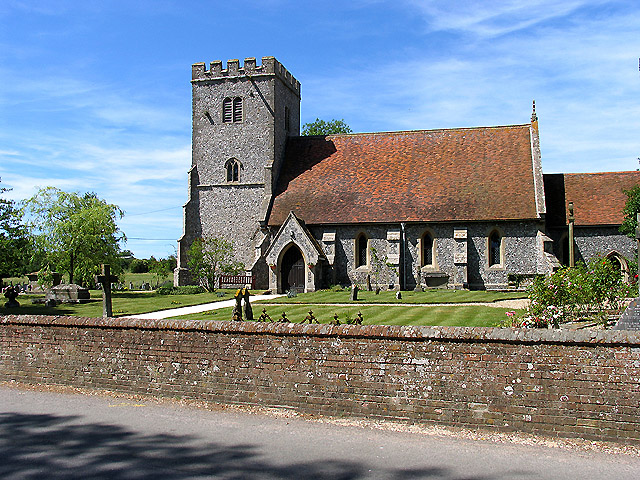
English: St Mary's and St Nicholas: Compton. The square is mostly farmland, some residences, a bridge and the church. The church is in the north eastern section of the square. |
| Petsa | |
| Gigikanan | From geograph.org.uk |
| Tagsulat | Pam Brophy |
| Attribution (required by the license) InfoField | Pam Brophy / St Mary's and St Nicholas: Compton / |
InfoField | Pam Brophy / St Mary's and St Nicholas: Compton |
| Object location | 51° 30′ 47.62″ N, 1° 14′ 34.2″ W | View this and other nearby images on: OpenStreetMap |
|---|
Pagtugot

|
This image was taken from the Geograph project collection. See this photograph's page on the Geograph website for the photographer's contact details. The copyright on this image is owned by Pam Brophy and is licensed for reuse under the Creative Commons Attribution-ShareAlike 2.0 license.
|
This file is licensed under the Creative Commons Attribution-Share Alike 2.0 Generic license.
Attribution: Pam Brophy
- Libre ka:
- sa pagsabwag – sa pagkopya, pag-apod-apod ug pagsabwag sa hinimo
- sa pag-remix – sa pag-adap sa binuhat
- Ubos sa mosunod nga mga kondisyon:
- atribusyon – Kinahanglan nimo nga hatagan ang angay nga kredito, maghatag usa ka link sa lisensya, ug ipakita kung adunay mga pagbag-o. Mahimo nimo kini buhaton sa bisan unsang makatarunganon nga paagi, apan dili sa bisan unsang paagi nga nagsugyot nga gi-endorso ka sa licensor o ang imong paggamit.
- share parehas – Kung imong gi-remix, gibag-o, o gibase sa materyal, kinahanglan nimo nga iapod-apod ang imong mga kontribusyon sa ilawom sa parehas o katugma nga lisensya sama sa orihinal.
Captions
Add a one-line explanation of what this file represents
St Mary's and St Nicholas, Compton, England
Items portrayed in this file
depicts English
parish church English
creator English
some value
copyright status English
copyrighted English
source of file English
file available on the internet English
22 Hunyo 2005
coordinates of depicted place English
51°30'47.621"N, 1°14'34.224"W
Kaagi sa payl
I-klik ang petsa/oras aron makit-an ang hulagway sa payl niadtong panahona.
| Petsa/Takna | Thumbnail | Mga dimensyon | Tiggamit | Komento | |
|---|---|---|---|---|---|
| kasamtangan | 05:08, 30 Enero 2010 | | 640 × 480 (196 KB) | GeographBot | == {{int:filedesc}} == {{Information |description={{en|1=St Mary's and St Nicholas: Compton. The square is mostly farmland, some residences, a bridge and the church. The church is in the north eastern section of the square.}} |date=2005-06-22 |source=From |
Mga paggamit sa payl
Ang mosunod nga mga panid misumpay niining payl:
Global nga paggamit sa payl
Kining ubang wiki naggamit ning maong payl:
- Paggamit sa ar.wikipedia.org
- Paggamit sa arz.wikipedia.org
- Paggamit sa bg.wikipedia.org
- Paggamit sa cy.wikipedia.org
- Paggamit sa en.wikipedia.org
- Paggamit sa es.wikipedia.org
- Paggamit sa fa.wikipedia.org
- Paggamit sa fr.wikipedia.org
- Paggamit sa it.wikipedia.org
- Paggamit sa lld.wikipedia.org
- Paggamit sa nl.wikipedia.org
- Paggamit sa pl.wikipedia.org
- Paggamit sa www.wikidata.org
Metadata
Ang kining payl adunay dugang nga impormasyon, mahimong nadugang gikan sa digital camera o scanner nga gigamit sa paghimo o pag-digitize niini.
Kon ang payl namodipikar gikan sa orihinal nga estado, ang ubang detalye mamahimong dili moreplek sa namodipikar nga payl.
| _error | 0 |
|---|