Dosya:Canada_Southern_Quebec_location_map.png
From Wikipedia, the free encyclopedia
Deha berz agozney cı çıniyo
Canada_Southern_Quebec_location_map.png (535 × 435 pikselan, ebatê dosya: 133 KB, MIME tipê cı: image/png)
| Na dosya depoyê Wikimedia Commons de esta u terefê proceyanê binan ra gureniyena. Cêr dê şınasiya dosyay pela mocniyeno. |
Xulasa
| ŞınasnayışCanada Southern Quebec location map.png |
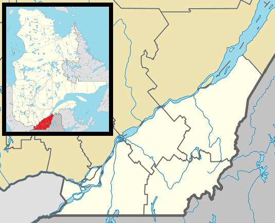
English: Map of southern Québec Province within Canada, for use in location map templates. Français : Carte du sud du Québec. |
| Tarix | (UTC) |
| Çıme |
This file was derived from: Canada Quebec location map 2.svg:  |
| Nuştekar |
|

|
This locator map image could be re-created using vector graphics as an SVG file. This has several advantages; see Commons:Media for cleanup for more information. If an SVG form of this image is available, please upload it and afterwards replace this template with
{{vector version available|new image name}}.
It is recommended to name the SVG file “Canada Southern Quebec location map.svg”—then the template Vector version available (or Vva) does not need the new image name parameter. |
Lisans
Ez, ke ena dosya viraste, bine ena lisans ser cap kena:
| Public domainPublic domainfalsefalse |
| Ez, Wêrê ena teliferê, nê kari Malê şarideye ezo heserena. Dınya heme ca dı ravêreno. Tay dewletan dı no kanuniyey heta mıkum nêbone; o haldı: Ez, ena karer qande herhangi yew amaci, be şert, hendı ke legali icab nikeni, şari hemi re ezo mısade dana. |
Qeydê barkerdışê oricinali
This image is a derivative work of the following images:
- File:Canada_Quebec_location_map_2.svg licensed with PD-self
- 2009-09-24T18:30:53Z Hanhil 2316x2822 (2687510 Bytes) {{Information |Description={{en|1=Québec Province within Canada.}} {{es|1=Provincia de Quebec en Canadá.}} |Source=Based on [[:Image:Canada_Quebec_location_map.svg]] |Author=~~~~ based on [[User:EOZyo|EOZyo]] |Date=2009-09-
Uploaded with derivativeFX
Captions
Add a one-line explanation of what this file represents
Items portrayed in this file
Dewrê mocnayışi
15 Kanun 2012
media type English
image/png
checksum English
ab53563f24895131f5df52ccbfd951a749ca08ac
data size English
135,690 byte
435 pixel
535 pixel
Verêniya dosya
Seba diyayışê viyarteyê dosya ra tarixê ke qısımê tarix/zemani derê inan bıtıkne.
| Tarix/Zeman | Resımo qıckek | Ebadi | Karber | Mışewre | |
|---|---|---|---|---|---|
| nıkayên | 03:42, 2 Gulane 2013 | | 535 - 435 (133 KB) | Gordalmighty | boundary fix |
| 14:46, 1 Gulane 2013 |  | 535 - 435 (132 KB) | Gordalmighty | colour problem | |
| 05:25, 1 Gulane 2013 |  | 535 - 435 (133 KB) | Gordalmighty | uploaded proper file | |
| 04:47, 1 Gulane 2013 |  | 535 - 435 (102 KB) | Gordalmighty | boundary fix | |
| 19:12, 23 Nisane 2013 |  | 520 - 420 (93 KB) | Gordalmighty | localized map to south of Saint Lawrence River & added colour | |
| 00:13, 15 Kanun 2012 |  | 600 - 400 (92 KB) | P199 | == {{int:filedesc}} == {{Information |Description={{en|1=Map of southern Québec Province within Canada, for use in location map templates.}} |Source={{Derived from|Canada_Quebec_location_map_2.svg|display=50}} |Date=2012-12-15 00:12 (UTC) |Author=*[[:... |
Gurenayışê dosya
The following pages link to this file:
Gurenayışê dosyaya gılovere
Ena dosya wikiyanê binan de gureniyena.
- ar.wikipedia.org sero guriyayış
- ca.wikipedia.org sero guriyayış
- ceb.wikipedia.org sero guriyayış
- el.wikipedia.org sero guriyayış
- en.wikipedia.org sero guriyayış
- Longueuil
- Westmount
- Dorval
- Hampstead, Quebec
- Mount Royal, Quebec
- L'Île-Dorval
- Sainte-Anne-de-Bellevue
- Laval, Quebec
- Sherbrooke
- Stanstead, Quebec
- Saint-Jean-sur-Richelieu
- Granby, Quebec
- Châteauguay
- Lévis
- Victoriaville
- Saint-Hyacinthe
- Beaconsfield, Quebec
- Baie-D'Urfé
- Lennoxville, Quebec
- Pointe-Claire
- Thetford Mines
- Saint-Hubert, Quebec
- Saint-Georges, Quebec
- Boucherville
- Pointe-Fortune, Quebec
- Rigaud, Quebec
- Vaudreuil-Dorion
- Richmond, Quebec
- Greenfield Park, Quebec
- Saint-Lambert, Montérégie
- Brossard
- Dollard-des-Ormeaux
- Sorel-Tracy
- Sainte-Julie, Quebec
- Salaberry-de-Valleyfield
- Saint-Bruno-de-Montarville
- Saint-Constant, Quebec
- Kirkland, Quebec
- Chambly, Quebec
- Varennes, Quebec
- Beloeil, Quebec
- La Prairie, Quebec
- Sainte-Catherine, Quebec
- Magog, Quebec
- Saint-Lazare, Quebec
Yê na dosya gurenayışê gıloveri tayêna bıvêne.
Metadata
This file contains additional information, probably added from the digital camera or scanner used to create or digitize it. If the file has been modified from its original state, some details may not fully reflect the modified image.
| Qerarê verıniye | 37.8 dpc |
|---|---|
| Rezulasyanê derganiye | 37.8 dpc |