File:Andover_-_High_Street_-_geograph.org.uk_-_2191677.jpg
From Wikipedia, the free encyclopedia
No higher resolution available.
Andover_-_High_Street_-_geograph.org.uk_-_2191677.jpg (800 × 600 pixels, file size: 112 KB, MIME type: image/jpeg)
| This is a file from the Wikimedia Commons. Information from its description page there is shown below. Commons is a freely licensed media file repository. You can help. |
Summary
| DescriptionAndover - High Street - geograph.org.uk - 2191677.jpg |
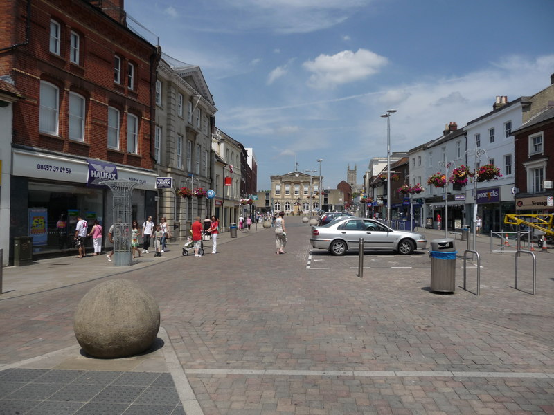
English: Andover - High Street, near to Andover, Hampshire, Great Britain.
Looking up the High Street towards the Guildhall. |
| Date | |
| Source | From geograph.org.uk; transferred by User:Baldboris99 using geograph_org2commons. |
| Author | Chris Talbot |
| Permission (Reusing this file) |
Creative Commons Attribution Share-alike license 2.0 |
| Attribution (required by the license) InfoField | Chris Talbot / Andover - High Street / |
InfoField | Chris Talbot / Andover - High Street |
| Camera location | 51° 12′ 20.72″ N, 1° 28′ 49.24″ W | View this and other nearby images on: OpenStreetMap |
|---|
| Object location | 51° 12′ 22″ N, 1° 28′ 48″ W | View this and other nearby images on: OpenStreetMap |
|---|
Licensing

|
This image was taken from the Geograph project collection. See this photograph's page on the Geograph website for the photographer's contact details. The copyright on this image is owned by Chris Talbot and is licensed for reuse under the Creative Commons Attribution-ShareAlike 2.0 license.
|
This file is licensed under the Creative Commons Attribution-Share Alike 2.0 Generic license.
Attribution: Chris Talbot
- You are free:
- to share – to copy, distribute and transmit the work
- to remix – to adapt the work
- Under the following conditions:
- attribution – You must give appropriate credit, provide a link to the license, and indicate if changes were made. You may do so in any reasonable manner, but not in any way that suggests the licensor endorses you or your use.
- share alike – If you remix, transform, or build upon the material, you must distribute your contributions under the same or compatible license as the original.
Captions
Andover High Street
Items portrayed in this file
depicts
some value
27 June 2010
51°12'20.722"N, 1°28'49.238"W
51°12'22.3"N, 1°28'48.0"W
image/jpeg
2cd30c9a3718c6714f5b441dfaa03ab7de1ec9d2
114,689 byte
600 pixel
800 pixel
File history
Click on a date/time to view the file as it appeared at that time.
| Date/Time | Thumbnail | Dimensions | User | Comment | |
|---|---|---|---|---|---|
| current | 19:16, 18 February 2011 | | 800 × 600 (112 KB) | File Upload Bot (Magnus Manske) |
File usage
The following pages on the English Wikipedia use this file (pages on other projects are not listed):
Global file usage
The following other wikis use this file:
- Usage on awa.wikipedia.org
- Usage on azb.wikipedia.org
- Usage on az.wikipedia.org
- Usage on ceb.wikipedia.org
- Usage on cy.wikipedia.org
- Usage on de.wikivoyage.org
- Usage on en.wikivoyage.org
- Usage on eo.wikipedia.org
- Usage on es.wikipedia.org
- Usage on fa.wikipedia.org
- Usage on ga.wikipedia.org
- Usage on hi.wikipedia.org
- Usage on it.wikivoyage.org
- Usage on ko.wikipedia.org
- Usage on lld.wikipedia.org
- Usage on lv.wikipedia.org
- Usage on nl.wikipedia.org
- Usage on nn.wikipedia.org
- Usage on no.wikipedia.org
- Usage on pl.wikipedia.org
- Usage on ro.wikipedia.org
- Usage on sv.wikipedia.org
- Usage on vo.wikipedia.org
- Usage on www.wikidata.org
- Usage on zh.wikipedia.org
Metadata
This file contains additional information, probably added from the digital camera or scanner used to create or digitize it.
If the file has been modified from its original state, some details may not fully reflect the modified file.
| _error | 0 |
|---|