File:Barwell_in_Leicestershire_-_geograph.org.uk_-_961593.jpg
From Wikipedia, the free encyclopedia
No higher resolution available.
Barwell_in_Leicestershire_-_geograph.org.uk_-_961593.jpg (640 × 508 pixels, file size: 65 KB, MIME type: image/jpeg)
| This is a file from the Wikimedia Commons. Information from its description page there is shown below. Commons is a freely licensed media file repository. You can help. |
Summary
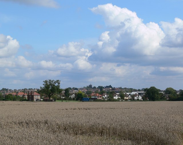
| DescriptionBarwell in Leicestershire - geograph.org.uk - 961593.jpg |
English: Barwell in Leicestershire Looking east across the fields from Ashby Road. |
| Date | |
| Source | From geograph.org.uk |
| Author | Mat Fascione |
| Attribution (required by the license) InfoField | Mat Fascione / Barwell in Leicestershire / |
InfoField | Mat Fascione / Barwell in Leicestershire |
| Camera location | 52° 33′ 46″ N, 1° 22′ 00″ W | View this and other nearby images on: OpenStreetMap |
|---|
| Object location | 52° 33′ 46″ N, 1° 22′ 00″ W | View this and other nearby images on: OpenStreetMap |
|---|
Licensing

|
This image was taken from the Geograph project collection. See this photograph's page on the Geograph website for the photographer's contact details. The copyright on this image is owned by Mat Fascione and is licensed for reuse under the Creative Commons Attribution-ShareAlike 2.0 license.
|
This file is licensed under the Creative Commons Attribution-Share Alike 2.0 Generic license.
Attribution: Mat Fascione
- You are free:
- to share – to copy, distribute and transmit the work
- to remix – to adapt the work
- Under the following conditions:
- attribution – You must give appropriate credit, provide a link to the license, and indicate if changes were made. You may do so in any reasonable manner, but not in any way that suggests the licensor endorses you or your use.
- share alike – If you remix, transform, or build upon the material, you must distribute your contributions under the same or compatible license as the original.
Captions
Add a one-line explanation of what this file represents
Items portrayed in this file
depicts
some value
13 September 2008
52°33'45.7"N, 1°22'0.1"W
52°33'45.72"N, 1°22'0.12"W
image/jpeg
6406ee1ee6f254a6a797c8feb3341d7427979495
66,651 byte
508 pixel
640 pixel
File history
Click on a date/time to view the file as it appeared at that time.
| Date/Time | Thumbnail | Dimensions | User | Comment | |
|---|---|---|---|---|---|
| current | 16:09, 22 February 2011 | | 640 × 508 (65 KB) | GeographBot | == {{int:filedesc}} == {{Information |description={{en|1=Barwell in Leicestershire Looking east across the fields from Ashby Road.}} |date=2008-09-13 |source=From [http://www.geograph.org.uk/photo/961593 geograph.org.uk] |author=[http://www.geograph.org.u |
File usage
The following pages on the English Wikipedia use this file (pages on other projects are not listed):
Global file usage
The following other wikis use this file:
Metadata
This file contains additional information, probably added from the digital camera or scanner used to create or digitize it.
If the file has been modified from its original state, some details may not fully reflect the modified file.
| _error | 0 |
|---|