File:Bass_Islands_map.png
From Wikipedia, the free encyclopedia
Size of this preview: 484 × 599 pixels. Other resolutions: 194 × 240 pixels | 388 × 480 pixels.
Original file (800 × 990 pixels, file size: 261 KB, MIME type: image/png)
| This is a file from the Wikimedia Commons. Information from its description page there is shown below. Commons is a freely licensed media file repository. You can help. |
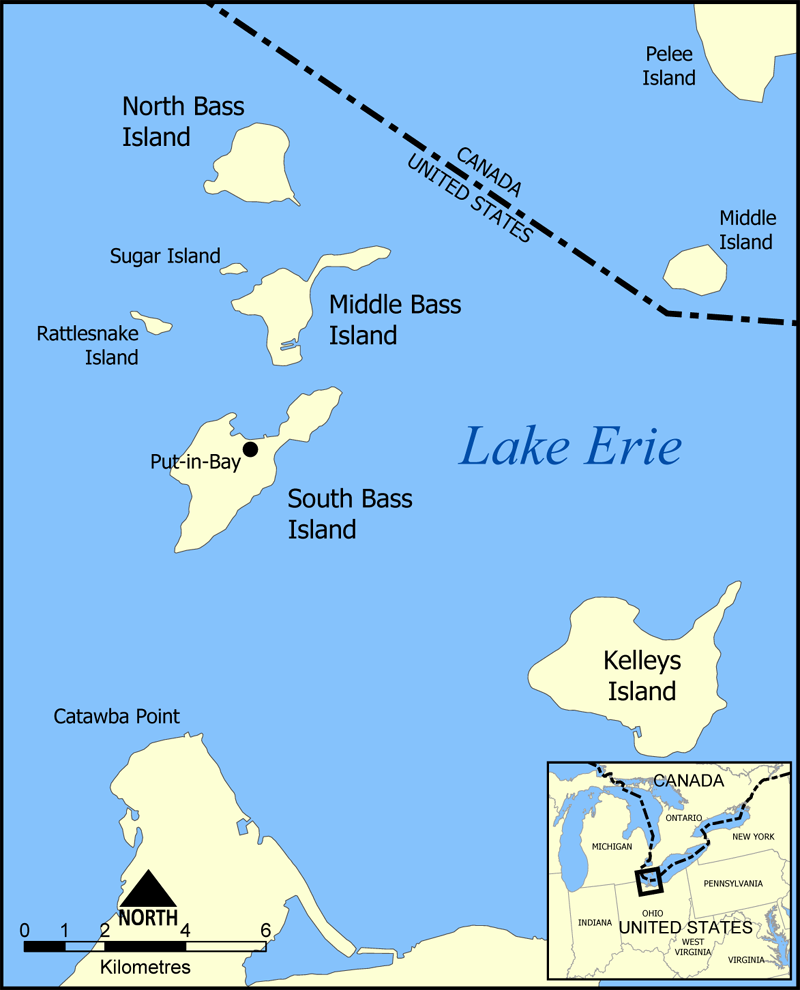
This is a map of the Bass Islands in Lake Erie. The three main islands are South Bass Island, Middle Bass Island, and North Bass Island. As well, the map shows the nearby Kelleys Island, Sugar Island, Rattlesnake Island, and Middle Island.
Created by NormanEinstein, June 23, 2005.
I, the copyright holder of this work, hereby publish it under the following license:

|
Permission is granted to copy, distribute and/or modify this document under the terms of the GNU Free Documentation License, Version 1.2 or any later version published by the Free Software Foundation; with no Invariant Sections, no Front-Cover Texts, and no Back-Cover Texts. A copy of the license is included in the section entitled GNU Free Documentation License.http://www.gnu.org/copyleft/fdl.htmlGFDLGNU Free Documentation Licensetruetrue |
| This file is licensed under the Creative Commons Attribution-Share Alike 3.0 Unported license. | ||
| ||
| This licensing tag was added to this file as part of the GFDL licensing update.http://creativecommons.org/licenses/by-sa/3.0/CC BY-SA 3.0Creative Commons Attribution-Share Alike 3.0truetrue |
Captions
Add a one-line explanation of what this file represents
Items portrayed in this file
depicts
image/png
e9641d032fcfb0003520dfb7c242f3c60a302ca0
266,975 byte
990 pixel
800 pixel
File history
Click on a date/time to view the file as it appeared at that time.
| Date/Time | Thumbnail | Dimensions | User | Comment | |
|---|---|---|---|---|---|
| current | 16:32, 23 June 2005 | | 800 × 990 (261 KB) | NormanEinstein | Corrected boundary line problem. |
| 15:04, 23 June 2005 |  | 800 × 990 (262 KB) | NormanEinstein | This is a map of the Bass Islands in Lake Erie. The three main islands are South Bass Island, Middle Bass Island, and North Bass Island. As well, the map shows the nearby Kelleys Island, Sugar Island, Rattlesnake Island, and Middle Island. Created by Nor |
File usage
The following pages on the English Wikipedia use this file (pages on other projects are not listed):
Global file usage
The following other wikis use this file:
- Usage on ceb.wikipedia.org
- Usage on de.wikipedia.org
- Usage on es.wikipedia.org
- Usage on fr.wikipedia.org
- Usage on hu.wikipedia.org
- Usage on nl.wikipedia.org
- Usage on pt.wikipedia.org
- Usage on ro.wikipedia.org
- Usage on uk.wikipedia.org
- Usage on ur.wikipedia.org
- Usage on vi.wikipedia.org
- Usage on www.wikidata.org
Retrieved from "https://en.wikipedia.org/wiki/File:Bass_Islands_map.png"