File:California_map_showing_Sacramento_County.png
From Wikipedia, the free encyclopedia
No higher resolution available.
California_map_showing_Sacramento_County.png (200 × 231 pixels, file size: 22 KB, MIME type: image/png)
| This is a file from the Wikimedia Commons. Information from its description page there is shown below. Commons is a freely licensed media file repository. You can help. |
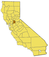
Map of Sacramento county in California. From en:

|
Permission is granted to copy, distribute and/or modify this document under the terms of the GNU Free Documentation License, Version 1.2 or any later version published by the Free Software Foundation; with no Invariant Sections, no Front-Cover Texts, and no Back-Cover Texts. A copy of the license is included in the section entitled GNU Free Documentation License.http://www.gnu.org/copyleft/fdl.htmlGFDLGNU Free Documentation Licensetruetrue |
| This file is licensed under the Creative Commons Attribution-Share Alike 3.0 Unported license. | ||
| ||
| This licensing tag was added to this file as part of the GFDL licensing update.http://creativecommons.org/licenses/by-sa/3.0/CC BY-SA 3.0Creative Commons Attribution-Share Alike 3.0truetrue |
Captions
Add a one-line explanation of what this file represents
Items portrayed in this file
depicts
image/png
3f33dc87df04c388b80a3fac184ed3f58cb1ba1a
22,751 byte
231 pixel
200 pixel
File history
Click on a date/time to view the file as it appeared at that time.
| Date/Time | Thumbnail | Dimensions | User | Comment | |
|---|---|---|---|---|---|
| current | 15:23, 14 July 2005 | | 200 × 231 (22 KB) | Pyramide~commonswiki | Map of Sacramento county in California. From en: {{GFDL}} Category:Maps of counties in California |
File usage
The following pages on the English Wikipedia use this file (pages on other projects are not listed):
- Andrus Island
- Antelope High School
- Ben Ali, Sacramento, California
- Brannan Island
- Carpenter Hill
- Dead Horse Island
- Grand Island (California)
- Ida Island
- Jensen Botanical Gardens
- Long Island (California)
- Michigan Bar, California
- Montezuma Island
- Natomas East Main Drainage Canal
- Norristown, California
- Paintersville, California
- Randall Island
- Robla, Sacramento, California
- Rusch Botanical Gardens
- Ryde, California
- Sloughhouse, California
- Stone Lake (California)
- Sunset Lawn Chapel of the Chimes
- Sutter Island
- Sutterville, California
- Swanston Estates
- Twitchell Island
- Tyler Island (California)
- Upper Land Park, Sacramento, California
- Valley View Acres, Sacramento, California
- West Island (California)
- Template:SacramentoCountyCA-geo-stub
Global file usage
The following other wikis use this file:
- Usage on pam.wikipedia.org
- Usage on www.wikidata.org
- Usage on yi.wikipedia.org