File:California_map_showing_Ventura_County.png
From Wikipedia, the free encyclopedia
No higher resolution available.
California_map_showing_Ventura_County.png (200 × 231 pixels, file size: 22 KB, MIME type: image/png)
| This is a file from the Wikimedia Commons. Information from its description page there is shown below. Commons is a freely licensed media file repository. You can help. |
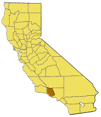
- {{en|Map of Ventura County — in western Southern California.
From en:

|
Permission is granted to copy, distribute and/or modify this document under the terms of the GNU Free Documentation License, Version 1.2 or any later version published by the Free Software Foundation; with no Invariant Sections, no Front-Cover Texts, and no Back-Cover Texts. A copy of the license is included in the section entitled GNU Free Documentation License.http://www.gnu.org/copyleft/fdl.htmlGFDLGNU Free Documentation Licensetruetrue |
| This file is licensed under the Creative Commons Attribution-Share Alike 3.0 Unported license. | ||
| ||
| This licensing tag was added to this file as part of the GFDL licensing update.http://creativecommons.org/licenses/by-sa/3.0/CC BY-SA 3.0Creative Commons Attribution-Share Alike 3.0truetrue |
Captions
Add a one-line explanation of what this file represents
Items portrayed in this file
depicts
image/png
090ebdc8c9faab8a806fc9e175758a53219a2a1b
22,818 byte
231 pixel
200 pixel
File history
Click on a date/time to view the file as it appeared at that time.
| Date/Time | Thumbnail | Dimensions | User | Comment | |
|---|---|---|---|---|---|
| current | 15:32, 14 July 2005 | | 200 × 231 (22 KB) | Pyramide~commonswiki | Map of Ventura county in California. From en: {{GFDL}} Category:Maps of counties in California |
File usage
The following pages on the English Wikipedia use this file (pages on other projects are not listed):
- Arroyo Sequit
- Arroyo Verde Park
- Buckhorn, Ventura County, California
- CSU Channel Islands University Park
- Calleguas Creek
- Camp Bartlett, California
- Chatsworth Peak
- Cobblestone Mountain (California)
- Coyote Creek (Ventura County)
- Cuddy Canyon, California
- Dos Vientos, Thousand Oaks, California
- Exchange Peak
- Fireworks Hill
- Frazier Mountain
- Hidden Valley, Ventura County, California
- Hines Peak
- Knoll Open Space
- Lockwood Valley, California
- Lyons Hot Springs
- Mugu Lagoon
- Mussel Shoals, California
- Ojala, California
- Ortonville, California
- San Buenaventura State Beach
- Sandstone Peak
- Santa Clara River Valley
- Santa Rosa Valley
- Sawmill Mountain
- Sea Cliff, California
- Sespe Gorge
- Simi Peak
- Solimar Beach
- Topatopa Mountains
- Tri Peaks (Santa Monica Mountains)
- Triunfo Pass
- Upper Ojai, California
- Ventura County Superior Court
- Template:VenturaCountyCA-geo-stub
Global file usage
The following other wikis use this file:
- Usage on bg.wikipedia.org
- Usage on fa.wikipedia.org
- Usage on li.wikipedia.org
- Usage on pam.wikipedia.org
- Usage on www.wikidata.org