File:Edlington_(Doncaster)_station_site_geograph-3451254-by-Ben-Brooksbank.jpg
From Wikipedia, the free encyclopedia
Size of this preview: 800 × 511 pixels. Other resolutions: 320 × 204 pixels | 640 × 409 pixels | 1,024 × 654 pixels | 1,280 × 818 pixels | 2,340 × 1,495 pixels.
Original file (2,340 × 1,495 pixels, file size: 3.21 MB, MIME type: image/jpeg)
| This is a file from the Wikimedia Commons. Information from its description page there is shown below. Commons is a freely licensed media file repository. You can help. |
Summary
| DescriptionEdlington (Doncaster) station site geograph-3451254-by-Ben-Brooksbank.jpg |
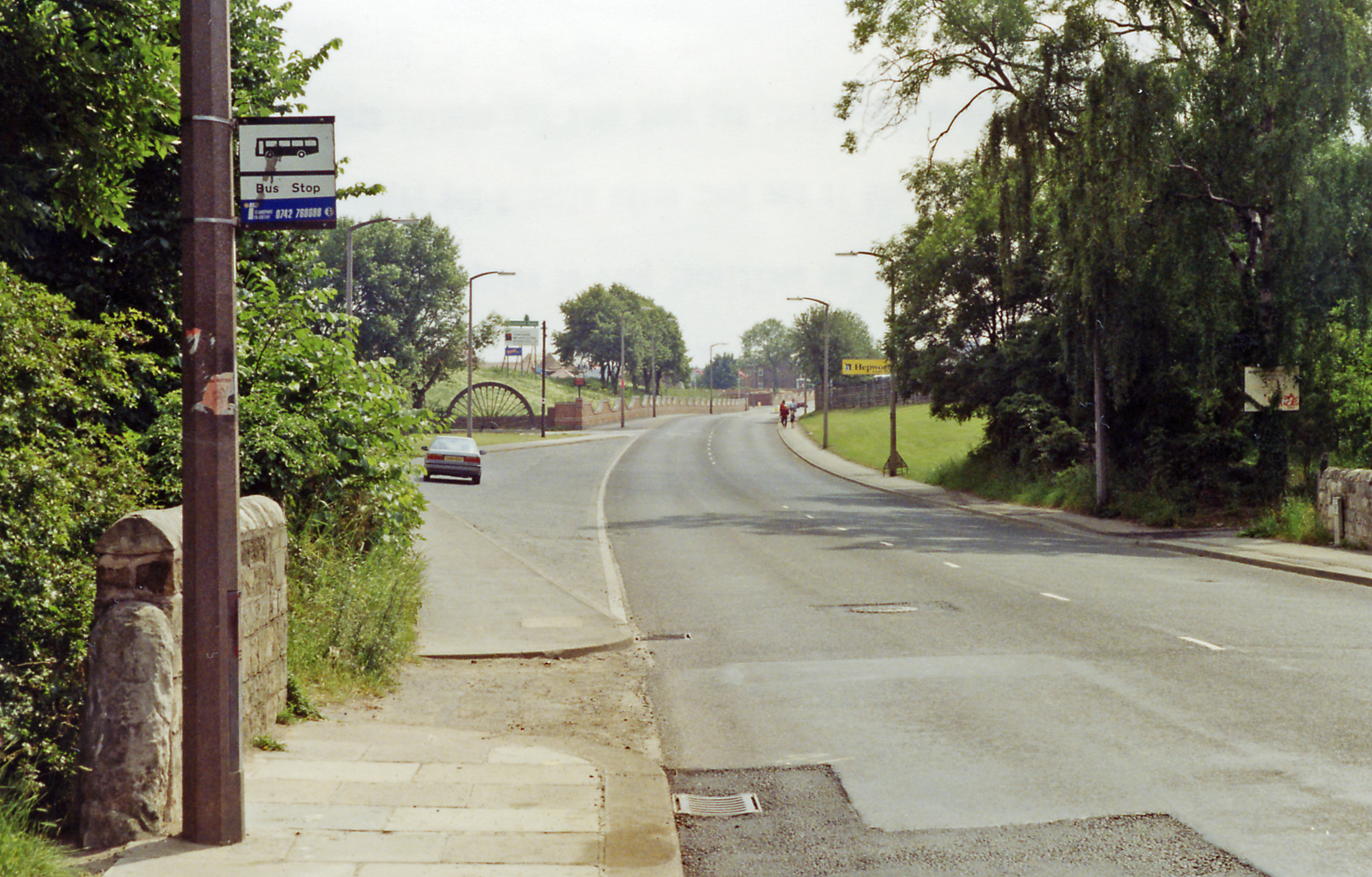
English: Edlington (Doncaster): site of former station/halt, 1992. View southward on the B6376 Warmsworth - Maltby road. The Halt had been on the left and was the terminus of the local service run until 10/9/51 from Wakefield on the ex-L&Y Dearne Valley mineral line, which continued to Black Carr and Bessacarr Junctions on the ex-GNR until 1966. |
| Date | |
| Source | From geograph.org.uk |
| Author | Ben Brooksbank |
| Permission (Reusing this file) |
Creative Commons Attribution Share-alike license 2.0 |
| Attribution (required by the license) InfoField | Ben Brooksbank / Edlington (Doncaster): site of former station/halt, 1992 / |
InfoField | Ben Brooksbank / Edlington (Doncaster): site of former station/halt, 1992 |
| Camera location | 53° 29′ 25.47″ N, 1° 10′ 59.58″ W | View this and other nearby images on: OpenStreetMap |
|---|
Licensing

|
This image was taken from the Geograph project collection. See this photograph's page on the Geograph website for the photographer's contact details. The copyright on this image is owned by Ben Brooksbank and is licensed for reuse under the Creative Commons Attribution-ShareAlike 2.0 license.
|
This file is licensed under the Creative Commons Attribution-Share Alike 2.0 Generic license.
Attribution: Ben Brooksbank
- You are free:
- to share – to copy, distribute and transmit the work
- to remix – to adapt the work
- Under the following conditions:
- attribution – You must give appropriate credit, provide a link to the license, and indicate if changes were made. You may do so in any reasonable manner, but not in any way that suggests the licensor endorses you or your use.
- share alike – If you remix, transform, or build upon the material, you must distribute your contributions under the same or compatible license as the original.
Captions
Add a one-line explanation of what this file represents
Items portrayed in this file
depicts
some value
21 June 1992
53°29'25.465"N, 1°10'59.581"W
File history
Click on a date/time to view the file as it appeared at that time.
| Date/Time | Thumbnail | Dimensions | User | Comment | |
|---|---|---|---|---|---|
| current | 07:56, 14 July 2013 | | 2,340 × 1,495 (3.21 MB) | Chevin | == {{int:filedesc}} == {{Information |Description={{en|1='''Edlington (Doncaster): site of former station/halt, 1992.'''<br/> View southward on the B6376 Warmsworth - Maltby road. The Halt had been on the left and was the terminus of the local service ... |
File usage
The following pages on the English Wikipedia use this file (pages on other projects are not listed):
Global file usage
The following other wikis use this file:
- Usage on www.wikidata.org
Metadata
This file contains additional information, probably added from the digital camera or scanner used to create or digitize it.
If the file has been modified from its original state, some details may not fully reflect the modified file.
| Orientation | Normal |
|---|---|
| Horizontal resolution | 157 dpc |
| Vertical resolution | 157 dpc |
| Software used | Adobe Photoshop Elements 3.0 Windows |
| File change date and time | 23:34, 8 May 2013 |
| Color space | sRGB |
| Image width | 2,340 px |
| Image height | 1,495 px |
| Date and time of digitizing | 23:34, 8 May 2013 |
| Date metadata was last modified | 23:34, 8 May 2013 |
_station_site_geograph-3451254-by-Ben-Brooksbank.jpg)