File:Egypt_Israel_Locator.png
From Wikipedia, the free encyclopedia
No higher resolution available.
Egypt_Israel_Locator.png (259 × 163 pixels, file size: 18 KB, MIME type: image/png)
| This is a file from the Wikimedia Commons. Information from its description page there is shown below. Commons is a freely licensed media file repository. You can help. |
Summary
| DescriptionEgypt Israel Locator.png |
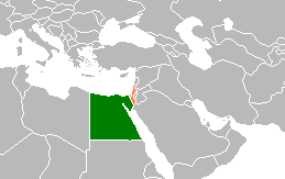
English: Egypt-Israel locator map. |
| Source | I made this map out of a licence free blank map of the world. (Transferred from en.wikipedia to Commons.) |
| Author | Groubani at English Wikipedia |
Licensing

|
Permission is granted to copy, distribute and/or modify this document under the terms of the GNU Free Documentation License, Version 1.2 or any later version published by the Free Software Foundation; with no Invariant Sections, no Front-Cover Texts, and no Back-Cover Texts. A copy of the license is included in the section entitled GNU Free Documentation License.http://www.gnu.org/copyleft/fdl.htmlGFDLGNU Free Documentation Licensetruetrue |
| This file is licensed under the Creative Commons Attribution-Share Alike 3.0 Unported license. | ||
| ||
| This licensing tag was added to this file as part of the GFDL licensing update.http://creativecommons.org/licenses/by-sa/3.0/CC BY-SA 3.0Creative Commons Attribution-Share Alike 3.0truetrue |
Original upload log
The original description page was here. All following user names refer to en.wikipedia.
- 2009-01-31 13:40 Groubani 259×163× (5465 bytes) I made this map out of a licence free blank map of the world.
Captions
Add a one-line explanation of what this file represents
Items portrayed in this file
depicts
File history
Click on a date/time to view the file as it appeared at that time.
| Date/Time | Thumbnail | Dimensions | User | Comment | |
|---|---|---|---|---|---|
| current | 17:31, 14 January 2017 | | 259 × 163 (18 KB) | عادل | Correction of Egypt borders |
| 19:15, 3 September 2012 |  | 259 × 163 (5 KB) | MGA73bot2 | {{BotMoveToCommons|en.wikipedia|year={{subst:CURRENTYEAR}}|month={{subst:CURRENTMONTHNAME}}|day={{subst:CURRENTDAY}}}} {{Information |Description={{en|I made this map out of a licence free blank map of the world.}} |Source=Transferred from [http://en... |
File usage
The following pages on the English Wikipedia use this file (pages on other projects are not listed):
Global file usage
The following other wikis use this file:
- Usage on ca.wikipedia.org
- Usage on de.wikipedia.org
- Usage on es.wikipedia.org
- Usage on fa.wikipedia.org
- Usage on fr.wikipedia.org
- Usage on hy.wikipedia.org
- Usage on id.wikipedia.org
- Usage on it.wikipedia.org
- Usage on min.wikipedia.org
- Usage on nl.wikipedia.org
- Usage on pl.wikipedia.org
- Usage on pt.wikipedia.org
- Usage on ru.wikipedia.org
- Usage on simple.wikipedia.org
- Usage on www.wikidata.org
- Usage on zh.wikipedia.org
Metadata
This file contains additional information, probably added from the digital camera or scanner used to create or digitize it.
If the file has been modified from its original state, some details may not fully reflect the modified file.
| Horizontal resolution | 72 dpi |
|---|---|
| Vertical resolution | 72 dpi |
| Color space | Uncalibrated |
| Image width | 259 px |
| Image height | 163 px |
| Software used | Adobe Photoshop CC 2015 (Windows) |
| Date and time of digitizing | 21:30, 14 January 2017 |
| File change date and time | 21:31, 14 January 2017 |
| Date metadata was last modified | 21:31, 14 January 2017 |
| Unique ID of original document | xmp.did:9a996628-08f5-3049-a15d-2f531b548ec4 |
Retrieved from "https://en.wikipedia.org/wiki/File:Egypt_Israel_Locator.png"