File:FWA_airport_map.PNG
From Wikipedia, the free encyclopedia
Size of this preview: 387 × 600 pixels. Other resolutions: 155 × 240 pixels | 310 × 480 pixels | 731 × 1,133 pixels.
Original file (731 × 1,133 pixels, file size: 101 KB, MIME type: image/png)
| This is a file from the Wikimedia Commons. Information from its description page there is shown below. Commons is a freely licensed media file repository. You can help. |
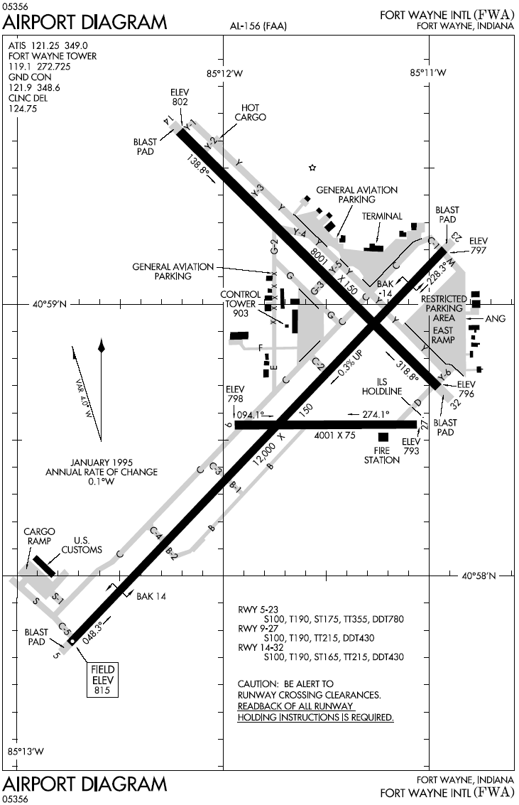
Airport map for Fort Wayne International Airport
| Public domainPublic domainfalsefalse |
This image or file is a work of a Federal Aviation Administration employee, taken or made as part of that person's official duties. As a work of the U.S. federal government, the image is in the public domain in the United States.
English | italiano | македонски | മലയാളം | Nederlands | русский | sicilianu | українська | 中文 | +/− |
 |
File history
Click on a date/time to view the file as it appeared at that time.
| Date/Time | Thumbnail | Dimensions | User | Comment | |
|---|---|---|---|---|---|
| current | 17:43, 5 January 2006 | | 731 × 1,133 (101 KB) | Cmprince | Airport map for Fort Wayne International Airport {{PD-USGov-FAA}} |
File usage
The following pages on the English Wikipedia use this file (pages on other projects are not listed):
Global file usage
The following other wikis use this file:
- Usage on de.wikipedia.org
- Usage on fa.wikipedia.org
- Usage on tg.wikipedia.org
- Usage on ur.wikipedia.org
- Usage on www.wikidata.org
Retrieved from "https://en.wikipedia.org/wiki/File:FWA_airport_map.PNG"