File:Gaza_Flotilla_Route.jpg
From Wikipedia, the free encyclopedia
No higher resolution available.
Gaza_Flotilla_Route.jpg (454 × 482 pixels, file size: 107 KB, MIME type: image/jpeg)
| This is a file from the Wikimedia Commons. Information from its description page there is shown below. Commons is a freely licensed media file repository. You can help. |
Summary
| DescriptionGaza Flotilla Route.jpg |
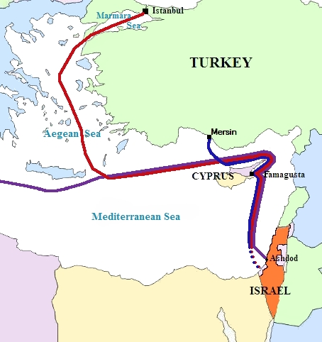
██ MV Mavi Marmara Afrikaans: Gaza-flottielje roete
العربية: طريق أسطول غزة
Беларуская: Шлях Газы флатыліі
Български: Пътят на Газа флотилия
Català: Camí de la Gaza flotilla
Deutsch: Routen des Gaza-Konvois
Ελληνικά: Πορεία της Γάζας στολίσκο
English: Gaza flotilla route
Español: Camino de la Gaza flotilla
Gaeilge: Conair de Gaza flotilla
עברית: עזה המסלול בשייטת
Íslenska: Slóð Gaza flotilla
Italiano: Percorso della Gaza flotilla
日本語: ガザ艦隊ルート
Malti: Passaġġ ta 'Gaża flotilla
Nederlands: Gaza flottielje route
Português: Caminho da Gaza flotilla
Română: Cale din Gaza flotilla
Русский: Путь Газы флотилии
Српски / srpski: Пут Газе флотиле
Türkçe: Gazze filosunun rotası
中文:加沙船隊航線 |
| Date | |
| Source | Own work |
| Author | Andre86 |

|
This incident map image could be re-created using vector graphics as an SVG file. This has several advantages; see Commons:Media for cleanup for more information. If an SVG form of this image is available, please upload it and afterwards replace this template with
{{vector version available|new image name}}.
It is recommended to name the SVG file “Gaza Flotilla Route.svg”—then the template Vector version available (or Vva) does not need the new image name parameter. |
 | This incident map image was uploaded in the JPEG format even though it consists of non-photographic data. This information could be stored more efficiently or accurately in the PNG or SVG format. If possible, please upload a PNG or SVG version of this image without compression artifacts, derived from a non-JPEG source (or with existing artifacts removed). After doing so, please tag the JPEG version with {{Superseded|NewImage.ext}} and remove this tag. This tag should not be applied to photographs or scans. If this image is a diagram or other image suitable for vectorisation, please tag this image with {{Convert to SVG}} instead of {{BadJPEG}}. If not suitable for vectorisation, use {{Convert to PNG}}. For more information, see {{BadJPEG}}. |  |
Licensing
| Public domainPublic domainfalsefalse |
| I, the copyright holder of this work, release this work into the public domain. This applies worldwide. In some countries this may not be legally possible; if so: I grant anyone the right to use this work for any purpose, without any conditions, unless such conditions are required by law. |
Captions
Add a one-line explanation of what this file represents
Items portrayed in this file
depicts
2 June 2010
File history
Click on a date/time to view the file as it appeared at that time.
| Date/Time | Thumbnail | Dimensions | User | Comment | |
|---|---|---|---|---|---|
| current | 12:20, 4 February 2014 | | 454 × 482 (107 KB) | Mikrobølgeovn | Reverted to version as of 04:51, 3 June 2010 Wrong route |
| 09:55, 6 June 2010 |  | 454 × 482 (120 KB) | Randam | route fix | |
| 22:09, 4 June 2010 |  | 454 × 482 (111 KB) | Randam | Route to Egypt | |
| 04:51, 3 June 2010 |  | 454 × 482 (107 KB) | Randam | adding the seas | |
| 04:45, 3 June 2010 |  | 454 × 482 (101 KB) | Randam | jpg | |
| 22:55, 1 June 2010 |  | 454 × 482 (34 KB) | Andre86 | {{Information |Description={{en|1=Gaza flotilla route }} |Source={{own}} |Author=Andre86 |Date=2 june 2010 |Permission= |other_versions= }} |
File usage
The following pages on the English Wikipedia use this file (pages on other projects are not listed):
Global file usage
The following other wikis use this file:
- Usage on ast.wikipedia.org
- Usage on de.wikipedia.org
- Usage on el.wikipedia.org
- Usage on eo.wikipedia.org
- Usage on es.wikipedia.org
- Usage on fi.wikipedia.org
- Usage on simple.wikipedia.org
- Usage on www.wikidata.org
Retrieved from "https://en.wikipedia.org/wiki/File:Gaza_Flotilla_Route.jpg"