File:Glastonbury_and_street_station_in_1979.jpg
From Wikipedia, the free encyclopedia
Size of this preview: 713 × 600 pixels. Other resolutions: 285 × 240 pixels | 571 × 480 pixels | 913 × 768 pixels.
Original file (913 × 768 pixels, file size: 194 KB, MIME type: image/jpeg)
| This is a file from the Wikimedia Commons. Information from its description page there is shown below. Commons is a freely licensed media file repository. You can help. |
Summary
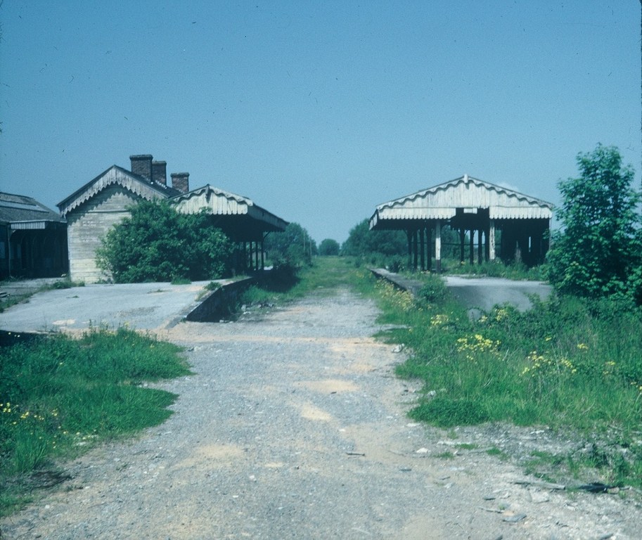
| DescriptionGlastonbury and Street Railway Station - geograph.org.uk - 2035511.jpg |
English: Glastonbury and Street Railway Station |
| Depicts InfoField | railway station, Glastonbury |
| Date |
|
| Source |
Geograph Britain and Ireland |
| Author |
David Hillas |
| Place of creation InfoField | Glastonbury |
| Camera location | 51° 08′ 50.5″ N, 2° 43′ 46″ W | View this and other nearby images on: OpenStreetMap |
|---|
| Object location | 51° 08′ 50.8″ N, 2° 43′ 48″ W | View this and other nearby images on: OpenStreetMap |
|---|
Licensing

|
This image was taken from the Geograph project collection. See this photograph's page on the Geograph website for the photographer's contact details. The copyright on this image is owned by David Hillas
|
This file is licensed under the Creative Commons Attribution-Share Alike 2.0 Generic license.
Attribution: Glastonbury and Street Railway Station by David Hillas
- You are free:
- to share – to copy, distribute and transmit the work
- to remix – to adapt the work
- Under the following conditions:
- attribution – You must give appropriate credit, provide a link to the license, and indicate if changes were made. You may do so in any reasonable manner, but not in any way that suggests the licensor endorses you or your use.
- share alike – If you remix, transform, or build upon the material, you must distribute your contributions under the same or compatible license as the original.
Captions
Glastonbury and Street Railway Station
Items portrayed in this file
depicts
some value
11 June 1979
51°8'50.6"N, 2°43'45.5"W
51°8'50.6"N, 2°43'47.6"W
image/jpeg
File history
Click on a date/time to view the file as it appeared at that time.
| Date/Time | Thumbnail | Dimensions | User | Comment | |
|---|---|---|---|---|---|
| current | 17:45, 21 May 2021 | | 913 × 768 (194 KB) | GeographBot | Uploading geograph.org.uk image from https://www.geograph.org.uk/photo/2035511 |
File usage
The following pages on the English Wikipedia use this file (pages on other projects are not listed):
Global file usage
The following other wikis use this file:
- Usage on www.wikidata.org
Metadata
This file contains additional information, probably added from the digital camera or scanner used to create or digitize it.
If the file has been modified from its original state, some details may not fully reflect the modified file.
| Camera manufacturer | FUJI PHOTO FILM CO., LTD. |
|---|---|
| Camera model | SP-2000 |
| Date and time of data generation | 08:54, 19 April 2010 |
| Orientation | Normal |
| Software used | Microsoft Windows Photo Gallery 6.0.6001.18000 |
| File change date and time | 17:30, 20 August 2010 |
| Y and C positioning | Centered |
| Exif version | 2.1 |
| Date and time of digitizing | 08:54, 19 April 2010 |
| Meaning of each component |
|
| DateTimeOriginal subseconds | 00 |
| DateTimeDigitized subseconds | 00 |
| Supported Flashpix version | 1 |
| File source | Digital still camera |
| Scene type | A directly photographed image |
| Unique image ID | F415D248E1724880A22D0635E6C622A4 |