File:Guadalupe_River_and_Tasman_Drive_San_Jose_aerial.jpg
From Wikipedia, the free encyclopedia
Size of this preview: 800 × 450 pixels. Other resolutions: 320 × 180 pixels | 640 × 360 pixels | 1,024 × 576 pixels | 1,280 × 720 pixels | 2,627 × 1,477 pixels.
Original file (2,627 × 1,477 pixels, file size: 1.17 MB, MIME type: image/jpeg)
| This is a file from the Wikimedia Commons. Information from its description page there is shown below. Commons is a freely licensed media file repository. You can help. |
Summary
| DescriptionGuadalupe River and Tasman Drive San Jose aerial.jpg |
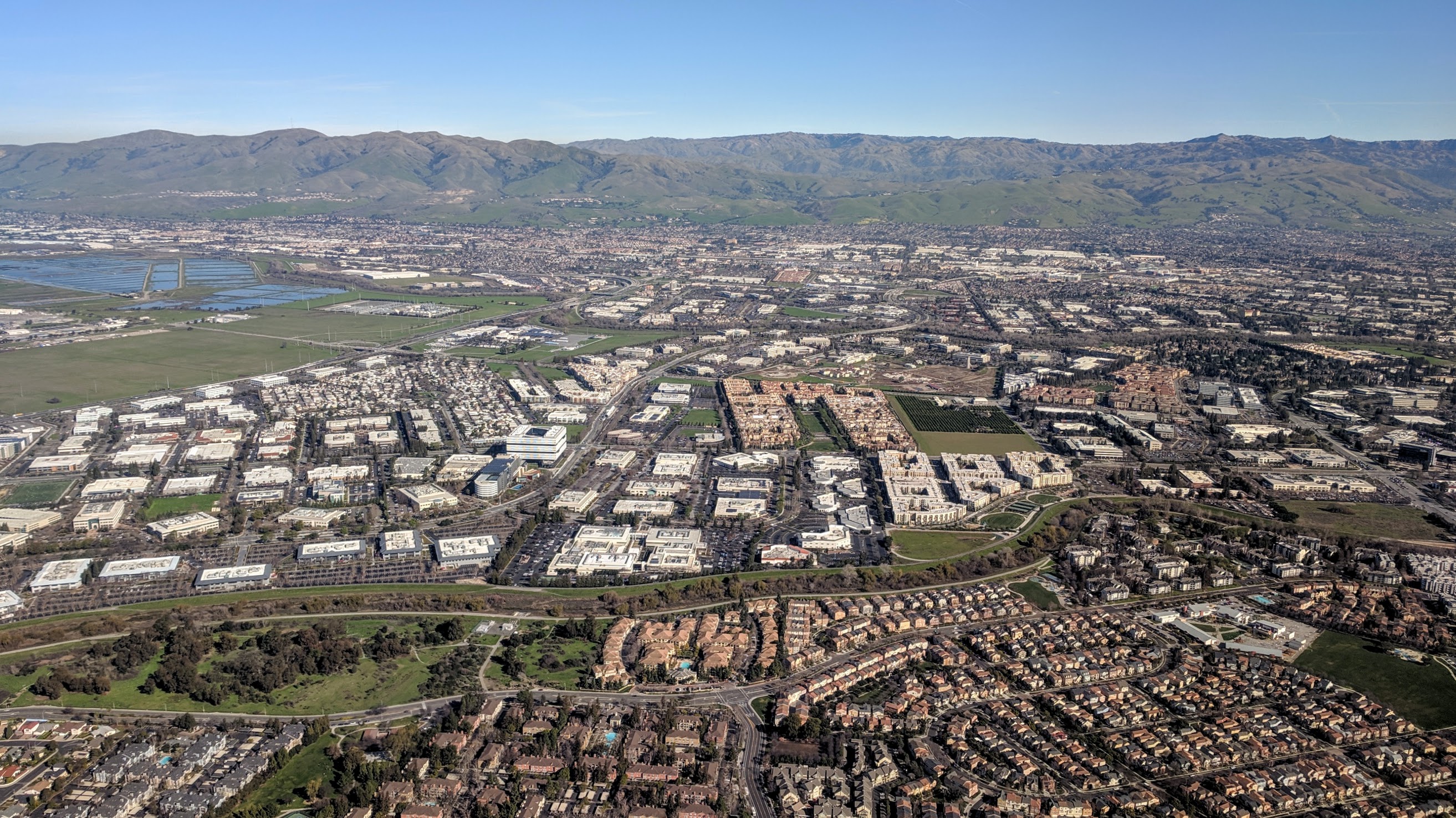
English: Aerial view looking east, of the Guadalupe River and Tasman Drive, Santa Clara (near side of the river) and San Jose (far side of the river), California. The Guadalupe River Trail is on the east (far) side of the river. The green area at near left is the Ulistac Natural Area. |
||
| Date | |||
| Source | Own work | ||
| Author | Dicklyon | ||
| Other versions |
|
.jpg)
.jpg)
| Camera location | 37° 21′ 15.03″ N, 121° 55′ 01.6″ W | View this and other nearby images on: OpenStreetMap |
|---|
Licensing
I, the copyright holder of this work, hereby publish it under the following license:
This file is licensed under the Creative Commons Attribution-Share Alike 4.0 International license.
- You are free:
- to share – to copy, distribute and transmit the work
- to remix – to adapt the work
- Under the following conditions:
- attribution – You must give appropriate credit, provide a link to the license, and indicate if changes were made. You may do so in any reasonable manner, but not in any way that suggests the licensor endorses you or your use.
- share alike – If you remix, transform, or build upon the material, you must distribute your contributions under the same or compatible license as the original.
Captions
Guadalupe River and Tasman Drive, San Jose and Santa Clara, aerial
Items portrayed in this file
depicts
some value
23 January 2019
37°21'15.030"N, 121°55'1.600"W
File history
Click on a date/time to view the file as it appeared at that time.
| Date/Time | Thumbnail | Dimensions | User | Comment | |
|---|---|---|---|---|---|
| current | 04:18, 8 May 2019 | | 2,627 × 1,477 (1.17 MB) | Dicklyon | User created page with UploadWizard |
File usage
The following pages on the English Wikipedia use this file (pages on other projects are not listed):
Global file usage
The following other wikis use this file:
- Usage on www.wikidata.org
Metadata
This file contains additional information, probably added from the digital camera or scanner used to create or digitize it.
If the file has been modified from its original state, some details may not fully reflect the modified file.
| Camera manufacturer | |
|---|---|
| Camera model | Pixel |
| Exposure time | 159/200,000 sec (0.000795) |
| F-number | f/2 |
| ISO speed rating | 52 |
| Date and time of data generation | 12:45, 23 January 2019 |
| Lens focal length | 4.67 mm |
| Latitude | 37° 21′ 15.03″ N |
| Longitude | 121° 55′ 1.6″ W |
| Altitude | 3 meters below sea level |
| Width | 2,688 px |
| Height | 1,512 px |
| Orientation | Normal |
| Horizontal resolution | 72 dpi |
| Vertical resolution | 72 dpi |
| Software used | HDR+ 1.0.229626132zr |
| File change date and time | 12:45, 23 January 2019 |
| Y and C positioning | Centered |
| Exposure Program | Normal program |
| Exif version | 2.2 |
| Date and time of digitizing | 12:45, 23 January 2019 |
| Meaning of each component |
|
| Shutter speed | 10.3 |
| APEX aperture | 2 |
| APEX brightness | 8.24 |
| Exposure bias | 0 |
| Maximum land aperture | 2 APEX (f/2) |
| Subject distance | 1.946 meters |
| Metering mode | Center weighted average |
| Flash | Flash did not fire, compulsory flash suppression |
| DateTime subseconds | 857844 |
| DateTimeOriginal subseconds | 857844 |
| DateTimeDigitized subseconds | 857844 |
| Supported Flashpix version | 1 |
| Color space | sRGB |
| Sensing method | One-chip color area sensor |
| Scene type | A directly photographed image |
| Custom image processing | Custom process |
| Exposure mode | Auto exposure |
| White balance | Auto white balance |
| Digital zoom ratio | 0 |
| Focal length in 35 mm film | 26 mm |
| Scene capture type | Standard |
| Contrast | Normal |
| Saturation | Normal |
| Sharpness | Normal |
| Subject distance range | Close view |
| Unique image ID | cc26762311d9118b0000000000000000 |
| GPS time (atomic clock) | 20:44 |
| Measurement precision | Poor (41) |
| Reference for direction of image | Magnetic direction |
| Direction of image | 327 |
| GPS date | 23 January 2019 |
| GPS tag version | 0.0.2.2 |