File:Hartlepool_railway_station_(site),_County_Durham_(geograph_4299986).jpg
From Wikipedia, the free encyclopedia
Size of this preview: 800 × 600 pixels. Other resolutions: 320 × 240 pixels | 640 × 480 pixels | 1,024 × 768 pixels | 1,280 × 960 pixels | 1,600 × 1,200 pixels.
Original file (1,600 × 1,200 pixels, file size: 363 KB, MIME type: image/jpeg)
| This is a file from the Wikimedia Commons. Information from its description page there is shown below. Commons is a freely licensed media file repository. You can help. |
Summary
| DescriptionHartlepool railway station (site), County Durham (geograph 4299986).jpg |
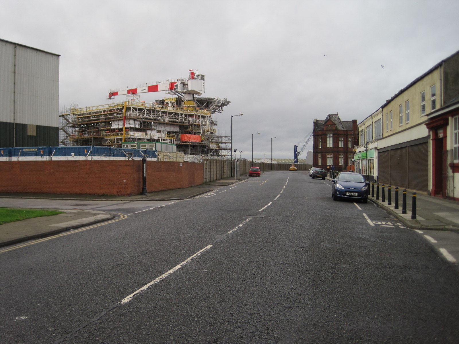
English: Hartlepool railway station (site), County Durham Opened in 1835 by the Hartlepool Dock and Railway Company as the terminus of the line from Haswell, this station closed to passengers in 1947 and completely in 1964. At the time, the station we now call Hartlepool was known as "West Hartlepool" - see NZ5132 : Hartlepool railway station, County Durham. View west on Northgate Street. The terminus building was to the left of the wall, roughly where the marine structure is, with the tracks further to the left. |
| Date | |
| Source | From geograph.org.uk |
| Author | Nigel Thompson |
| Permission (Reusing this file) |
Creative Commons Attribution Share-alike license 2.0 |
| Attribution (required by the license) InfoField | Nigel Thompson / Hartlepool railway station (site), County Durham / |
InfoField | Nigel Thompson / Hartlepool railway station (site), County Durham |
.jpg)
| Camera location | 54° 41′ 55.5″ N, 1° 11′ 11″ W | View this and other nearby images on: OpenStreetMap |
|---|
| Object location | 54° 41′ 55.5″ N, 1° 11′ 15″ W | View this and other nearby images on: OpenStreetMap |
|---|
Licensing

|
This image was taken from the Geograph project collection. See this photograph's page on the Geograph website for the photographer's contact details. The copyright on this image is owned by Nigel Thompson and is licensed for reuse under the Creative Commons Attribution-ShareAlike 2.0 license.
|
This file is licensed under the Creative Commons Attribution-Share Alike 2.0 Generic license.
Attribution: Nigel Thompson
- You are free:
- to share – to copy, distribute and transmit the work
- to remix – to adapt the work
- Under the following conditions:
- attribution – You must give appropriate credit, provide a link to the license, and indicate if changes were made. You may do so in any reasonable manner, but not in any way that suggests the licensor endorses you or your use.
- share alike – If you remix, transform, or build upon the material, you must distribute your contributions under the same or compatible license as the original.
Captions
Add a one-line explanation of what this file represents
Items portrayed in this file
depicts
some value
1 January 2015
54°41'55.493"N, 1°11'11.202"W
54°41'55.50"N, 1°11'14.57"W
image/jpeg
File history
Click on a date/time to view the file as it appeared at that time.
| Date/Time | Thumbnail | Dimensions | User | Comment | |
|---|---|---|---|---|---|
| current | 09:44, 31 May 2018 | | 1,600 × 1,200 (363 KB) | User.who.is.anonymous | Transferred from geograph.co.uk using [https://tools.wmflabs.org/geograph2commons/ geograph2commons] |
File usage
The following pages on the English Wikipedia use this file (pages on other projects are not listed):
Global file usage
The following other wikis use this file:
- Usage on www.wikidata.org
,_County_Durham_(geograph_4299986).jpg)