File:Langa_map.jpg
From Wikipedia, the free encyclopedia
No higher resolution available.
Langa_map.jpg (327 × 257 pixels, file size: 117 KB, MIME type: image/jpeg)
| This is a file from the Wikimedia Commons. Information from its description page there is shown below. Commons is a freely licensed media file repository. You can help. |
Summary
| DescriptionLanga map.jpg |
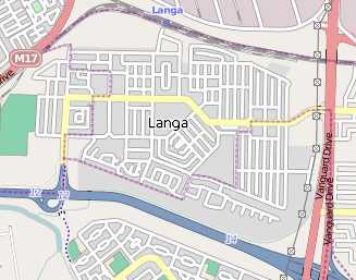
This map of Langa, Cape Town was created from OpenStreetMap project data, collected by the community. This map may be incomplete, and may contain errors. Don't rely solely on it for navigation. |
| Date | (UTC) |
| Source | openstreetmap.org |
| Creator |
OpenStreetMap contributors |
| Permission (Reusing this file) |
OpenStreetMap data and maps are licensed under the Creative Commons Attribution-ShareAlike 2.0 license (CC-BY-SA 2.0). This file is licensed under the Creative Commons Attribution-Share Alike 2.0 Generic license.
|
| Georeferencing | Georeference the map in Wikimaps Warper If inappropriate please set warp_status = skip to hide. |
Original upload log
The original description page was here. All following user names refer to en.wikipedia.
| Date/Time | Dimensions | User | Comment |
|---|---|---|---|
| 2010-07-25 07:26:13 | 327 × 257 | Discott | {{Information |Description = This map of Langa in Cape Town was created from OpenStreetMap project data, collected by the community |Source = http://www.openstreetmap.org/ |Date = ~~~~~ |Author = OpenStreetMap contributors |
Captions
Add a one-line explanation of what this file represents
Items portrayed in this file
depicts
25 July 2010
File history
Click on a date/time to view the file as it appeared at that time.
| Date/Time | Thumbnail | Dimensions | User | Comment | |
|---|---|---|---|---|---|
| current | 21:05, 11 October 2017 | | 327 × 257 (117 KB) | AntiCompositeNumber | Transferred from en.wikipedia (MTC!) (1.1.0) |
File usage
The following pages on the English Wikipedia use this file (pages on other projects are not listed):
Global file usage
The following other wikis use this file:
- Usage on af.wikipedia.org
- Usage on ca.wikipedia.org
- Usage on de.wikipedia.org
Metadata
This file contains additional information, probably added from the digital camera or scanner used to create or digitize it.
If the file has been modified from its original state, some details may not fully reflect the modified file.
| Orientation | Normal |
|---|---|
| Horizontal resolution | 72 dpi |
| Vertical resolution | 72 dpi |
| Software used | Adobe Photoshop CS2 Windows |
| File change date and time | 15:23, 25 July 2010 |
| Color space | sRGB |
| Image width | 327 px |
| Image height | 257 px |
| Date and time of digitizing | 23:23, 25 July 2010 |
| Date metadata was last modified | 23:23, 25 July 2010 |
Retrieved from "https://en.wikipedia.org/wiki/File:Langa_map.jpg"