File:Location_map_Oakland.png
From Wikipedia, the free encyclopedia
Size of this preview: 633 × 600 pixels. Other resolutions: 253 × 240 pixels | 506 × 480 pixels | 690 × 654 pixels.
Original file (690 × 654 pixels, file size: 459 KB, MIME type: image/png)
| This is a file from the Wikimedia Commons. Information from its description page there is shown below. Commons is a freely licensed media file repository. You can help. |
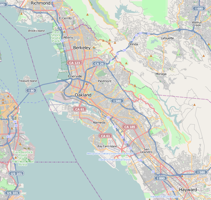
| DescriptionLocation map Oakland.png |
This map of Oakland and Berkeley, California, and vicinity was created from OpenStreetMap project data, collected by the community. This map may be incomplete, and may contain errors. Don't rely solely on it for navigation. |
|||||||||
| Date | (see file history) | |||||||||
| Source | openstreetmap.org | |||||||||
| Creator |
OpenStreetMap contributors |
|||||||||
| Permission (Reusing this file) |
OpenStreetMap data and maps are licensed under the Creative Commons Attribution-ShareAlike 2.0 license (CC-BY-SA 2.0). This file is licensed under the Creative Commons Attribution-Share Alike 2.0 Generic license.
|
|||||||||
| Geotemporal data | ||||||||||
| Bounding box |
|
|||||||||
| Georeferencing | Georeference the map in Wikimaps Warper If inappropriate please set warp_status = skip to hide. | |||||||||
Captions
Vicinity map of Oakland and Berkeley, California, created from OpenStreetMap projected data collected by the community.
Items portrayed in this file
depicts
File history
Click on a date/time to view the file as it appeared at that time.
| Date/Time | Thumbnail | Dimensions | User | Comment | |
|---|---|---|---|---|---|
| current | 06:59, 24 September 2010 | | 690 × 654 (459 KB) | Zzyzx11 | {{OpenStreetMap |location=Oakland, California |top=37.94 |bottom=37.654 |left=-122.421 |right=-122.039 }} Category:OpenStreetMap maps of the United States |
File usage
More than 100 pages use this file. The following list shows the first 100 pages that use this file only. A full list is available.
- 10th Street Market
- 555 City Center
- African American Museum and Library at Oakland
- Alameda High School
- Alameda Works Shipyard
- Anthony Chabot Regional Park
- Bank of America Building (Oakland)
- Basilica of St. Joseph, Alameda
- Berkeley, California
- Berkeley Art Museum and Pacific Film Archive
- Berkeley City Club
- Berkeley Marina
- Berkeley Public Library
- Bowles Hall
- Briones Regional Park
- California Hall (UC Berkeley)
- California School for the Blind
- Camino of Rancho San Antonio
- Cathedral of Christ the Light (Oakland, California)
- Chabot Space and Science Center
- China Clipper flight departure site
- Civic Center, Oakland, California
- Claremont Canyon Regional Preserve
- Clorox Building
- Cloyne Court Hotel
- College of California
- Congregation Beth Israel (Berkeley, California)
- Cragmont, Berkeley, California
- Croll Building
- Doe Memorial Library
- Donald and Helen Olsen House
- Downtown Berkeley, Berkeley, California
- Downtown Oakland Historic District
- Dr. Aurelia Reinhardt Redwood Regional Park
- Dunsmuir House
- East Oakland, Oakland, California
- Eden Congregational Church
- Elihu M. Harris State Office Building
- Emeryville Crescent State Marine Reserve
- Emeryville Shellmound
- Episcopal Church of the Good Shepherd (Berkeley, California)
- First Church of Christ, Scientist (Berkeley, California)
- First Presbyterian Church Sanctuary Building
- Founders' Rock
- Fox Oakland Theatre
- Frank H. Ogawa Plaza
- Glenview, Oakland, California
- Greek Orthodox Church of the Assumption
- Green Shutter Hotel
- Haas Pavilion
- Hearst Greek Theatre
- Hearst Memorial Mining Building
- Heinold's First and Last Chance Saloon
- Hillside Elementary School
- Huckleberry Botanic Regional Preserve
- Jack London District, Oakland, California
- Jingletown
- Joaquin Miller House
- Kaiser Center
- Lake Merritt
- Lake Merritt Plaza
- Lakeside Apartments District, Oakland, California
- LeConte Hall
- Lorin District, Berkeley, California
- Martin Luther King Jr. Shoreline
- Masonic Temple (Berkeley, California)
- Masonic Temple and Lodge (Alameda, California)
- Northside, Berkeley, California
- Oakland Arena
- Oakland Ballpark
- Oakland City Hall
- Oakland Coliseum
- Oakland Museum of California
- Oakland firestorm of 1991
- Ohlone Park
- Ordway Building
- Panoramic Hill, Oakland/Berkeley, California
- Paramount Theatre (Oakland, California)
- Pardee Home
- People's Park (Berkeley)
- Piedmont Avenue (Berkeley)
- Prescott, Oakland, California
- Rancho San Antonio (Peralta)
- René C. Davidson Courthouse
- Ronald V. Dellums Federal Building
- San Antonio, Oakland, California
- Senior Hall (Berkeley, California)
- South Berkeley Community Church
- Southside, Berkeley, California
- St. John's Presbyterian Church (Berkeley, California)
- Studio Building (Berkeley, California)
- Thorsen House
- Tilden Regional Park
- Tribune Tower (Oakland)
- Trinity Church (Oakland, California)
- UC Theatre
- USS Potomac (AG-25)
- University High School (Oakland, California)
- University House, Berkeley
- Uptown Oakland
View more links to this file.
Global file usage
The following other wikis use this file:
- Usage on ar.wikipedia.org
- Usage on ceb.wikipedia.org
- Usage on fa.wikipedia.org
- Usage on fr.wikipedia.org
- Usage on he.wikipedia.org
- Usage on id.wikipedia.org
- Usage on ja.wikipedia.org
- Usage on kn.wikipedia.org
- Usage on lv.wikipedia.org
- Usage on pl.wikipedia.org
- Usage on pl.wikibooks.org
- Usage on simple.wikipedia.org
- Usage on si.wikipedia.org
- Usage on th.wikipedia.org
- Usage on tr.wikipedia.org
- Usage on ur.wikipedia.org
- Usage on uz.wikipedia.org
- Usage on vi.wikipedia.org
View more global usage of this file.
Retrieved from "https://en.wikipedia.org/wiki/File:Location_map_Oakland.png"