File:Manteno_civilisation_map.jpg
From Wikipedia, the free encyclopedia
Size of this preview: 560 × 599 pixels. Other resolutions: 224 × 240 pixels | 598 × 640 pixels.
Original file (598 × 640 pixels, file size: 31 KB, MIME type: image/jpeg)
| This is a file from the Wikimedia Commons. Information from its description page there is shown below. Commons is a freely licensed media file repository. You can help. |
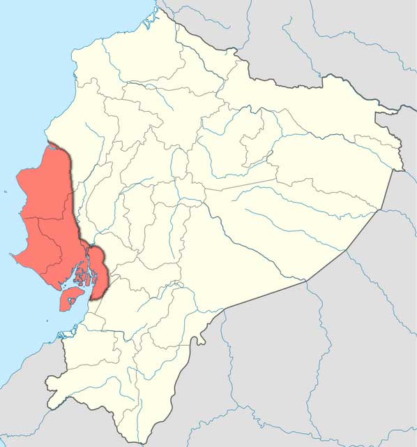
| DescriptionManteno civilisation map.jpg | Map of the en:Manteño civilisation in Ecuador. Overlaid on the original map using the text source Peregrine, P. N., et al. (2001) Encyclopedia of Prehistory: Middle America, 5, p. 307 Retrieved on 28 March 2010. . In particular, the eastern boundary is uncertain, with most settlement on the coast. |
| Date | (UTC) |
| Source | |
| Author |
|
I, the copyright holder of this work, hereby publish it under the following license:

|
Permission is granted to copy, distribute and/or modify this document under the terms of the GNU Free Documentation License, Version 1.2 only as published by the Free Software Foundation; with no Invariant Sections, no Front-Cover Texts, and no Back-Cover Texts. A copy of the license is included in the section entitled GNU Free Documentation License. | 1.2 onlyhttp://www.gnu.org/licenses/old-licenses/fdl-1.2.htmlGFDL 1.2GNU Free Documentation License 1.2truetrue |
Original upload log
This image is a derivative work of the following images:
- File:Ecuador_location_map.svg licensed with GFDL-1.2
- 2008-12-09T21:09:07Z NordNordWest 1536x1654 (422346 Bytes) {{Information |Description= {{de|Positionskarte von [[:de:Ecuador|Ecuador]]}} Quadratische Plattkarte. Geographische Begrenzung der Karte: * N: 1.7° N * S: 5.3° S * W: 81.5° W * O: 75.0° W {{en|Location map of [[:en:Ecuad
Uploaded with derivativeFX
Captions
Add a one-line explanation of what this file represents
Items portrayed in this file
depicts
30 March 2010
File history
Click on a date/time to view the file as it appeared at that time.
| Date/Time | Thumbnail | Dimensions | User | Comment | |
|---|---|---|---|---|---|
| current | 19:55, 30 March 2010 | | 598 × 640 (31 KB) | Jarry1250 | {{Information |Description=Map of the en:Manteño civilisation in Ecuador. Overlaid on the original map using the text source {{cite book |author=Peregrine, P. N., et al. |title=Encyclopedia of Prehistory: Middle America |volume=5 |date=2001 |url=htt |
File usage
The following pages on the English Wikipedia use this file (pages on other projects are not listed):
Global file usage
The following other wikis use this file:
- Usage on be.wikipedia.org
- Usage on es.wikipedia.org
- Usage on it.wikipedia.org
- Usage on lt.wikipedia.org
Metadata
This file contains additional information, probably added from the digital camera or scanner used to create or digitize it.
If the file has been modified from its original state, some details may not fully reflect the modified file.
| _error | 0 |
|---|
Retrieved from "https://en.wikipedia.org/wiki/File:Manteno_civilisation_map.jpg"