File:Metro_atlanta.jpg
From Wikipedia, the free encyclopedia
Size of this preview: 570 × 599 pixels. Other resolutions: 228 × 240 pixels | 456 × 480 pixels | 730 × 768 pixels | 1,025 × 1,078 pixels.
Original file (1,025 × 1,078 pixels, file size: 385 KB, MIME type: image/jpeg)
| This is a file from the Wikimedia Commons. Information from its description page there is shown below. Commons is a freely licensed media file repository. You can help. |

|
This map image could be re-created using vector graphics as an SVG file. This has several advantages; see Commons:Media for cleanup for more information. If an SVG form of this image is available, please upload it and afterwards replace this template with
{{vector version available|new image name}}.
It is recommended to name the SVG file “Metro atlanta.svg”—then the template Vector version available (or Vva) does not need the new image name parameter. |
 | This map image was uploaded in the JPEG format even though it consists of non-photographic data. This information could be stored more efficiently or accurately in the PNG or SVG format. If possible, please upload a PNG or SVG version of this image without compression artifacts, derived from a non-JPEG source (or with existing artifacts removed). After doing so, please tag the JPEG version with {{Superseded|NewImage.ext}} and remove this tag. This tag should not be applied to photographs or scans. If this image is a diagram or other image suitable for vectorisation, please tag this image with {{Convert to SVG}} instead of {{BadJPEG}}. If not suitable for vectorisation, use {{Convert to PNG}}. For more information, see {{BadJPEG}}. |  |
Summary
| DescriptionMetro atlanta.jpg |
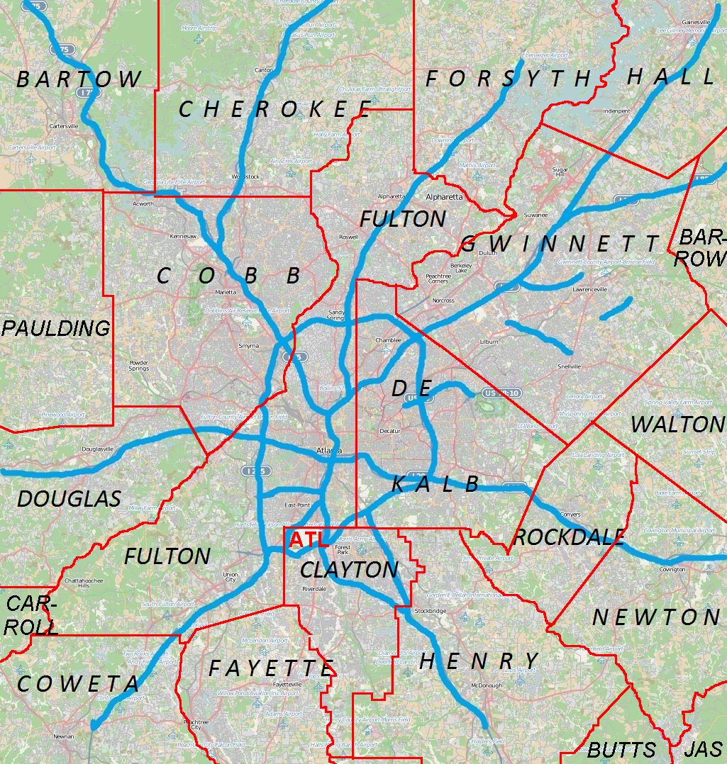
English: Metro Atlanta from Open Street Map |
| Date | |
| Source | Open street map |
| Author | Open street map |
Licensing
This file is licensed under the Creative Commons Attribution 2.5 Generic license.
- You are free:
- to share – to copy, distribute and transmit the work
- to remix – to adapt the work
- Under the following conditions:
- attribution – You must give appropriate credit, provide a link to the license, and indicate if changes were made. You may do so in any reasonable manner, but not in any way that suggests the licensor endorses you or your use.
Captions
Add a one-line explanation of what this file represents
Items portrayed in this file
depicts
12 April 2011
image/jpeg
File history
Click on a date/time to view the file as it appeared at that time.
| Date/Time | Thumbnail | Dimensions | User | Comment | |
|---|---|---|---|---|---|
| current | 00:44, 18 April 2011 | | 1,025 × 1,078 (385 KB) | Keizers | +county borders and airport |
| 17:22, 15 April 2011 |  | 1,025 × 1,078 (571 KB) | Keizers | shows all counties now | |
| 17:38, 14 April 2011 |  | 1,025 × 1,078 (548 KB) | Keizers | added thicker freeway lines and 3 key county names | |
| 15:16, 14 April 2011 |  | 1,025 × 1,078 (362 KB) | Keizers | {{Information |Description ={{en|1=Metro Atlanta from Open Street Map}} |Source =Open street map |Author =Open street map |Date =2011-04-12 |Permission = |other_versions = }} Category:Atlanta maps |
File usage
More than 100 pages use this file. The following list shows the first 100 pages that use this file only. A full list is available.
- Aberdeen, Georgia
- Alpharetta, Georgia
- Archibald Smith Plantation Home
- Austell, Georgia
- Avondale Estates, Georgia
- Belvedere Park, Georgia
- Ben Hill, Atlanta
- Big Chicken
- Bradley Observatory
- Braelinn, Georgia
- Brookhaven, Georgia
- Buckhead
- Buford, Georgia
- Buford Highway
- Campbell County Courthouse (Georgia)
- Candler-McAfee, Georgia
- Canton, Georgia
- Cartersville, Georgia
- Cecil and Hermione Alexander House
- Chamblee, Georgia
- Chattahoochee Hills, Georgia
- Cobb County, Georgia
- College Park, Georgia
- Collier Heights
- Conyers, Georgia
- Conyers Residential Historic District
- Covington, Georgia
- Crawford-Dorsey House and Cemetery
- Cumberland, Georgia
- Cumming, Georgia
- Dallas, Georgia
- Decatur, Georgia
- Delta Flight Museum
- Doraville, Georgia
- Douglasville, Georgia
- Downtown Atlanta
- East Cobb, Georgia
- East Point, Georgia
- Elisha Winn House
- Etowah Indian Mounds
- Fairburn, Georgia
- Forest Park, Georgia
- Georgia Tech
- Glenloch, Peachtree City, Georgia
- Greenhaven, Georgia
- Hickory Flat, Georgia
- Hiram, Georgia
- Holly Springs, Georgia
- Isaac Roberts House
- Johns Creek, Georgia
- Jonesboro, Georgia
- Jonesboro Historic District (Jonesboro, Georgia)
- Judge William Wilson House
- Kedron, Georgia
- Kelleytown, Georgia
- Kennesaw, Georgia
- Kennesaw Mountain National Battlefield Park
- Lawrenceville, Georgia
- Lithonia, Georgia
- Loganville, Georgia
- Mableton, Georgia
- Marietta, Georgia
- Marietta National Cemetery
- Mechanicsville, Gwinnett County, Georgia
- Mercedes-Benz Stadium
- Midway Presbyterian Church and Cemetery
- Milton, Georgia
- National Museum of Commercial Aviation
- Newnan, Georgia
- Norcross, Georgia
- Northlake, Georgia
- Northwest Marietta Historic District
- Oglethorpe University
- Old Seminary Building
- Panola Mountain
- Panthersville, Georgia
- Peachtree Corners, Georgia
- Rest Haven, Georgia
- Robert Mable House and Cemetery
- Roscoe–Dunaway Gardens Historic District
- Roswell, Georgia
- Sandy Springs, Georgia
- SciTrek
- Scottdale, Georgia
- Snellville, Georgia
- South Fulton, Georgia
- Southside Park
- Starrsville, Georgia
- State Farm Arena
- Stately Oaks
- Stockbridge, Georgia
- Stone Mountain, Georgia
- Suwanee, Georgia
- The Superb
- Thomasville Heights
- Truist Park
- Vinings, Georgia
- Whitlock Avenue Historic District
- Whittier Mill Village
- Winnona Park Historic District
View more links to this file.
Global file usage
The following other wikis use this file:
- Usage on ar.wikipedia.org
- Usage on ban.wikipedia.org
- Usage on bcl.wikipedia.org
- Usage on bn.wikipedia.org
- Usage on ceb.wikipedia.org
- Usage on de.wikipedia.org
- Usage on eo.wikipedia.org
- Usage on fa.wikipedia.org
- فرودگاه بینالمللی هارتسفیلد-جکسون آتلانتا
- الگو:Location map Metro Atlanta
- آلفارتا، جورجیا
- آستل، جورجیا
- اوندیل استیتس، جورجیا
- بروکهاون، جورجیا
- بافرد، جورجیا
- کانتون، جورجیا
- کارترسویل، جورجیا
- کمبلی، جورجیا
- چاتاهوچی هیلز، جورجیا
- کنیرز، جورجیا
- کوینگتن، جورجیا
- کامینگ، جورجیا
- دالاس، جورجیا
- دراویل، جورجیا
- داگلاس ویل، جورجیا
- ایست پوینت، جورجیا
- فیربرن، جورجیا
- فرست پارک، جورجیا
- گینس ویل، جورجیا
- هیرام، جورجیا
- جانز کریک، جورجیا
- جونزبرو، جورجیا
- کنساو، جورجیا
- لارنسویل، جورجیا
- لیتنیا، جورجیا
- لگانویل، جورجیا
- مریتا، جورجیا
- مک دنو، جورجیا
- میلتن، جورجیا
- مونرو، جورجیا
- نیونن، جورجیا
- نورکراس، جورجیا
- پیچتری سیتی، جورجیا
- پیچتری کرنرز، جورجیا
- رزول، جورجیا
- سندی اسپرینگ، جورجیا
- اسنلویل، جورجیا
- استوک بریج، جورجیا
View more global usage of this file.
Metadata
This file contains additional information, probably added from the digital camera or scanner used to create or digitize it.
If the file has been modified from its original state, some details may not fully reflect the modified file.
| _error | 0 |
|---|
Retrieved from "https://en.wikipedia.org/wiki/File:Metro_atlanta.jpg"