File:Military_department_of_California_1858.jpg
From Wikipedia, the free encyclopedia
Size of this preview: 418 × 599 pixels. Other resolutions: 167 × 240 pixels | 335 × 480 pixels | 535 × 768 pixels | 714 × 1,024 pixels | 1,428 × 2,048 pixels | 4,271 × 6,124 pixels.
Original file (4,271 × 6,124 pixels, file size: 10.24 MB, MIME type: image/jpeg)
| This is a file from the Wikimedia Commons. Information from its description page there is shown below. Commons is a freely licensed media file repository. You can help. |
Summary
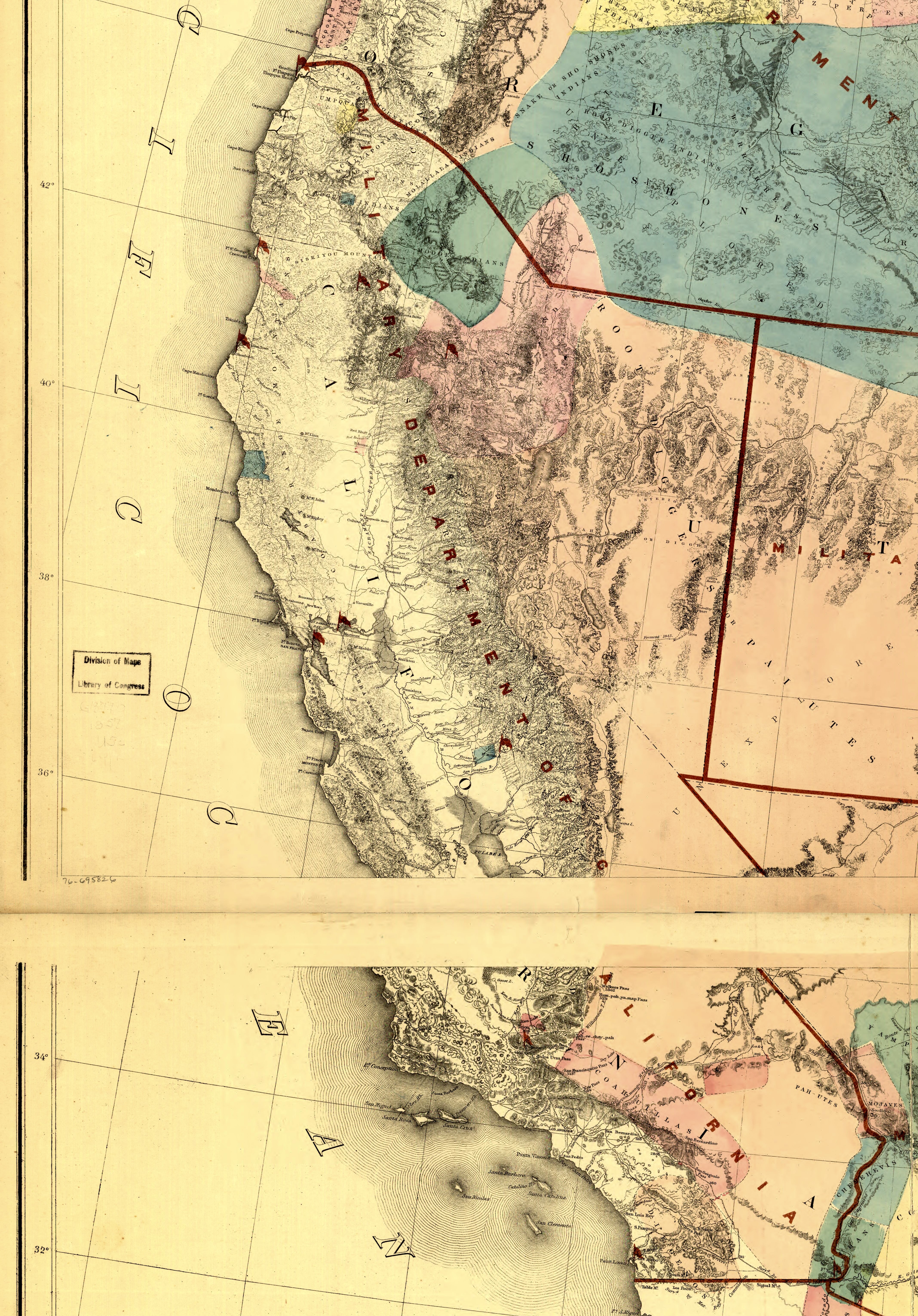
| DescriptionMilitary department of California 1858.jpg |
English: Military department of California 1858 |
| Date | |
| Source | Derivative of File:Map of the territory of the United States from the Mississippi to the Pacific Ocean; ordered by Jeff'n Davis, Secretary of War to accompany the reports of the explorations for a railroad route. LOC 76695826.jpg |
| Author | US govt |
Licensing
| Public domainPublic domainfalsefalse |
This work is in the public domain in the United States because it is a work prepared by an officer or employee of the United States Government as part of that person’s official duties under the terms of Title 17, Chapter 1, Section 105 of the US Code.
Note: This only applies to original works of the Federal Government and not to the work of any individual U.S. state, territory, commonwealth, county, municipality, or any other subdivision. This template also does not apply to postage stamp designs published by the United States Postal Service since 1978. (See § 313.6(C)(1) of Compendium of U.S. Copyright Office Practices). It also does not apply to certain US coins; see The US Mint Terms of Use.
|
 | |
| This file has been identified as being free of known restrictions under copyright law, including all related and neighboring rights. | ||
https://creativecommons.org/publicdomain/mark/1.0/PDMCreative Commons Public Domain Mark 1.0falsefalse
Captions
Military department of California 1858
Items portrayed in this file
depicts
1 January 1858Gregorian
image/jpeg
File history
Click on a date/time to view the file as it appeared at that time.
| Date/Time | Thumbnail | Dimensions | User | Comment | |
|---|---|---|---|---|---|
| current | 22:25, 17 March 2023 | | 4,271 × 6,124 (10.24 MB) | Jengod | Uploaded a work by US govt from Derivative of File:Map of the territory of the United States from the Mississippi to the Pacific Ocean; ordered by Jeff'n Davis, Secretary of War to accompany the reports of the explorations for a railroad route. LOC 76695826.jpg with UploadWizard |
File usage
The following pages on the English Wikipedia use this file (pages on other projects are not listed):
Metadata
This file contains additional information, probably added from the digital camera or scanner used to create or digitize it.
If the file has been modified from its original state, some details may not fully reflect the modified file.
| Orientation | Normal |
|---|---|
| Horizontal resolution | 72 dpi |
| Vertical resolution | 72 dpi |
| Y and C positioning | Centered |
| Exif version | 2.21 |
| Meaning of each component |
|
| Supported Flashpix version | 1 |
| Color space | sRGB |
| Scene capture type | Standard |