File:Mount_Tsukuba_Relief_Map,_SRTM.jpg
From Wikipedia, the free encyclopedia
No higher resolution available.
Mount_Tsukuba_Relief_Map,_SRTM.jpg (800 × 600 pixels, file size: 312 KB, MIME type: image/jpeg)
| This is a file from the Wikimedia Commons. Information from its description page there is shown below. Commons is a freely licensed media file repository. You can help. |
Summary
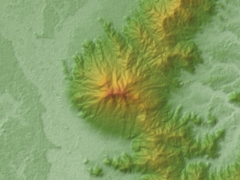
| DescriptionMount Tsukuba Relief Map, SRTM.jpg | |
| Date | |
| Source |
Topographic data: NASA's SRTM-1 30m Mesh (ver.3 2014) |
| Author | Batholith |
| Object location | 36° 13′ 30″ N, 140° 06′ 00″ E | View this and other nearby images on: OpenStreetMap |
|---|
Licensing
| Public domainPublic domainfalsefalse |
| I, the copyright holder of this work, release this work into the public domain. This applies worldwide. In some countries this may not be legally possible; if so: I grant anyone the right to use this work for any purpose, without any conditions, unless such conditions are required by law. |
| Public domainPublic domainfalsefalse |
This image uses high-resolution digital topography data from NASA's Shuttle Radar Topography Mission (SRTM) at JPL-Caltech [1]. It is in the public domain in the United States.
|
 | |
| English | Bahasa Indonesia | македонски | polski | português | 中文 | 中文(简体) | +/− |
Captions
Add a one-line explanation of what this file represents
Items portrayed in this file
depicts
28 February 2016
36°13'30.000"N, 140°6'0.000"E
File history
Click on a date/time to view the file as it appeared at that time.
| Date/Time | Thumbnail | Dimensions | User | Comment | |
|---|---|---|---|---|---|
| current | 15:14, 14 April 2016 | | 800 × 600 (312 KB) | Batholith | 再レンダリング |
| 10:11, 28 February 2016 |  | 800 × 600 (289 KB) | Batholith | {{Information |Description= {{en|Relief map of Mount Tsukuba, Tsukuba, Ibaraki, Japan. From "SRTM-1 (30m Mesh) Ver.3 2014".}} {{ja|[[:... |
File usage
The following pages on the English Wikipedia use this file (pages on other projects are not listed):
Global file usage
The following other wikis use this file: