File:Oxford_Road_Halt_railway_station_(site),_Oxfordshire_(geograph_4788289).jpg
From Wikipedia, the free encyclopedia
Size of this preview: 800 × 600 pixels. Other resolutions: 320 × 240 pixels | 640 × 480 pixels | 1,024 × 767 pixels | 1,280 × 959 pixels | 1,600 × 1,199 pixels.
Original file (1,600 × 1,199 pixels, file size: 309 KB, MIME type: image/jpeg)
| This is a file from the Wikimedia Commons. Information from its description page there is shown below. Commons is a freely licensed media file repository. You can help. |
Summary
| DescriptionOxford Road Halt railway station (site), Oxfordshire (geograph 4788289).jpg |
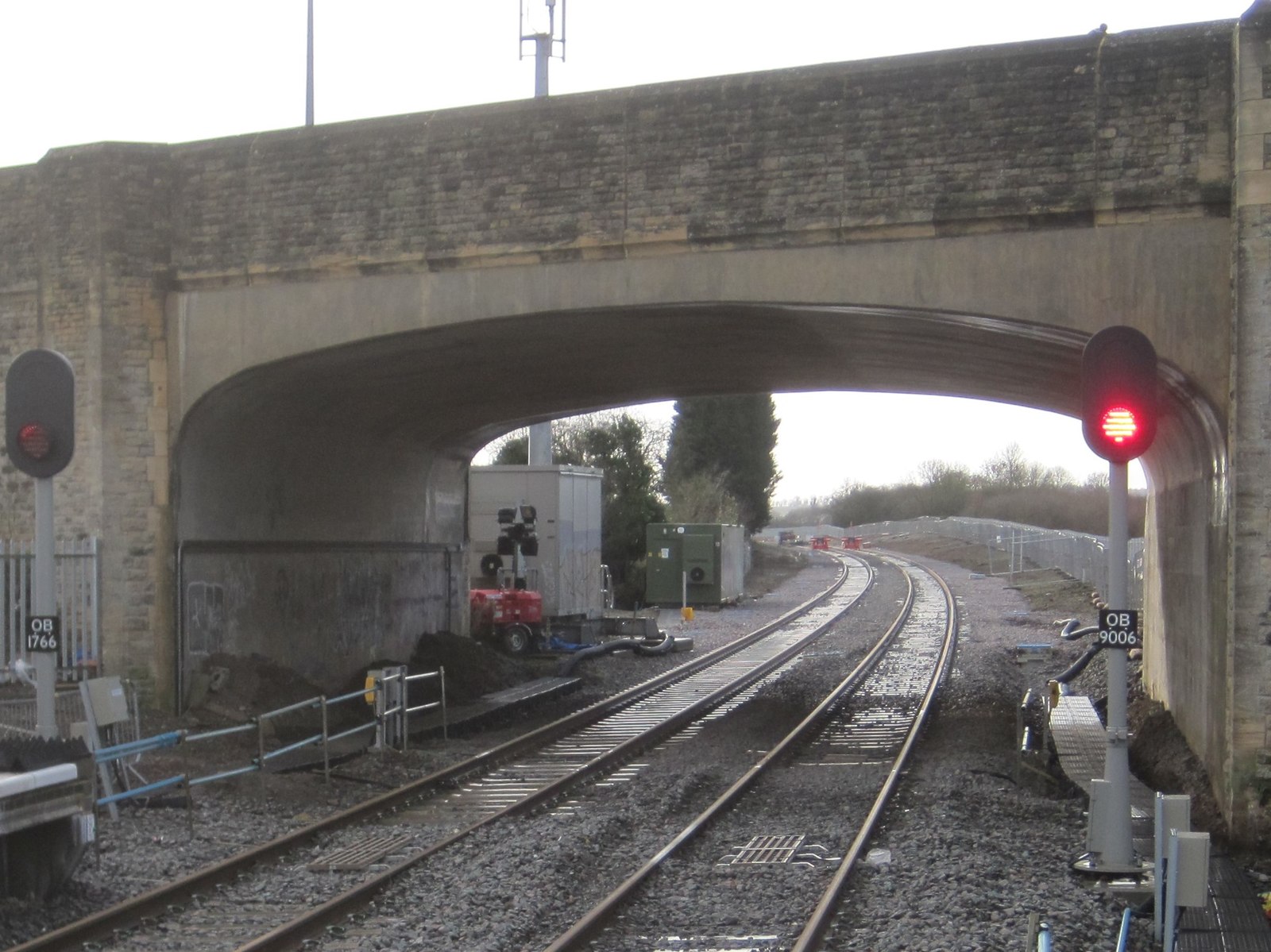
English: Oxford Road Halt railway station (site), Oxfordshire Opened in 1906 by the London and North Western Railway on the line from Oxford to Cambridge via Bicester, this halt closed in 1917, reopened in 1919 and closed permanently in 1926. View south west towards Wolvercote and Oxford. The halt platforms probably straddled a now-removed level crossing, beyond where the road bridge now is. |
| Date | |
| Source | From geograph.org.uk |
| Author | Nigel Thompson |
| Permission (Reusing this file) |
Creative Commons Attribution Share-alike license 2.0 |
| Attribution (required by the license) InfoField | Nigel Thompson / Oxford Road Halt railway station (site), Oxfordshire / |
InfoField | Nigel Thompson / Oxford Road Halt railway station (site), Oxfordshire |
| Camera location | 51° 48′ 13.3″ N, 1° 16′ 30″ W | View this and other nearby images on: OpenStreetMap |
|---|
| Object location | 51° 48′ 11″ N, 1° 16′ 33″ W | View this and other nearby images on: OpenStreetMap |
|---|
Licensing

|
This image was taken from the Geograph project collection. See this photograph's page on the Geograph website for the photographer's contact details. The copyright on this image is owned by Nigel Thompson and is licensed for reuse under the Creative Commons Attribution-ShareAlike 2.0 license.
|
This file is licensed under the Creative Commons Attribution-Share Alike 2.0 Generic license.
Attribution: Nigel Thompson
- You are free:
- to share – to copy, distribute and transmit the work
- to remix – to adapt the work
- Under the following conditions:
- attribution – You must give appropriate credit, provide a link to the license, and indicate if changes were made. You may do so in any reasonable manner, but not in any way that suggests the licensor endorses you or your use.
- share alike – If you remix, transform, or build upon the material, you must distribute your contributions under the same or compatible license as the original.
Captions
Add a one-line explanation of what this file represents
Items portrayed in this file
depicts
51°48'13.273"N, 1°16'30.364"W
9 January 2016
51°48'11.02"N, 1°16'33.02"W
File history
Click on a date/time to view the file as it appeared at that time.
| Date/Time | Thumbnail | Dimensions | User | Comment | |
|---|---|---|---|---|---|
| current | 11:59, 25 December 2019 | | 1,600 × 1,199 (309 KB) | Lamberhurst | Transferred from geograph.co.uk using [https://tools.wmflabs.org/geograph2commons/ geograph2commons] |
File usage
The following pages on the English Wikipedia use this file (pages on other projects are not listed):
,_Oxfordshire_(geograph_4788289).jpg)