File:Panorámica_Pumapungo.png
From Wikipedia, the free encyclopedia
Original file (5,807 × 1,723 pixels, file size: 17.08 MB, MIME type: image/png)
| This is a file from the Wikimedia Commons. Information from its description page there is shown below. Commons is a freely licensed media file repository. You can help. |
Summary
| Camera location | 2° 54′ 32.82″ S, 78° 59′ 46.81″ W | View this and other nearby images on: OpenStreetMap |
|---|
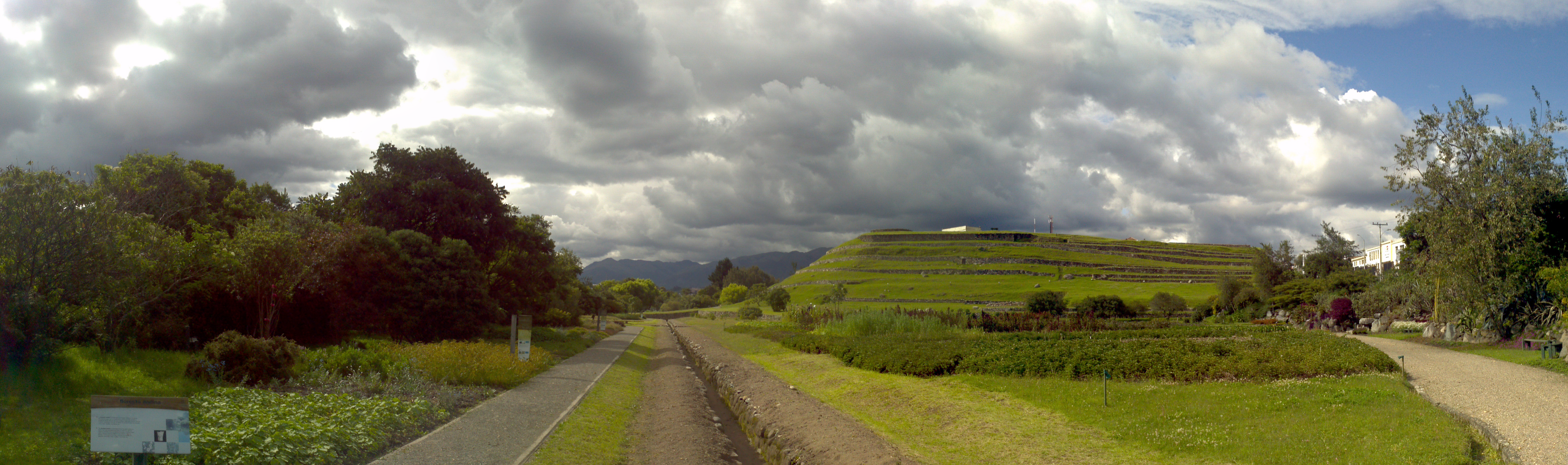
| DescriptionPanorámica Pumapungo.png |
Español: Panorámica de parte de las ruinas de Pumapungo en Cuenca, Ecuador. English: Panoramic view of part of the ruins of Pumapungo in Cuenca, Ecuador. |
| Date | |
| Source |
Own work This image was created with Photoshop Photomerge (stitched images may differ from reality). |
| Author | PAULOGARCIA2005 |
| Other versions | Derivative works of this file: Pumapungo banner.jpg |

|
NOTE: This image is a panorama consisting of 4 frames that were merged or stitched in Adobe Photoshop. As a result, this image necessarily underwent some form of digital manipulation. These manipulations may include blending, blurring, cloning, and colour and perspective adjustments. As a result of these adjustments, the image content may be slightly different from reality at the points where multiple images were combined. This manipulation is often required due to lens, perspective, and parallax distortions.
Boarisch | български | dansk | Deutsch | Zazaki | Ελληνικά | English | Canadian English | British English | Esperanto | español | eesti | suomi | français | hrvatski | magyar | italiano | 日本語 | 한국어 | македонски | മലയാളം | Nederlands | polski | português | русский | sicilianu | slovenščina | svenska | Türkçe | українська | العربية | 中文 | +/− |
Licensing
- You are free:
- to share – to copy, distribute and transmit the work
- to remix – to adapt the work
- Under the following conditions:
- attribution – You must give appropriate credit, provide a link to the license, and indicate if changes were made. You may do so in any reasonable manner, but not in any way that suggests the licensor endorses you or your use.
| Annotations InfoField | This image is annotated: View the annotations at Commons |
Restos de los muros.
Canal de agua para los Baños del Inca.
Museo del Banco Central
Captions
Items portrayed in this file
depicts
2°54'32.825"S, 78°59'46.810"W
30 January 2012
File history
Click on a date/time to view the file as it appeared at that time.
| Date/Time | Thumbnail | Dimensions | User | Comment | |
|---|---|---|---|---|---|
| current | 08:11, 5 February 2012 | 5,807 × 1,723 (17.08 MB) | PAULOGARCIA2005 |
File usage
Global file usage
The following other wikis use this file:
- Usage on es.wikipedia.org
- Usage on fa.wikipedia.org
- Usage on incubator.wikimedia.org
- Usage on it.wikipedia.org
- Usage on pt.wikipedia.org
- Usage on uk.wikipedia.org
- Usage on www.wikidata.org
Metadata
This file contains additional information, probably added from the digital camera or scanner used to create or digitize it.
If the file has been modified from its original state, some details may not fully reflect the modified file.
| Horizontal resolution | 28.35 dpc |
|---|---|
| Vertical resolution | 28.35 dpc |
| Date and time of digitizing |
|