File:South_Africa_Provinces_showing_WC.png
From Wikipedia, the free encyclopedia
Size of this preview: 800 × 578 pixels. Other resolutions: 320 × 231 pixels | 640 × 462 pixels | 1,024 × 740 pixels | 1,146 × 828 pixels.
Original file (1,146 × 828 pixels, file size: 20 KB, MIME type: image/png)
| This is a file from the Wikimedia Commons. Information from its description page there is shown below. Commons is a freely licensed media file repository. You can help. |
Summary
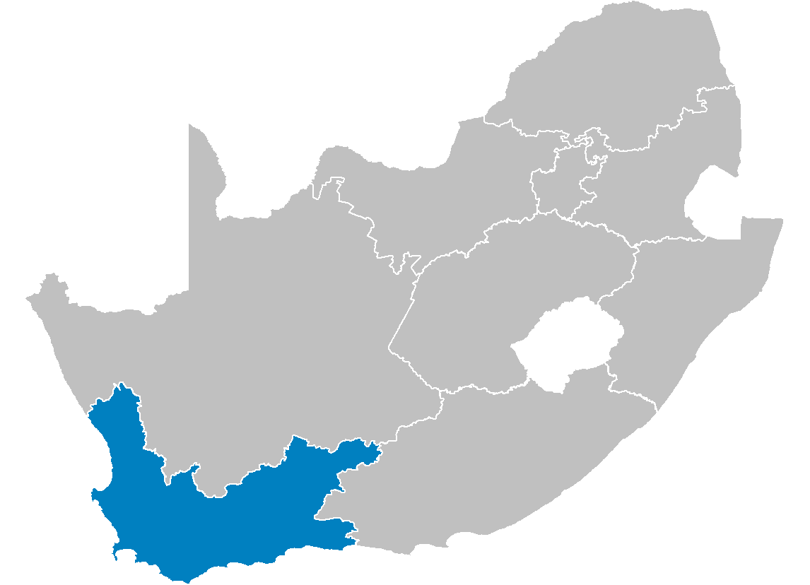
| DescriptionSouth Africa Provinces showing WC.png | Map of South Africa showing the Western Cape province after the 12th amendment of the constitution in December 2005. |
| Date | |
| Source | Created by me from Shapefile data from the Municipal Demarcation Board, South Africa. |
| Author | Wayne Dam (User:Waynedam) |
| Permission (Reusing this file) |
Dual-licensed under the GFDL and CC-By-SA-2.5, 2.0, and 1.0. |
Licensing
I, the copyright holder of this work, hereby publish it under the following licenses:

|
Permission is granted to copy, distribute and/or modify this document under the terms of the GNU Free Documentation License, Version 1.2 or any later version published by the Free Software Foundation; with no Invariant Sections, no Front-Cover Texts, and no Back-Cover Texts. A copy of the license is included in the section entitled GNU Free Documentation License.http://www.gnu.org/copyleft/fdl.htmlGFDLGNU Free Documentation Licensetruetrue |
| This file is licensed under the Creative Commons Attribution-Share Alike 3.0 Unported license. | ||
| ||
| This licensing tag was added to this file as part of the GFDL licensing update.http://creativecommons.org/licenses/by-sa/3.0/CC BY-SA 3.0Creative Commons Attribution-Share Alike 3.0truetrue |
This file is licensed under the Creative Commons Attribution-Share Alike 2.5 Generic, 2.0 Generic and 1.0 Generic license.
- You are free:
- to share – to copy, distribute and transmit the work
- to remix – to adapt the work
- Under the following conditions:
- attribution – You must give appropriate credit, provide a link to the license, and indicate if changes were made. You may do so in any reasonable manner, but not in any way that suggests the licensor endorses you or your use.
- share alike – If you remix, transform, or build upon the material, you must distribute your contributions under the same or compatible license as the original.
You may select the license of your choice.
Licensing
I, the copyright holder of this work, hereby publish it under the following licenses:
|
|
Permission is granted to copy, distribute and/or modify this document under the terms of the GNU Free Documentation License, Version 1.2 or any later version published by the Free Software Foundation; with no Invariant Sections, no Front-Cover Texts, and no Back-Cover Texts. A copy of the license is included in the section entitled GNU Free Documentation License.http://www.gnu.org/copyleft/fdl.htmlGFDLGNU Free Documentation Licensetruetrue |
| This file is licensed under the Creative Commons Attribution-Share Alike 3.0 Unported license. | ||
| ||
| This licensing tag was added to this file as part of the GFDL licensing update.http://creativecommons.org/licenses/by-sa/3.0/CC BY-SA 3.0Creative Commons Attribution-Share Alike 3.0truetrue |
This file is licensed under the Creative Commons Attribution 2.5 Generic license.
- You are free:
- to share – to copy, distribute and transmit the work
- to remix – to adapt the work
- Under the following conditions:
- attribution – You must give appropriate credit, provide a link to the license, and indicate if changes were made. You may do so in any reasonable manner, but not in any way that suggests the licensor endorses you or your use.
You may select the license of your choice.
Captions
Add a one-line explanation of what this file represents
Items portrayed in this file
depicts
29 April 2006
File history
Click on a date/time to view the file as it appeared at that time.
| Date/Time | Thumbnail | Dimensions | User | Comment | |
|---|---|---|---|---|---|
| current | 14:21, 29 April 2006 | | 1,146 × 828 (20 KB) | Waynedam | == Summary == {{Information| |Description=Map of South Africa showing the Western Cape province after the 12th amendment of the constitution in December 2005. |Source=Created by me from Shapefile data from the [http://www.demarcation.org.za/ Municipal De |
File usage
The following pages on the English Wikipedia use this file (pages on other projects are not listed):
- Aan de Doorns
- Akkedisberg Pass
- Ashton, South Africa
- Bakoven
- Belhar
- Biedouw Valley
- Bird Island Nature Reserve (South Africa)
- Birkenhead, South Africa
- Bishop Lavis
- Bishopscourt, Cape Town
- Blinkberg Pass
- Boggomsbaai
- Bonnievale, South Africa
- Bonteheuwel
- Bothmanskloof Pass
- Brandvlei Dam
- Brandwag, Mossel Bay
- Burgers Pass
- Capri Village
- Chatsworth, Western Cape
- Church Square (Cape Town)
- Clovelly, Cape Town
- Corné Mulder
- Dasklip Pass
- De Jagers Pass
- De Oude Weg
- Dennehof, South Africa
- Drakenstein Lion Park
- Du Plessis Pass
- Duiwenhoks River
- Duynefontein
- Dwarskloof Pass
- Ebenhaeser
- Edgemead
- Eendekuil
- Fairview, Mossel Bay
- Firgrove, Western Cape
- Floorshoogte Pass
- Franschhoek Pass
- Garcia's Pass
- Glen Beach
- Gondwana Game Reserve
- Green Point Common
- Grotto Bay
- Gydo Pass
- Gysmanshoek Pass
- Haarlem, South Africa
- Hangberg
- Harfield Village
- Harkerville
- Heideveld
- Herbertsdale
- Hex River Pass
- Hex River Poort Pass
- Hoekwil
- Houwhoek Pass
- Hydra Bay
- Jakkalsfontein
- Jongensfontein
- Kalbaskraal
- Karatara
- Karatera Pass
- Kensington, Cape Town
- Langkloof Mountains
- Languedoc, South Africa
- Malgas
- Mbekweni
- Meadowridge
- Montague Gardens, Cape Town
- Norwood, Western Cape
- Olifants River (Southern Cape)
- Olivedale, Western Cape
- Onmeetbarediepgat
- Orange Kloof
- Oukloof
- Parel Vallei
- Raithby, South Africa
- Rheenendal
- Richwood, Western Cape
- Rietpoort
- Riviersonderend Mountains
- Romansrivier
- Simondium
- Soetendalsvlei
- Steenkampskraal mine
- Stormsvlei
- Sunnydale, Cape Town
- Van Dyks Bay
- Vanrhynsdorp
- Voëlklip
- Wemmers River
- Wetton, Cape Town
- Wynberg Park
- Template:WesternCape-geo-stub
Global file usage
The following other wikis use this file:
- Usage on ar.wikipedia.org
- Usage on bg.wikipedia.org
- Usage on de.wikipedia.org
- Usage on en.wikinews.org
- Usage on fo.wikipedia.org
- Usage on ms.wikipedia.org
- Usage on nl.wikipedia.org
- Usage on nn.wikipedia.org
- Usage on nov.wikipedia.org
- Usage on no.wikipedia.org
- Usage on nso.wikipedia.org
- Usage on ny.wikipedia.org
- Usage on pl.wikipedia.org
- Usage on pl.wikivoyage.org
- Usage on ro.wikipedia.org
- Usage on st.wikipedia.org
- Usage on sw.wikipedia.org
- Usage on vo.wikipedia.org
- Usage on www.wikidata.org
- Usage on zu.wikipedia.org