File:USGS_Helvetia_1909_sfc01561.jpg
From Wikipedia, the free encyclopedia
Original file (4,818 × 2,720 pixels, file size: 6.25 MB, MIME type: image/jpeg)
| This is a file from the Wikimedia Commons. Information from its description page there is shown below. Commons is a freely licensed media file repository. You can help. |
Summary
| DescriptionUSGS Helvetia 1909 sfc01561.jpg |
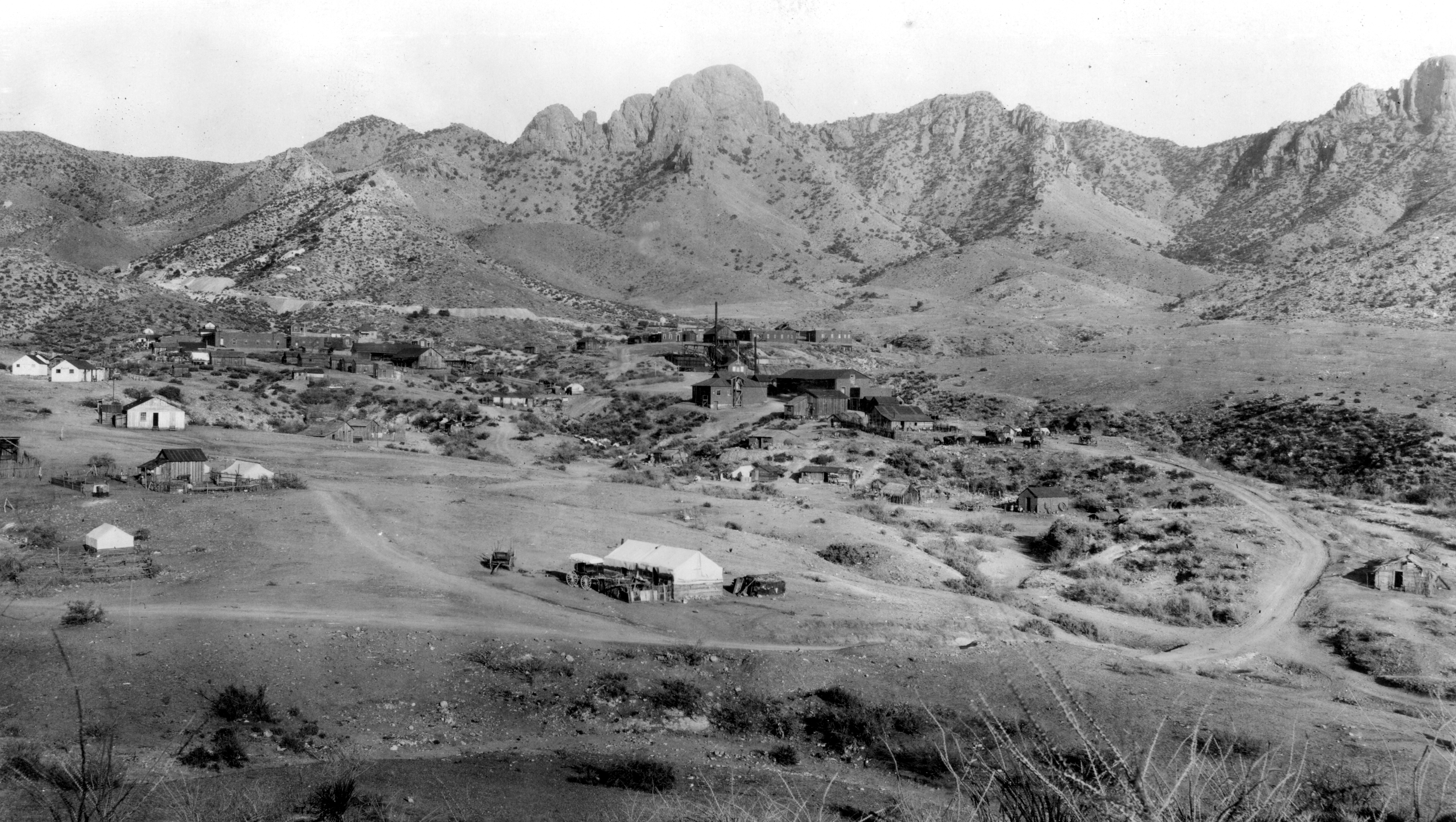
English: Helvetia Camp, basin and mines. Crest of Santa Rita Mountains in background. Looking east from ridge of Tiptop Mountain, at an elevation of 4,300 feet. From left starting at second peak in upper left, thru the center of the following mine locations are identified: Heavy Weight, Copper World, Mohawk, Leader, Isle Royal, Old Dick, and Omega. Pima County, Arizona. 1909. |
||||
| Date | |||||
| Source | http://libraryphoto.cr.usgs.gov/cgi-bin/show_picture.cgi?ID=ID.%20Schrader,%20F.C.%201561 | ||||
| Author | USGS | ||||
| Permission (Reusing this file) |
|
Licensing
| Public domainPublic domainfalsefalse |
This image is in the public domain in the United States because it only contains materials that originally came from the United States Geological Survey, an agency of the United States Department of the Interior. For more information, see the official USGS copyright policy.
Bahasa Indonesia ∙ català ∙ čeština ∙ Deutsch ∙ eesti ∙ English ∙ español ∙ français ∙ galego ∙ italiano ∙ Nederlands ∙ português ∙ polski ∙ sicilianu ∙ suomi ∙ Tiếng Việt ∙ Türkçe ∙ български ∙ македонски ∙ русский ∙ മലയാളം ∙ 한국어 ∙ 日本語 ∙ 中文 ∙ 中文(简体) ∙ 中文(繁體) ∙ العربية ∙ فارسی ∙ +/− |
Captions
Items portrayed in this file
depicts
1909
File history
Click on a date/time to view the file as it appeared at that time.
| Date/Time | Thumbnail | Dimensions | User | Comment | |
|---|---|---|---|---|---|
| current | 02:59, 30 January 2013 | | 4,818 × 2,720 (6.25 MB) | Slick-o-bot | Bot: convert to a non-interlaced jpeg (see bug #17645) |
| 15:24, 10 August 2009 |  | 4,818 × 2,720 (5.83 MB) | Transity | == {{int:filedesc}} == {{Information |Description={{en|1=Helvetia Camp, basin and mines. Crest of Santa Rita Mountains in background. Looking east from ridge of Tiptop Mountain, at an elevation of 4,300 feet. From left starting at second peak in upper lef |
File usage
Global file usage
The following other wikis use this file:
- Usage on de.wikipedia.org
- Usage on fa.wikipedia.org
- Usage on it.wikipedia.org
- Usage on www.wikidata.org
- Usage on zh.wikipedia.org
Metadata
This file contains additional information, probably added from the digital camera or scanner used to create or digitize it.
If the file has been modified from its original state, some details may not fully reflect the modified file.
| Orientation | Normal |
|---|---|
| Horizontal resolution | 750 dpi |
| Vertical resolution | 750 dpi |
| Software used | Adobe Photoshop 7.0 |
| File change date and time | 15:32, 13 September 2004 |
| Color space | Uncalibrated |