Object
| Status?
| Year/architect
| Town/section
| Address
| Coordinates
| Number?
| Image
|
Chapel of the Three Sisters (nl) (fr)
|
|
|
Bree |
Abroxweg |
51.15652°N 5.60232°E / 51.15652; 5.60232 (Relictid 70778 -) |
70778 Info |
|
Abroxmolen (nl)
|
|
|
Bree |
Abroxweg 41 |
51.16600°N 5.59838°E / 51.16600; 5.59838 (Relictid 70779 -) |
70779 Info |
|
Farm (nl) (fr)
|
|
|
Bree |
Abroxweg 48 |
51.16570°N 5.59990°E / 51.16570; 5.59990 (Relictid 70780 -) |
70780 Info |
|
U-shaped farm (nl) (fr)
|
|
|
Bree |
Abroxweg 51 |
51.16783°N 5.60215°E / 51.16783; 5.60215 (Relictid 70781 -) |
70781 Info |
|
Farmstead "Emeshof" (nl) (fr)
|
|
|
Bree |
Genattestraat 31 |
51.16038°N 5.58770°E / 51.16038; 5.58770 (Relictid 70782 -) |
70782 Info |
|
Genamolen (nl)
|
 Yes Yes |
|
Bree |
Genattestraat 39 |
51.16281°N 5.58992°E / 51.16281; 5.58992 (Relictid 70783 -) |
70783 Info |
|
elongated farm of 1860 (nl) (fr)
|
|
|
Bree |
Jef van Hoofstraat 9 |
51.15479°N 5.60554°E / 51.15479; 5.60554 (Relictid 70784 -) |
70784 Info |
|
Our Lady Chapel (nl) (fr)
|
|
|
Bree |
Kapelstraat |
51.16038°N 5.59630°E / 51.16038; 5.59630 (Relictid 70785 -) |
70785 Info |
|
St. Martin Parish (nl) (fr)
|
Yes |
|
Bree |
Kerkstraat |
51.15502°N 5.60313°E / 51.15502; 5.60313 (Relictid 70786 -) |
70786 Info |
|
Chapel of Our Lady of Peace (nl) (fr)
|
|
|
Bree |
Kerkstraat |
51.16131°N 5.60812°E / 51.16131; 5.60812 (Relictid 70787 -) |
70787 Info |
|
Farm (nl) (fr)
|
|
|
Bree |
Kerkstraat 1 |
51.15410°N 5.60202°E / 51.15410; 5.60202 (Relictid 70788 -) |
70788 Info |
|
Farm (nl) (fr)
|
|
|
Bree |
Kerkstraat 3 |
51.15410°N 5.60202°E / 51.15410; 5.60202 (Relictid 70788 -) |
70788 Info |
|
Former presbytery (nl) (fr)
|
|
|
Bree |
Kerkstraat 6 |
51.15456°N 5.60321°E / 51.15456; 5.60321 (Relictid 70789 -) |
70789 Info |
|
Bipartisan farm of 1842 (nl) (fr)
|
|
|
Bree |
Kerkstraat 31 |
51.15695°N 5.60382°E / 51.15695; 5.60382 (Relictid 70790 -) |
70790 Info |
|
Farmstead "Mariahof" (nl) (fr)
|
|
|
Bree |
Mariahofstraat 51 |
51.17787°N 5.66343°E / 51.17787; 5.66343 (Relictid 70791 -) |
70791 Info |
|
Former watermill, Schoot (nl) (fr)
|
|
|
Bree |
Schootstraat 64 |
51.15975°N 5.58211°E / 51.15975; 5.58211 (Relictid 70792 -) |
70792 Info |
|
Farmstead "Kroezenhof" (nl) (fr)
|
|
|
Bree |
Vennestraat 30 |
51.15863°N 5.58387°E / 51.15863; 5.58387 (Relictid 70793 -) |
70793 Info |
|
Farmstead "Kroezenhof" (nl) (fr)
|
|
|
Bree |
Vennestraat 32 |
51.15863°N 5.58387°E / 51.15863; 5.58387 (Relictid 70793 -) |
70793 Info |
|
Farmstead "Kupkenshof" (nl) (fr)
|
|
|
Bree |
Waterstraat 8 |
51.16956°N 5.60514°E / 51.16956; 5.60514 (Relictid 70794 -) |
70794 Info |
|
Two house farm (nl) (fr)
|
|
|
Bree |
Waterstraat 9 |
51.16824°N 5.61364°E / 51.16824; 5.61364 (Relictid 70795 -) |
70795 Info |
|
Small house (nl) (fr)
|
|
|
Bree |
Witte Torenwal 21 |
51.14248°N 5.59756°E / 51.14248; 5.59756 (Relictid 70796 -) |
70796 Info |
|
Small house (nl) (fr)
|
|
|
Bree |
Bocholterkiezel 5 |
51.14432°N 5.59374°E / 51.14432; 5.59374 (Relictid 70797 -) |
70797 Info |
|
Detached house from the early XX (nl) (fr)
|
|
|
Bree |
Bocholterkiezel 6 |
51.14456°N 5.59439°E / 51.14456; 5.59439 (Relictid 70798 -) |
70798 Info |
|
Part of a former dual farm (nl) (fr)
|
|
|
Bree |
Bocholterkiezel 13 |
51.14526°N 5.59374°E / 51.14526; 5.59374 (Relictid 70799 -) |
70799 Info |
|
Farmstead "Mussenburghof" (nl) (fr)
|
|
|
Bree |
Brugstraat 76 |
51.14198°N 5.61831°E / 51.14198; 5.61831 (Relictid 70800 -) |
70800 Info |
|
Farmstead "Swennenhof" (nl) (fr)
|
|
|
Bree |
Driehoevenstraat 21 |
51.14917°N 5.60334°E / 51.14917; 5.60334 (Relictid 70801 -) |
70801 Info |
|
Corner house in eclectic style (nl) (fr)
|
|
|
Bree |
Gerdingerpoort 1 |
51.14232°N 5.59487°E / 51.14232; 5.59487 (Relictid 70803 -) |
70803 Info |
|
Former company P. Bergmans-Valle Houthandel (nl) (fr)
|
|
|
Bree |
Gerdingerpoort 5 |
51.14261°N 5.59459°E / 51.14261; 5.59459 (Relictid 70804 -) |
70804 Info |
|
house (nl)
|
|
|
Bree |
Gerdingerpoort 7 |
51.14294°N 5.59373°E / 51.14294; 5.59373 (Relictid 70805 -) |
70805 Info |
|
Mansion (nl)
|
|
|
Bree |
Gerdingerpoort 10 |
51.14281°N 5.59486°E / 51.14281; 5.59486 (Relictid 70806 -) |
70806 Info |
|
House "De Sterre" (nl)
|
|
|
Bree |
Gerdingerstraat 1 |
51.14142°N 5.59587°E / 51.14142; 5.59587 (Relictid 70807 -) |
70807 Info |
|
House "Die Swaene" (nl)
|
|
|
Bree |
Gerdingerstraat 5 |
51.14154°N 5.59579°E / 51.14154; 5.59579 (Relictid 70808 -) |
70808 Info |
|
House "Die Swaene" (nl) (fr)
|
|
|
Bree |
Gerdingerstraat 7 |
51.14154°N 5.59579°E / 51.14154; 5.59579 (Relictid 70808 -) |
70808 Info |
|
house with baroque views (nl) (fr)
|
|
|
Bree |
Gerdingerstraat 8 |
51.14184°N 5.59585°E / 51.14184; 5.59585 (Relictid 70809 -) |
70809 Info |
|
Broad house (nl) (fr)
|
|
|
Bree |
Gerdingerstraat 10 |
51.14195°N 5.59589°E / 51.14195; 5.59589 (Relictid 70810 -) |
70810 Info |
|
house (nl) (fr)
|
|
|
Bree |
Gerdingerstraat 11 |
51.14168°N 5.59565°E / 51.14168; 5.59565 (Relictid 70811 -) |
70811 Info |
|
Two large houses with identical façade decoration (nl) (fr)
|
|
|
Bree |
Gerdingerstraat 13 |
51.14178°N 5.59547°E / 51.14178; 5.59547 (Relictid 70812 -) |
70812 Info |
|
Two large houses with identical façade decoration (nl) (fr)
|
|
|
Bree |
Gerdingerstraat 15 |
51.14178°N 5.59547°E / 51.14178; 5.59547 (Relictid 70812 -) |
70812 Info |
|
house (nl) (fr)
|
|
|
Bree |
Gerdingerstraat 17 |
51.14182°N 5.59542°E / 51.14182; 5.59542 (Relictid 70813 -) |
70813 Info |
|
house (nl) (fr)
|
|
|
Bree |
Gerdingerstraat 19 |
51.14184°N 5.59525°E / 51.14184; 5.59525 (Relictid 70814 -) |
70814 Info |
|
Broad House late XIX-early XX (nl) (fr)
|
|
|
Bree |
Gerdingerstraat 21 |
51.14190°N 5.59522°E / 51.14190; 5.59522 (Relictid 70815 -) |
70815 Info |
|
house (nl) (fr)
|
|
|
Bree |
Gerdingerstraat 23 |
51.14197°N 5.59521°E / 51.14197; 5.59521 (Relictid 70816 -) |
70816 Info |
|
Primary school (nl) (fr)
|
|
|
Bree |
Grauwe Torenwal 16 |
51.13921°N 5.59968°E / 51.13921; 5.59968 (Relictid 70817 -) |
70817 Info |
|
detached house of XIXc (nl) (fr)
|
|
|
Bree |
Gruitroderkiezel 6 |
51.13734°N 5.59367°E / 51.13734; 5.59367 (Relictid 70818 -) |
70818 Info |
|
Detached villa (nl) (fr)
|
|
|
Bree |
Gruitroderkiezel 46 |
51.13402°N 5.59265°E / 51.13402; 5.59265 (Relictid 70819 -) |
70819 Info |
|
Castle "De Viggel" (nl)
|
|
|
Bree |
Gruitroderkiezel 73 |
51.13187°N 5.59782°E / 51.13187; 5.59782 (Relictid 70820 -) |
70820 Info |
|
Church of Our Lady of the Sacred Heart (nl) (fr)
|
|
|
Bree |
Gruitroderkiezel 206 |
51.12224°N 5.59140°E / 51.12224; 5.59140 (Relictid 70821 -) |
70821 Info |
|
St. Michael Parish (nl) (fr)
|
Yes |
|
Bree |
Hoogstraat |
51.14117°N 5.59776°E / 51.14117; 5.59776 (Relictid 70822 -) |
70822 Info |

|
Former inn "In de Croen" (nl) (fr)
|
|
|
Bree |
Hoogstraat 2 |
51.14067°N 5.59804°E / 51.14067; 5.59804 (Relictid 70823 -) |
70823 Info |
|
House early XX (nl) (fr)
|
|
|
Bree |
Hoogstraat 4 |
51.14075°N 5.59815°E / 51.14075; 5.59815 (Relictid 70824 -) |
70824 Info |
|
House early XX (nl) (fr)
|
|
|
Bree |
Hoogstraat 6 |
51.14075°N 5.59815°E / 51.14075; 5.59815 (Relictid 70824 -) |
70824 Info |
|
house in eclectic style (nl) (fr)
|
|
|
Bree |
Hoogstraat 5 |
51.14144°N 5.59862°E / 51.14144; 5.59862 (Relictid 70827 -) |
70827 Info |
|
House "De Rode Leeuw" (nl)
|
|
|
Bree |
Hoogstraat 8 |
51.14079°N 5.59824°E / 51.14079; 5.59824 (Relictid 70828 -) |
70828 Info |
|
House "De Rode Leeuw" (nl)
|
|
|
Bree |
Hoogstraat 10 |
51.14079°N 5.59824°E / 51.14079; 5.59824 (Relictid 70828 -) |
70828 Info |
|
house (nl) (fr)
|
|
|
Bree |
Hoogstraat 12 |
51.14090°N 5.59839°E / 51.14090; 5.59839 (Relictid 70829 -) |
70829 Info |
|
house (nl) (fr)
|
|
|
Bree |
Hoogstraat 13 |
51.14165°N 5.59908°E / 51.14165; 5.59908 (Relictid 70830 -) |
70830 Info |
|
House "Princenhof" (nl)
|
|
|
Bree |
Hoogstraat 20 |
51.14080°N 5.59887°E / 51.14080; 5.59887 (Relictid 70831 -) |
70831 Info |
|
Two large houses (nl) (fr)
|
|
|
Bree |
Hoogstraat 22 |
51.14080°N 5.59887°E / 51.14080; 5.59887 (Relictid 70832 -) |
70832 Info |
|
house (nl) (fr)
|
|
|
Bree |
Hoogstraat 32 |
51.14153°N 5.59957°E / 51.14153; 5.59957 (Relictid 70833 -) |
70833 Info |
|
Farmstead "Philpkenshof" (nl)
|
|
|
Bree |
Houterstraat 21 |
51.15260°N 5.64029°E / 51.15260; 5.64029 (Relictid 70834 -) |
70834 Info |
|
"Kaaihoeve" (nl)
|
|
|
Bree |
Kanaalkaai 1 |
51.14439°N 5.61573°E / 51.14439; 5.61573 (Relictid 70835 -) |
70835 Info |
|
Former office (nl) (fr)
|
|
|
Bree |
Kanaalkaai 5 |
51.14388°N 5.61679°E / 51.14388; 5.61679 (Relictid 70836 -) |
70836 Info |
|
house (nl) (fr)
|
|
|
Bree |
Kanaalkom 4 |
51.14703°N 5.61174°E / 51.14703; 5.61174 (Relictid 70837 -) |
70837 Info |
|
house (nl) (fr)
|
|
|
Bree |
Kanaallaan 1 |
51.14341°N 5.60404°E / 51.14341; 5.60404 (Relictid 70838 -) |
70838 Info |
|
house (nl) (fr)
|
|
|
Bree |
Kanaallaan 3 |
51.14373°N 5.60404°E / 51.14373; 5.60404 (Relictid 70839 -) |
70839 Info |
|
Terraced houses from the '30s (nl) (fr)
|
|
|
Bree |
Kanaallaan 19 |
51.14418°N 5.60577°E / 51.14418; 5.60577 (Relictid 70840 -) |
70840 Info |
|
Terraced houses from the '30s (nl) (fr)
|
|
|
Bree |
Kanaallaan 21 |
51.14418°N 5.60577°E / 51.14418; 5.60577 (Relictid 70840 -) |
70840 Info |
|
Terraced houses from the '30s (nl) (fr)
|
|
|
Bree |
Kanaallaan 23 |
51.14418°N 5.60577°E / 51.14418; 5.60577 (Relictid 70840 -) |
70840 Info |
|
house (nl) (fr)
|
|
|
Bree |
Kanaallaan 20 |
51.14379°N 5.60627°E / 51.14379; 5.60627 (Relictid 70841 -) |
70841 Info |
|
house (nl) (fr)
|
|
|
Bree |
Kanaallaan 25 |
51.14432°N 5.60579°E / 51.14432; 5.60579 (Relictid 70842 -) |
70842 Info |
|
house (nl) (fr)
|
|
|
Bree |
Kanaallaan 25A |
51.14432°N 5.60579°E / 51.14432; 5.60579 (Relictid 70842 -) |
70842 Info |
|
Villa (nl) (fr)
|
|
|
Bree |
Kanaallaan 27 |
51.14435°N 5.60629°E / 51.14435; 5.60629 (Relictid 70843 -) |
70843 Info |
|
Farm "Klein Stukkenhof" (nl)
|
|
|
Bree |
Klein Stukkenstraat 2 |
51.12613°N 5.59999°E / 51.12613; 5.59999 (Relictid 70844 -) |
70844 Info |
|
Broad House late XIX (nl) (fr)
|
|
|
Bree |
Kloosterstraat 8 |
51.14056°N 5.59700°E / 51.14056; 5.59700 (Relictid 70845 -) |
70845 Info |
|
Former Hospital of the Holy Cross (nl) (fr)
|
|
|
Bree |
Kloosterstraat 11 |
51.14023°N 5.59752°E / 51.14023; 5.59752 (Relictid 70846 -) |
70846 Info |
|
Former Hospital of the Holy Cross (nl) (fr)
|
|
|
Bree |
Kloosterstraat 13 |
51.14023°N 5.59752°E / 51.14023; 5.59752 (Relictid 70846 -) |
70846 Info |
|
house (nl) (fr)
|
|
|
Bree |
Kloosterstraat 12 |
51.14033°N 5.59687°E / 51.14033; 5.59687 (Relictid 70847 -) |
70847 Info |
|
Former city farm (nl) (fr)
|
|
|
Bree |
Kloosterstraat 14 |
51.14040°N 5.59656°E / 51.14040; 5.59656 (Relictid 70848 -) |
70848 Info |
|
house (nl) (fr)
|
|
|
Bree |
Witte Torenwal 2 |
51.14217°N 5.60096°E / 51.14217; 5.60096 (Relictid 70849 -) |
70849 Info |
|
State Police Barracks (nl) (fr)
|
|
|
Bree |
Malta 7 |
51.14234°N 5.60167°E / 51.14234; 5.60167 (Relictid 70850 -) |
70850 Info |
|
Mansion (nl) (fr)
|
|
|
Bree |
Malta 9 |
51.14248°N 5.60183°E / 51.14248; 5.60183 (Relictid 70851 -) |
70851 Info |
|
Villa "Zonnewende" (nl)
|
|
|
Bree |
Malta 20 |
51.14215°N 5.60291°E / 51.14215; 5.60291 (Relictid 70852 -) |
70852 Info |
|
Broad House in Art Deco style (nl) (fr)
|
|
|
Bree |
Malta 25 |
51.14321°N 5.60310°E / 51.14321; 5.60310 (Relictid 70853 -) |
70853 Info |
|
Hall (former) (nl) (fr)
|
|
|
Bree |
Markt 2 |
51.14115°N 5.59737°E / 51.14115; 5.59737 (Relictid 70854 -) |
70854 Info |
|
"Michielshuis" (nl)
|
|
|
Bree |
Markt 8 |
51.14150°N 5.59676°E / 51.14150; 5.59676 (Relictid 70855 -) |
70855 Info |

|
Mansion (nl) (fr)
|
|
|
Bree |
Markt 13 |
51.14104°N 5.59668°E / 51.14104; 5.59668 (Relictid 70856 -) |
70856 Info |
|
L-shaped building Xixa (nl) (fr)
|
|
|
Bree |
Markt 23 |
51.14129°N 5.59624°E / 51.14129; 5.59624 (Relictid 70857 -) |
70857 Info |
|
house (nl) (fr)
|
|
|
Bree |
Meinestraat 14 |
51.14194°N 5.59870°E / 51.14194; 5.59870 (Relictid 70858 -) |
70858 Info |
|
Two large houses from XIX (nl) (fr)
|
|
|
Bree |
Nieuwstadpoort 9 |
51.14009°N 5.59489°E / 51.14009; 5.59489 (Relictid 70859 -) |
70859 Info |
|
Two large houses from XIX (nl) (fr)
|
|
|
Bree |
Nieuwstadpoort 11 |
51.14009°N 5.59489°E / 51.14009; 5.59489 (Relictid 70859 -) |
70859 Info |
|
Mansion (nl) (fr)
|
|
|
Bree |
Nieuwstadstraat 12 |
51.14117°N 5.59519°E / 51.14117; 5.59519 (Relictid 70860 -) |
70860 Info |
|
house (nl) (fr)
|
|
|
Bree |
Hoogstraat 32 |
51.14153°N 5.59957°E / 51.14153; 5.59957 (Relictid 70861 -) |
70861 Info |
|
Former home "the Eysere hant" (nl) (fr)
|
|
|
Bree |
Opitterstraat 7 |
51.14130°N 5.59991°E / 51.14130; 5.59991 (Relictid 70862 -) |
70862 Info |
|
house (nl) (fr)
|
|
|
Bree |
Opitterstraat 24 |
51.14048°N 5.60000°E / 51.14048; 5.60000 (Relictid 70863 -) |
70863 Info |
|
house (nl) (fr)
|
|
|
Bree |
Opitterstraat 28 |
51.14042°N 5.60026°E / 51.14042; 5.60026 (Relictid 70864 -) |
70864 Info |
|
house (nl) (fr)
|
|
|
Bree |
Opitterstraat 32 |
51.14046°N 5.60060°E / 51.14046; 5.60060 (Relictid 70865 -) |
70865 Info |
|
St Job Chapel (nl) (fr)
|
|
|
Bree |
Oudestraat |
51.13876°N 5.59839°E / 51.13876; 5.59839 (Relictid 70866 -) |
70866 Info |
|
Chapel of Our Lady of Montfort (nl) (fr)
|
|
|
Bree |
Panhovenstraat |
51.13376°N 5.61618°E / 51.13376; 5.61618 (Relictid 70867 -) |
70867 Info |
|
Parish Church St. Lutgardis (nl) (fr)
|
|
|
Bree |
't Hasseltkiezel |
51.14247°N 5.64751°E / 51.14247; 5.64751 (Relictid 70868 -) |
70868 Info |
|
Vogeldonskhof (nl) (fr)
|
|
|
Bree |
't Hasseltkiezel 33 |
51.14338°N 5.68151°E / 51.14338; 5.68151 (Relictid 70869 -) |
70869 Info |
|
Former refugiehuis of the Abbey of Postel (nl) (fr)
|
Yes |
|
Bree |
Grauwe Torenwal 3 |
51.14005°N 5.59784°E / 51.14005; 5.59784 (Relictid 70870 -) |
70870 Info |
|
Deanery (nl) (fr)
|
|
|
Bree |
Vaesstraat 2 |
51.14029°N 5.59900°E / 51.14029; 5.59900 (Relictid 70871 -) |
70871 Info |

|
Two identical houses wide (nl) (fr)
|
|
|
Bree |
Vaesstraat 3 |
51.14069°N 5.59918°E / 51.14069; 5.59918 (Relictid 70872 -) |
70872 Info |
|
Former kapelanij (nl) (fr)
|
|
|
Bree |
Vaesstraat 4 |
51.14037°N 5.59946°E / 51.14037; 5.59946 (Relictid 70873 -) |
70873 Info |
|
Farmstead "Patersburgerhof" (nl) (fr)
|
|
|
Bree |
Veldstraat 2 |
51.13829°N 5.64588°E / 51.13829; 5.64588 (Relictid 70874 -) |
70874 Info |
|
Memorial to the casualties of W.O. I (nl) (fr)
|
|
|
Bree |
Vrijthof |
51.14132°N 5.59776°E / 51.14132; 5.59776 (Relictid 70875 -) |
70875 Info |

|
Two civilian houses XIXd (nl) (fr)
|
|
|
Bree |
Vrijthof 3 |
51.14154°N 5.59808°E / 51.14154; 5.59808 (Relictid 70876 -) |
70876 Info |
|
Two civilian houses XIXd (nl) (fr)
|
|
|
Bree |
Vrijthof 4 |
51.14154°N 5.59808°E / 51.14154; 5.59808 (Relictid 70876 -) |
70876 Info |
|
Two houses from the late XIX (nl) (fr)
|
|
|
Bree |
Vrijthof 5 |
51.14158°N 5.59803°E / 51.14158; 5.59803 (Relictid 70877 -) |
70877 Info |
|
Two houses from the late XIX (nl) (fr)
|
|
|
Bree |
Vrijthof 6 |
51.14158°N 5.59803°E / 51.14158; 5.59803 (Relictid 70877 -) |
70877 Info |
|
Burger House (nl) (fr)
|
|
|
Bree |
Vrijthof 9 |
51.14178°N 5.59772°E / 51.14178; 5.59772 (Relictid 70878 -) |
70878 Info |
|
Augustinian Monastery and Chapel (former) (nl) (fr)
|
Yes |
|
Bree |
Vrijthof 10 |
51.14194°N 5.59732°E / 51.14194; 5.59732 (Relictid 70879 -) |
70879 Info |
|
Diephuis from the 1920 (nl) (fr)
|
|
|
Bree |
Witte Torenstraat 10 |
51.14363°N 5.59980°E / 51.14363; 5.59980 (Relictid 70880 -) |
70880 Info |
|
Parish Church of Our Lady in Gerdingen (nl) (fr)
|
Yes |
|
Bree |
Barrierstraat 6 |
51.14760°N 5.58833°E / 51.14760; 5.58833 (Relictid 71027 -) |
71027 Info |
|
Former farm (nl) (fr)
|
|
|
Bree |
Barrierstraat 3 |
51.14728°N 5.58882°E / 51.14728; 5.58882 (Relictid 71028 -) |
71028 Info |
|
Former farm (nl) (fr)
|
|
|
Bree |
Barrierstraat 5 |
51.14728°N 5.58882°E / 51.14728; 5.58882 (Relictid 71028 -) |
71028 Info |
|
Village house from XIXd (nl) (fr)
|
|
|
Bree |
Barrierstraat 28 |
51.14680°N 5.58547°E / 51.14680; 5.58547 (Relictid 71029 -) |
71029 Info |
|
Village house from the late XIX (nl) (fr)
|
|
|
Bree |
Barrierstraat 47 |
51.14465°N 5.58113°E / 51.14465; 5.58113 (Relictid 71030 -) |
71030 Info |
|
Cast Iron Cross (nl) (fr)
|
|
|
Bree |
Heuvelstraat |
51.13277°N 5.56869°E / 51.13277; 5.56869 (Relictid 71031 -) |
71031 Info |
|
Farmstead "Cluysemanshof" (nl) (fr)
|
|
|
Bree |
Kluisstraat 5 |
51.12981°N 5.58488°E / 51.12981; 5.58488 (Relictid 71032 -) |
71032 Info |
|
Gerkenberg Monastery (nl)
|
|
|
Bree |
Meeuwerkiezel 88 |
51.13189°N 5.58004°E / 51.13189; 5.58004 (Relictid 71033 -) |
71033 Info |
|
Our Lady Chapel (nl)
|
|
|
Bree |
Pannenbakkersstraat |
51.14543°N 5.58207°E / 51.14543; 5.58207 (Relictid 71034 -) |
71034 Info |
|
Former farm (nl) (fr)
|
|
|
Bree |
Schoolstraat 81 |
51.14710°N 5.58705°E / 51.14710; 5.58705 (Relictid 71035 -) |
71035 Info |
|
St. John's Chapel (nl) (fr)
|
|
|
Bree |
Thijsstraat |
51.14914°N 5.58677°E / 51.14914; 5.58677 (Relictid 71036 -) |
71036 Info |
|
Two have (nl) (fr)
|
|
|
Bree |
Thijsstraat 16 |
51.14884°N 5.58764°E / 51.14884; 5.58764 (Relictid 71037 -) |
71037 Info |
|
Two have (nl) (fr)
|
|
|
Bree |
Thijsstraat 18 |
51.14884°N 5.58764°E / 51.14884; 5.58764 (Relictid 71037 -) |
71037 Info |
|
Truyenshof typical Kempen farm (nl)
|
|
|
Bree |
Truyenhofstraat 1 |
51.13992°N 5.57795°E / 51.13992; 5.57795 (Relictid 71038 -) |
71038 Info |
|
Saint Anthony's Chapel (nl)
|
|
|
Bree |
Maaseikerbaan |
51.11477°N 5.65890°E / 51.11477; 5.65890 (Relictid 71040 -) |
71040 Info |
|
Farmstead "Veltmanshof" (nl)
|
|
|
Bree |
Maaseikerbaan 1 |
51.11691°N 5.64839°E / 51.11691; 5.64839 (Relictid 71041 -) |
71041 Info |
|
Pollismolen (nl)
|
Yes |
|
Bree |
Molenstraat 48 |
51.11561°N 5.63482°E / 51.11561; 5.63482 (Relictid 71042 -) |
71042 Info |
|
Slagmolen (nl)
|
|
|
Bree |
Molenstraat 52 |
51.11510°N 5.63780°E / 51.11510; 5.63780 (Relictid 71043 -) |
71043 Info |
|
Farm (nl) (fr)
|
|
|
Bree |
Opstraat 10 |
51.11617°N 5.64461°E / 51.11617; 5.64461 (Relictid 71044 -) |
71044 Info |
|
Vinck Mill (nl)
|
|
|
Bree |
Opstraat 14 |
51.11586°N 5.64413°E / 51.11586; 5.64413 (Relictid 71045 -) |
71045 Info |
|
Rectory (nl) (fr)
|
Yes |
|
Bree |
Pater Neyenslaan 2 |
51.11822°N 5.64619°E / 51.11822; 5.64619 (Relictid 71046 -) |
71046 Info |
|
Former guard bridge house (nl) (fr)
|
|
|
Bree |
Ziepstraat 44 |
51.11581°N 5.66797°E / 51.11581; 5.66797 (Relictid 71047 -) |
71047 Info |
|
Chapel of Our Lady of the Sacred Heart (nl) (fr)
|
|
|
Bree |
Bosstraat |
51.13459°N 5.66921°E / 51.13459; 5.66921 (Relictid 71048 -) |
71048 Info |
|
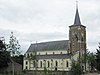
St. Peter's Parish (nl) (fr)
|
Yes |
|
Bree |
Dorpstraat |
51.12672°N 5.66001°E / 51.12672; 5.66001 (Relictid 71049 -) |
71049 Info |
|
Two village houses (nl) (fr)
|
|
|
Bree |
Dorpstraat 18 |
51.12696°N 5.66087°E / 51.12696; 5.66087 (Relictid 71050 -) |
71050 Info |
|
Two village houses (nl) (fr)
|
|
|
Bree |
Dorpstraat 20 |
51.12696°N 5.66087°E / 51.12696; 5.66087 (Relictid 71050 -) |
71050 Info |
|
Village house (nl) (fr)
|
|
|
Bree |
Dorpstraat 22 |
51.12700°N 5.66108°E / 51.12700; 5.66108 (Relictid 71051 -) |
71051 Info |
|
Village house from 1886 (nl) (fr)
|
|
|
Bree |
Dorpstraat 23 |
51.12745°N 5.66062°E / 51.12745; 5.66062 (Relictid 71052 -) |
71052 Info |
|
Former farm (nl) (fr)
|
|
|
Bree |
Dorpstraat 24 |
51.12668°N 5.66125°E / 51.12668; 5.66125 (Relictid 71053 -) |
71053 Info |
|
Village house from 1854 (nl) (fr)
|
|
|
Bree |
Dorpstraat 25 |
51.12771°N 5.66050°E / 51.12771; 5.66050 (Relictid 71054 -) |
71054 Info |
|
Small elongated farm (nl) (fr)
|
|
|
Bree |
Dorpstraat 27 |
51.12776°N 5.66084°E / 51.12776; 5.66084 (Relictid 71055 -) |
71055 Info |
|
Former farm of 1865 (nl) (fr)
|
|
|
Bree |
Dorpstraat 30 |
51.12723°N 5.66201°E / 51.12723; 5.66201 (Relictid 71056 -) |
71056 Info |
|
Former farm of 1885 (nl) (fr)
|
|
|
Bree |
Dorpstraat 29 |
51.12783°N 5.66103°E / 51.12783; 5.66103 (Relictid 71057 -) |
71057 Info |
|
Former school teacher's house and home section (nl) (fr)
|
|
|
Bree |
Dorpstraat 33 |
51.12783°N 5.66154°E / 51.12783; 5.66154 (Relictid 71058 -) |
71058 Info |
|
Farm (nl) (fr)
|
|
|
Bree |
Dorpstraat 40 |
51.12809°N 5.66330°E / 51.12809; 5.66330 (Relictid 71059 -) |
71059 Info |
|
"Koudhuis" (nl)
|
|
|
Bree |
Kerkhofstraat 7 |
51.12707°N 5.65847°E / 51.12707; 5.65847 (Relictid 71060 -) |
71060 Info |
|
Keyartmolen (nl)
|
Yes |
|
Bree |
Keyartstraat 4 |
51.12348°N 5.65660°E / 51.12348; 5.65660 (Relictid 71061 -) |
71061 Info |
|
Semi-closed farm (nl) (fr)
|
|
|
Bree |
Keyartstraat 29 |
51.12649°N 5.65857°E / 51.12649; 5.65857 (Relictid 71062 -) |
71062 Info |
|
Former elongated farm (nl) (fr)
|
|
|
Bree |
Keyartstraat 30 |
51.12552°N 5.65912°E / 51.12552; 5.65912 (Relictid 71063 -) |
71063 Info |
|
Closed farm (nl) (fr)
|
|
|
Bree |
Keyartstraat 32 |
51.12630°N 5.65931°E / 51.12630; 5.65931 (Relictid 71064 -) |
71064 Info |
|
Village house (nl) (fr)
|
|
|
Bree |
Solterweg 2 |
51.12643°N 5.66014°E / 51.12643; 5.66014 (Relictid 71066 -) |
71066 Info |
|
Former farmhouse XIXc (nl) (fr)
|
|
|
Bree |
Solterweg 4 |
51.12642°N 5.66034°E / 51.12642; 5.66034 (Relictid 71067 -) |
71067 Info |
|
Mill Village (nl) (fr)
|
Yes |
|
Bree |
Solterweg 16 |
51.12535°N 5.66130°E / 51.12535; 5.66130 (Relictid 71068 -) |
71068 Info |
|
Harvester Mill (nl) (fr)
|
|
|
Bree |
Opstraat 98 |
51.11181°N 5.63021°E / 51.11181; 5.63021 (Relictid 72437 -) |
72437 Info |
|
elongated farm "Stukkenheidehof" (nl)
|
|
|
Bree |
Grensstraat 1 |
51.13227°N 5.61923°E / 51.13227; 5.61923 (Relictid 86033 -) |
86033 Info |
|
Wrought iron cross (nl) (fr)
|
|
|
Bree |
Nijsenbergstraat |
51.11590°N 5.60963°E / 51.11590; 5.60963 (Relictid 86034 -) |
86034 Info |
|
Farmstead "Straeterhof" (nl)
|
|
|
Bree |
Straterhofweg 1 |
51.14048°N 5.64500°E / 51.14048; 5.64500 (Relictid 86035 -) |
86035 Info |
|
Farm "Kluitshof" later "Groot Kluitshof" (nl)
|
|
|
Bree |
Kluitshofweg 4 |
51.12799°N 5.57932°E / 51.12799; 5.57932 (Relictid 86036 -) |
86036 Info |
|
Wrought iron cross (nl) (fr)
|
|
|
Bree |
Meeuwerkiezel |
51.12660°N 5.56839°E / 51.12660; 5.56839 (Relictid 86037 -) |
86037 Info |
|
Cross (nl)
|
|
|
Bree |
Muizendijkstraat |
51.11090°N 5.57759°E / 51.11090; 5.57759 (Relictid 86038 -) |
86038 Info |
|
Memorial to the casualties of W.O. I (nl) (fr)
|
|
|
Bree |
Siemenstraat |
51.14387°N 5.58973°E / 51.14387; 5.58973 (Relictid 86039 -) |
86039 Info |
|
farm "Stukkenheidehof" (nl)
|
|
|
Bree |
Grensstraat 2 |
51.13366°N 5.62431°E / 51.13366; 5.62431 (Relictid 86040 -) |
86040 Info |
|
Chapel of Our Lady Comforter of the Afflicted (nl) (fr)
|
Yes |
|
Bree |
Opitterkiezel 200 |
51.12093°N 5.63807°E / 51.12093; 5.63807 (Relictid 86041 -) |
86041 Info |
|
Convent and School (nl) (fr)
|
|
|
Bree |
Opitterkiezel 211 |
51.11935°N 5.64274°E / 51.11935; 5.64274 (Relictid 86042 -) |
86042 Info |
|
Farm with old establishment (nl) (fr)
|
|
|
Bree |
Rorenweg 16 |
51.12954°N 5.63544°E / 51.12954; 5.63544 (Relictid 86043 -) |
86043 Info |
|
Farm with old establishment (nl) (fr)
|
|
|
Bree |
Rorenweg 24 |
51.12625°N 5.64089°E / 51.12625; 5.64089 (Relictid 86044 -) |
86044 Info |
|
Parish Church St. Trudo (nl) (fr)
|
Yes |
|
Bree |
Itterplein 1 |
51.11759°N 5.64625°E / 51.11759; 5.64625 (Relictid 88644 -) |
88644 Info |
|
Restored village house (nl) (fr)
|
Yes |
|
Bree |
Itterplein 1 |
51.11759°N 5.64625°E / 51.11759; 5.64625 (Relictid 88645 -) |
88645 Info |
|
Single eclectic mansion (nl) (fr)
|
|
|
Bree |
Itterplein 20 |
51.11677°N 5.64593°E / 51.11677; 5.64593 (Relictid 88646 -) |
88646 Info |
|
Brewery St. Joseph (nl) (fr)
|
|
|
Bree |
Itterplein 24 |
51.11694°N 5.64693°E / 51.11694; 5.64693 (Relictid 88647 -) |
88647 Info |
|
Former section house (nl) (fr)
|
|
|
Bree |
Itterplein 26 |
51.11669°N 5.64725°E / 51.11669; 5.64725 (Relictid 88648 -) |
88648 Info |
|
Wrought iron cross (nl) (fr)
|
|
|
Bree |
Rorenweg |
51.12268°N 5.64065°E / 51.12268; 5.64065 (Relictid 88649 -) |
88649 Info |
|


_-_Sint-Petruskerk.jpg)
