For faster navigation, this Iframe is preloading the Wikiwand page for Civita Castellana.

Civita Castellana

Cività Castellana
Civita Castellana

Piazza Matteotti
Administration
Pays
Drapeau de l
Italie
Région
Drapeau de la région du Latium
Latium 
Province
Provincia di Viterbo-Stemma.svg
Viterbe 
Code postal 01033
Code ISTAT 056021
Code cadastral C765
Préfixe tel. 0761
Démographie
Gentilé civitonici
Population 16 127 hab. (30-06-2019[1])
Densité 194 hab./km2
Géographie
Coordonnées 42° 17′ 46″ nord, 12° 24′ 36″ est
Altitude Min. 145 m
Max. 145 m
Superficie 8 328 ha = 83,28 km2
Divers
Saint patron Santi Giovanni e Marciano
Fête patronale 16 septembre
Localisation
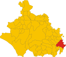
Localisation de Cività Castellana

Localisation dans la province de Viterbe.
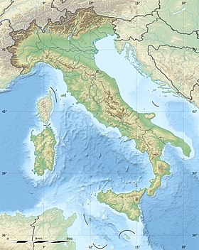
Géolocalisation sur la carte : Italie
Voir sur la carte topographique d
City locator 14.svg
Cività Castellana
Géolocalisation sur la carte : Italie
Voir sur la carte administrative d
City locator 14.svg
Cività Castellana
Géolocalisation sur la carte : Latium
Voir sur la carte administrative du Latium
City locator 14.svg
Cività Castellana
Liens
Site web Site officiel

Cività Castellana est une commune italienne de la province de Viterbe dans la région Latium en Italie.

Géographie

Les Roches rouges de Cività CastellanaCamille Corot, vers 1827Nationalmuseum, Stockholm[2]
Les Roches rouges de Cività Castellana
Camille Corot, vers 1827
Nationalmuseum, Stockholm[2]

Histoire

Cività Castellana fut dans l'Antiquité la capitale des Falisques, nommée Faléries, située à la limite des territoires étrusque et latin. Au début du IVe siècle av. J.-C., elle fut conquise par les Romains commandés par Camille.

La citadelle fut construite par Jules II et servit de prison d'État. Le pont à doubles arcades a été bâti en 1712 par le cardinal Imperiali.

L'armée française de Macdonald y battit les Napolitains le [3]. L'armée napolitaine, forte de 40 000 hommes, était commandée par le général autrichien Karl Mack[4].

Administration

Les maires successifs
Période Identité Étiquette Qualité
         
Les données manquantes sont à compléter.

Hameaux

Borghetto, Sassacci

Communes limitrophes

Castel Sant'Elia, Collevecchio, Corchiano, Fabrica di Roma, Faleria, Gallese, Magliano Sabina, Ponzano Romano, Sant'Oreste

Notes et références

  1. (it) Popolazione residente e bilancio demografico sur le site de l'ISTAT.
  2. Tableau de Corot, Stockholm
  3. Dezobry et Bachelet, Dictionnaire de biographie, t.1, Ch.Delagrave, 1876, p. 599-600
  4. Ciro Paoletti, A Military History of Italy, Praeger Security International, 2008, p. 70-71.

Sur les autres projets Wikimedia :

{{bottomLinkPreText}} {{bottomLinkText}}
Civita Castellana
Listen to this article

This browser is not supported by Wikiwand :(
Wikiwand requires a browser with modern capabilities in order to provide you with the best reading experience.
Please download and use one of the following browsers:

This article was just edited, click to reload
This article has been deleted on Wikipedia (Why?)

Back to homepage

Please click Add in the dialog above
Please click Allow in the top-left corner,
then click Install Now in the dialog
Please click Open in the download dialog,
then click Install
Please click the "Downloads" icon in the Safari toolbar, open the first download in the list,
then click Install
{{::$root.activation.text}}

Install Wikiwand

Install on Chrome Install on Firefox
Don't forget to rate us

Tell your friends about Wikiwand!

Gmail Facebook Twitter Link

Enjoying Wikiwand?

Tell your friends and spread the love:
Share on Gmail Share on Facebook Share on Twitter Share on Buffer

Our magic isn't perfect

You can help our automatic cover photo selection by reporting an unsuitable photo.

This photo is visually disturbing This photo is not a good choice

Thank you for helping!


Your input will affect cover photo selection, along with input from other users.

X

Wikiwand 2.0 is here 🎉! We've made some exciting updates - No worries, you can always revert later on