Fichier:Cornish_windsor_bridge.jpg
De Wikipedia, l'encyclopédie encyclopedia
Fichier d’origine (4 567 × 3 198 pixels, taille du fichier : 1,49 Mio, type MIME : image/jpeg)
Ce fichier et sa description proviennent de Wikimedia Commons.
|
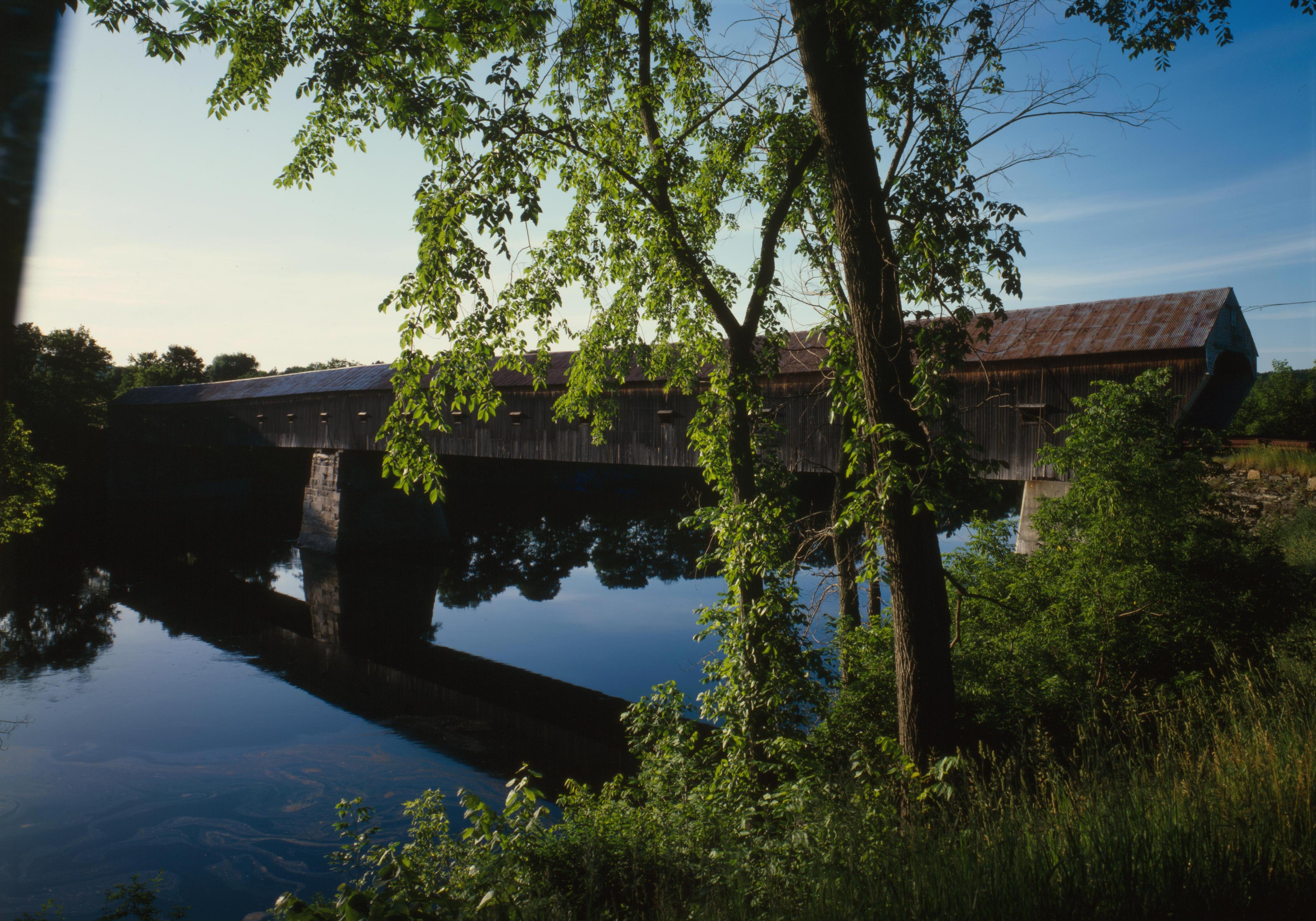
Ceci est une photographie d’un monument référencé dans le National Register of Historic Places des États-Unis sous le numéro 76000135. |
| Lieu de la prise de vue | 43° 28′ 26″ N, 72° 23′ 01″ O | Voir cet endroit et d’autres images sur : OpenStreetMap |
|---|
| DescriptionCornish windsor bridge.jpg |
English: Southern (downstream) side of the Cornish-Windsor Covered Bridge, which spans the end of the Zoarville Bridge, which spans the Connecticut River between Cornish, New Hampshire and Windsor, Vermont, in the United States. Built in 1866, it is listed on the National Register of Historic Places. |
|||||||||||||||||||||||
| Date | ||||||||||||||||||||||||
| Source | Library of Congress, Prints and Photograph Division HAER: NH,10-CORN,2-11 | |||||||||||||||||||||||
| Auteur |
creator QS:P170,Q6188857 |
|||||||||||||||||||||||
| Autorisation (Réutilisation de ce fichier) |
|
|||||||||||||||||||||||
.jpg)

|
Cette image est disponible sur la Prints and Photographs division de la Bibliothèque du Congrès des États-Unis sous le numéro d’identification hhh.nh0177.
Ce bandeau n’indique rien sur le statut de l’œuvre au regard du droit d'auteur. Un bandeau de droit d’auteur est requis. Voir Commons:À propos des licences pour plus d’informations. العربية ∙ беларуская (тарашкевіца) ∙ বাংলা ∙ čeština ∙ Deutsch ∙ English ∙ español ∙ فارسی ∙ suomi ∙ français ∙ galego ∙ עברית ∙ magyar ∙ Bahasa Indonesia ∙ italiano ∙ 日本語 ∙ lietuvių ∙ македонски ∙ മലയാളം ∙ Nederlands ∙ polski ∙ português ∙ português do Brasil ∙ română ∙ русский ∙ sicilianu ∙ slovenčina ∙ slovenščina ∙ Türkçe ∙ українська ∙ 简体中文 ∙ 繁體中文 ∙ +/− |
Légendes
Éléments décrits dans ce fichier
dépeint
43°28'26.000"N, 72°23'1.000"W
image/jpeg
29069a1957ab8a1733830f4e70b41ca8e332fab7
1 557 280 octet
3 198 pixel
4 567 pixel
Historique du fichier
Cliquer sur une date et heure pour voir le fichier tel qu'il était à ce moment-là.
| Date et heure | Vignette | Dimensions | Utilisateur | Commentaire | |
|---|---|---|---|---|---|
| actuel | 6 septembre 2009 à 19:32 | | 4 567 × 3 198 (1,49 Mio) | Cropbot | upload cropped version, operated by User:Finavon. Summary: border cropped |
| 14 août 2009 à 07:07 |  | 4 911 × 3 556 (1,69 Mio) | Nyttend | {{Location|43|28|26|N|72|23|1|W}} {{Information |Description={{en|Southern (downstream) side of the {{w|Cornish-Windsor Covered Bridge}}, which spans the end of the {{w|Zoarville Bridge}}, which spans the {{w|Connecticut River}} between {{w|Cornish, New H |
Utilisation du fichier
La page suivante utilise ce fichier :
Usage global du fichier
Les autres wikis suivants utilisent ce fichier :
- Utilisation sur ar.wikipedia.org
- Utilisation sur de.wikipedia.org
- Utilisation sur en.wikipedia.org
- Windsor, Vermont
- List of Historic Civil Engineering Landmarks
- National Register of Historic Places listings in Windsor County, Vermont
- Portal:U.S. roads/Did you know
- List of bridges on the National Register of Historic Places in New Hampshire
- List of bridges on the National Register of Historic Places in Vermont
- Portal:U.S. roads/Did you know/October 2011
- User:Eurodog/sandbox153
- Utilisation sur es.wikipedia.org
- Utilisation sur vi.wikipedia.org
- Utilisation sur zh.wikipedia.org
Métadonnées
Ce fichier contient des informations supplémentaires, probablement ajoutées par l'appareil photo numérique ou le numériseur utilisé pour le créer.
Si le fichier a été modifié depuis son état original, certains détails peuvent ne pas refléter entièrement l'image modifiée.
| Largeur | 4 911 px |
|---|---|
| Hauteur | 3 556 px |
| Schéma de compression | Non compressé |
| Composition des pixels | RVB |
| Orientation | Normale |
| Nombre de rangées par bande | 4 |
| Résolution horizontale | 4 911 pt/cm |
| Résolution verticale | 3 556 pt/cm |
| Arrangement des données | Format tronçonné |
| Date de modification du fichier | 21 mai 2001 à 18:08 |