Fichier:Downtown_Detroit,_Michigan_from_Windsor,_Ontario_(21760963102).jpg
De Wikipedia, l'encyclopédie encyclopedia
Fichier d’origine (3 898 × 1 315 pixels, taille du fichier : 1,2 Mio, type MIME : image/jpeg)
Ce fichier et sa description proviennent de Wikimedia Commons.
Description
| DescriptionDowntown Detroit, Michigan from Windsor, Ontario (21760963102).jpg |
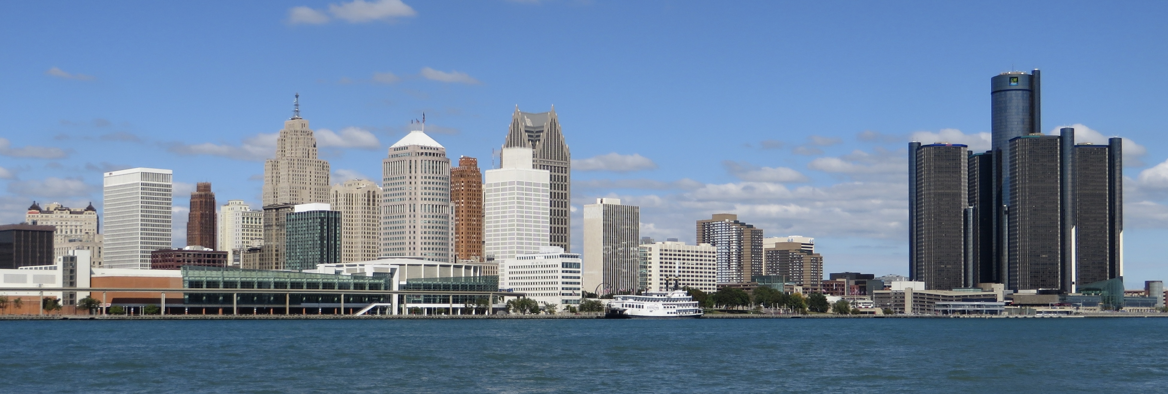
Detroit is the most populous city in the U.S. state of Michigan, the fourth-largest city in the Midwest and the largest city on the United States–Canada border. It is the seat of Wayne County, the most populous county in the state. Detroit's metropolitan area, known as Metro Detroit, is home to 5.3 million people, making it the fourteenth-most populous metropolitan area in the United States and the second-largest in the Midwestern United States (behind Chicago). It is a major port on the Detroit River, a strait that connects the Great Lakes system to the Saint Lawrence Seaway. The City of Detroit anchors the second-largest economic region in the Midwest, behind Chicago, and the thirteenth-largest in the United States. Detroit is the center of a three-county urban area (population 3,734,090, area of 1,337 square miles (3,460 km2), a 2010 United States Census) six-county metropolitan statistical area (2010 Census population of 4,296,250, area of 3,913 square miles [10,130 km2]), and a nine-county Combined Statistical Area (2010 Census population of 5,218,852, area of 5,814 square miles [15,060 km2]). The Detroit–Windsor area, a commercial link straddling the Canada–U.S. border, has a total population of about 5,700,000. The Detroit metropolitan region holds roughly one-half of Michigan's population. Detroit was founded on July 24, 1701, by the French explorer and adventurer Antoine de la Mothe Cadillac and a party of settlers. With expansion of the automobile industry, the Detroit area emerged as a significant metropolitan region within the United States in the early 20th century, when the city became the fourth-largest in the country for a period. In the 1950s and 1960s, expansion continued with construction of a regional freeway system. Due to industrial restructuring and loss of jobs in the auto industry, Detroit lost considerable population from the late 20th century to present. Between 2000 and 2010 the city's population fell by 25 percent, changing its ranking from the nation's 10th-largest city to 18th. In 2010, the city had a population of 713,777, more than a 60 percent drop from a peak population of over 1.8 million at the 1950 census. This resulted from suburbanization, industrial restructuring, and the decline of Detroit's auto industry. Following the shift of population and jobs to its suburbs or other states or nations, the city has focused on becoming the metropolitan region's employment and economic center. Downtown Detroit has held an increased role as an entertainment destination in the 21st century, with the restoration of several historic theatres, several new sports stadiums, and a riverfront revitalization project. More recently, the population of Downtown Detroit, Midtown Detroit, and a handful of other neighborhoods has increased. Many other neighborhoods remain distressed, with extensive abandonment of properties. The Governor of Michigan, Rick Snyder, declared a financial emergency for the city in March 2013, appointing an emergency manager. On July 18, 2013, Detroit filed the largest municipal bankruptcy case in U.S. history. It was declared bankrupt by Judge Steven W. Rhodes of the Bankruptcy Court for the Eastern District of Michigan on December 3, 2013; he cited its $18.5 billion debt and declared that negotiations with its thousands of creditors were unfeasible. On November 7, 2014, Judge Rhodes approved the city's bankruptcy plan, allowing the city to begin the process of exiting bankruptcy. The City of Detroit successfully exited Chapter 9 municipal bankruptcy with all finances handed back to the city at midnight on December 11, 2014. en.wikipedia.org/wiki/Wikipedia:Text_of_Creative_Commons_... |
| Date | |
| Source | Downtown Detroit, Michigan from Windsor, Ontario |
| Auteur | Ken Lund from Reno, Nevada, USA |
| Lieu de la prise de vue | 42° 19′ 05,47″ N, 83° 02′ 55,12″ O | Voir cet endroit et d’autres images sur : OpenStreetMap |
|---|
Conditions d’utilisation
- Vous êtes libre :
- de partager – de copier, distribuer et transmettre cette œuvre
- d’adapter – de modifier cette œuvre
- Sous les conditions suivantes :
- paternité – Vous devez donner les informations appropriées concernant l'auteur, fournir un lien vers la licence et indiquer si des modifications ont été faites. Vous pouvez faire cela par tout moyen raisonnable, mais en aucune façon suggérant que l’auteur vous soutient ou approuve l’utilisation que vous en faites.
- partage à l’identique – Si vous modifiez, transformez, ou vous basez sur cette œuvre, vous devez distribuer votre contribution sous la même licence ou une licence compatible avec celle de l’original.
| Cette image a été originellement postée sur Flickr par Ken Lund à l'adresse https://flickr.com/photos/75683070@N00/21760963102. Elle a été passée en revue le 19 décembre 2016 par le robot FlickreviewR, qui a confirmé qu'elle se trouvait sous licence cc-by-sa-2.0. |
19 décembre 2016
Légendes
Valeur sans élément de Wikidata
27 septembre 2015
42°19'5.470"N, 83°2'55.122"W
0,0008 seconde
7,5 millimètre
image/jpeg
Historique du fichier
Cliquer sur une date et heure pour voir le fichier tel qu'il était à ce moment-là.
| Date et heure | Vignette | Dimensions | Utilisateur | Commentaire | |
|---|---|---|---|---|---|
| actuel | 17 février 2023 à 15:49 | 3 898 × 1 315 (1,2 Mio) | 636Buster | slight crop | |
| 19 décembre 2016 à 16:51 |  | 3 910 × 1 739 (3,4 Mio) | Mindmatrix | Transferred from Flickr via Flickr2Commons |
Utilisation du fichier
Les 2 pages suivantes utilisent ce fichier :
Usage global du fichier
Les autres wikis suivants utilisent ce fichier :
- Utilisation sur ban.wikipedia.org
- Utilisation sur en.wikipedia.org
- Utilisation sur id.wikipedia.org
- Utilisation sur ja.wikipedia.org
- Utilisation sur nn.wikipedia.org
- Utilisation sur pt.wikipedia.org
- Utilisation sur simple.wikipedia.org
- Utilisation sur zh.wikipedia.org
Métadonnées
Ce fichier contient des informations supplémentaires, probablement ajoutées par l'appareil photo numérique ou le numériseur utilisé pour le créer.
Si le fichier a été modifié depuis son état original, certains détails peuvent ne pas refléter entièrement l'image modifiée.
| Fabricant de l’appareil photo | Canon |
|---|---|
| Modèle de l’appareil photo | Canon PowerShot SX280 HS |
| Orientation | Normale |
| Résolution horizontale | 180 pt/po |
| Résolution verticale | 180 pt/po |
| Date de modification du fichier | 27 septembre 2015 à 11:10 |
| Positionnement YCbCr | Centré |
| Durée d’exposition | 1/1 250 s (0,0008 s) |
| Ouverture focale | f / 4 |
| Sensibilité ISO (vitesse d’obturation) | 80 |
| Version d’EXIF | 2.3 |
| Date et heure de génération des données | 27 septembre 2015 à 11:10 |
| Date et heure de la numérisation | 27 septembre 2015 à 11:10 |
| Signification de chaque composante |
|
| Vitesse d’obturation APEX | 10,280770743217 |
| Ouverture APEX | 4 |
| Biais de compensation d’exposition APEX | −0,33333333333333 |
| Ouverture maximale interne de la lentille | 4 APEX (f / 4) |
| Mode de mesure | Motif géométrique |
| Flash | Flash non déclenché, suppression du flash obligatoire |
| Longueur focale de la lentille | 7,5 mm |
| Version de FlashPix prise en charge | 1 |
| Espace colorimétrique | sRGB |
| Résolution horizontale du plan focal | 16 393,442622951 |
| Résolution verticale du plan focal | 16 393,442622951 |
| Unité de résolution du plan focal | pouces |
| Type de capteur | Capteur de couleur à une puce |
| Source du fichier | Appareil photo numérique |
| Rendu d’image personnalisé | Procédé personnalisé |
| Mode d’exposition | Exposition manuelle |
| Balance des blancs | Balance des blancs automatique |
| Taux de zoom numérique | 1 |
| Type de capture de la scène | Standard |
| Latitude | 42° 19′ 6,14″ N |
| Longitude | 83° 2′ 54,74″ W |
| Altitude | 167,4 mètres au dessus du niveau de la mer |
| État du récepteur | Mesure en cours |
| Système géodésique utilisé | WGS-84 |
| Version de la balise GPS | 2.3.0.0 |
| Lentille utilisée | 4.5-90.0 mm |
| Note d’évaluation (sur 5) | 0 |
| Version d’IIM | 2 |
.jpg)