Bestand:Arkansas_counties_map.png
Uit Wikipedia, de vrije encyclopedia
Grootte van deze voorvertoning: 678 × 599 pixels. Andere resoluties: 272 × 240 pixels | 543 × 480 pixels | 793 × 701 pixels.
Oorspronkelijk bestand (793 × 701 pixels, bestandsgrootte: 2,14 MB, MIME-type: image/png)
| Dit is een bestand van Wikimedia Commons. Onderstaande beschrijving komt van de beschrijving van het bestand daar. |
Beschrijving
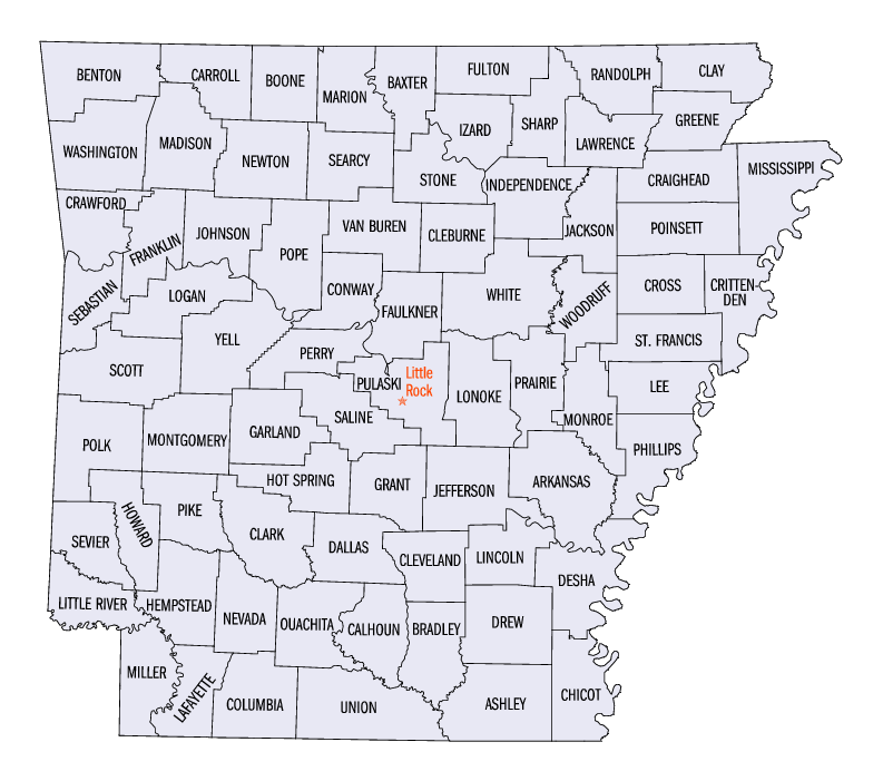
| BeschrijvingArkansas counties map.png |
Dit bestand heeft geen beschrijving en misschien ontbreekt er ook wel andere informatie.
Voeg een zinvolle beschrijving toe aan dit bestand. |
| Bron | US gov |
| Auteur | United States Census Bureau |
Licentie
| Public domainPublic domainfalsefalse |
This image or file is a work of a United States Census Bureau employee, taken or made as part of that person's official duties. As a work of the U.S. federal government, the image is in the public domain.
English ∙ español ∙ 日本語 ∙ македонски ∙ മലയാളം ∙ português do Brasil ∙ русский ∙ українська ∙ +/− |
 |
Oorspronkelijk uploadlogboek
De oorspronkelijke beschrijving van deze afbeelding stond hier. Alle volgende gebruikersnamen verwijzen naar en.wikipedia.
- 2005-06-24 22:39 Jengod 793×701× (110129 bytes) [[Category:Arkansas maps]] {{PD-USGov-DOC-Census}}
Bijschriften
Beschrijf in één regel wat dit bestand voorstelt
Items getoond in dit bestand
beeldt af
image/png
72f9a1576dcac0491c06c0365812be3c90ecd2f0
2.244.903 byte
701 pixel
793 pixel
Bestandsgeschiedenis
Klik op een datum/tijd om het bestand te zien zoals het destijds was.
| Datum/tijd | Miniatuur | Afmetingen | Gebruiker | Opmerking | |
|---|---|---|---|---|---|
| huidige versie | 27 feb 2022 03:27 | | 793 × 701 (2,14 MB) | Felagoth | added transparency |
| 10 jul 2006 19:31 |  | 793 × 701 (108 kB) | JosN |
Bestandsgebruik
Dit bestand wordt op de volgende pagina gebruikt:
Globaal bestandsgebruik
De volgende andere wiki's gebruiken dit bestand:
- Gebruikt op bg.wikipedia.org
- Gebruikt op cy.wikipedia.org
- Gebruikt op en.wikipedia.org
- Gebruikt op fr.wikipedia.org
- Gebruikt op he.wikipedia.org
- Gebruikt op hu.wikipedia.org
- Gebruikt op it.wikipedia.org
- Gebruikt op ja.wikipedia.org
- Gebruikt op ko.wikipedia.org
- Gebruikt op nds.wikipedia.org
- Gebruikt op pt.wikipedia.org
- Gebruikt op ro.wikipedia.org
- Gebruikt op ru.wikipedia.org
- Gebruikt op simple.wikipedia.org
- Gebruikt op sv.wikipedia.org
- Gebruikt op zh.wikipedia.org
Metadata
Dit bestand bevat metadata met EXIF-informatie, die door een fotocamera, scanner of fotobewerkingsprogramma toegevoegd kan zijn.
| Gebruikte software | GIMP 2.10 |
|---|---|
| Uniek ID van het originele document | xmp.did:db7f8b29-d5c4-4369-9f1d-5cc4542f5808 |
| Horizontale resolutie | 28,35 dpc |
| Verticale resolutie | 28,35 dpc |
| Tijdstip laatste bestandswijziging | 27 feb 2022 01:27 |
Overgenomen van "https://nl.wikipedia.org/wiki/Bestand:Arkansas_counties_map.png"