Bestand:Landsat-emirau-island-adjusted.png
Uit Wikipedia, de vrije encyclopedia
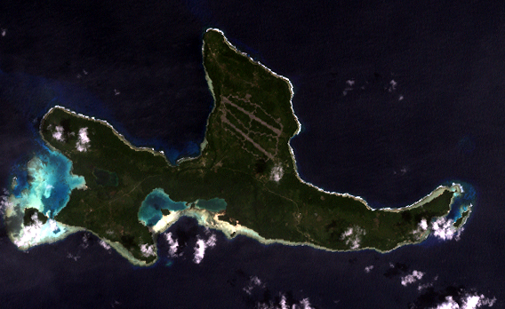
Landsat-emirau-island-adjusted.png (568 × 348 pixels, bestandsgrootte: 774 kB, MIME-type: image/png)
| Dit is een bestand van Wikimedia Commons. Onderstaande beschrijving komt van de beschrijving van het bestand daar. |
Orthocorrected Landsat 7 image of Emirau Island, New Ireland province, Papua New Guinea. Acquired 2000-II-6; orthocorrected by EarthSat. Source for this dataset was the Global Land Cover Facility archief kopie op de Wayback Machine. Levels have been adjusted using GIMP. This is a public domain image.
| Public domainPublic domainfalsefalse |
Deze afbeelding bevindt zich in het publiek domein omdat het materiaal bevat dat oorspronkelijk afkomstig is van de United States Geological Survey, een agentschap van de United States Department of the Interior. Voor meer informatie, zie het officiële USGS-auteursrechtenbeleid
Bahasa Indonesia ∙ català ∙ čeština ∙ Deutsch ∙ eesti ∙ English ∙ español ∙ français ∙ galego ∙ italiano ∙ Nederlands ∙ português ∙ polski ∙ sicilianu ∙ suomi ∙ Tiếng Việt ∙ Türkçe ∙ български ∙ македонски ∙ русский ∙ മലയാളം ∙ 한국어 ∙ 日本語 ∙ 中文 ∙ 中文(简体) ∙ 中文(繁體) ∙ العربية ∙ فارسی ∙ +/− |
Bestandsgeschiedenis
Klik op een datum/tijd om het bestand te zien zoals het destijds was.
| Datum/tijd | Miniatuur | Afmetingen | Gebruiker | Opmerking | |
|---|---|---|---|---|---|
| huidige versie | 14 mei 2005 20:00 | | 568 × 348 (774 kB) | Dmoews~commonswiki | Orthocorrected Landsat 7 image of Emirau Island, New Ireland province, Papua New Guinea. Acquired 2000-II-6; orthocorrected by [http://www.earthsat.com/ EarthSat]. Source for this dataset was the [http://www.landcover.org/ Global Land Cover Facility]. |
Bestandsgebruik
Dit bestand wordt op de volgende pagina gebruikt:
Globaal bestandsgebruik
De volgende andere wiki's gebruiken dit bestand:
- Gebruikt op fr.wikipedia.org
- Gebruikt op gl.wikipedia.org
- Gebruikt op it.wikipedia.org
- Gebruikt op ja.wikipedia.org
- Gebruikt op pnb.wikipedia.org
- Gebruikt op www.wikidata.org