Bestand:Map_of_Finland_with_provinces_(numbered).png
Uit Wikipedia, de vrije encyclopedia
Geen hogere resolutie beschikbaar.
Map_of_Finland_with_provinces_(numbered).png (150 × 260 pixels, bestandsgrootte: 2 kB, MIME-type: image/png)
| Dit is een bestand van Wikimedia Commons. Onderstaande beschrijving komt van de beschrijving van het bestand daar. |

|
Bestand:FI-provinces-numbered.svg is een vectorversie van dit bestand. Indien niet van slechtere kwaliteit dient deze gebruikt te worden in plaats van deze rasterafbeelding.
File:Map of Finland with provinces (numbered).png → File:FI-provinces-numbered.svg
Zie Help:SVG voor meer informatie.
|
 |
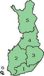
Map of Finland with the Province lines visible (numbered)
(c) adrian.benko, 2005, based on images by (c) helix84, 2005, based on images by (c) Jani Niemenmaa, 2003

|
Toestemming wordt verleend voor het kopiëren, verspreiden en/of wijzigen van dit document onder de voorwaarden van de GNU-licentie voor vrije documentatie, versie 1.2 of enige latere versie als gepubliceerd door de Free Software Foundation; zonder Invariant Sections, zonder Front-Cover Texts, en zonder Back-Cover Texts. Een kopie van de licentie is opgenomen in de sectie GNU-licentie voor vrije documentatie.http://www.gnu.org/copyleft/fdl.htmlGFDLGNU Free Documentation Licensetruetrue |
| Dit bestand is gelicenseerd onder de Creative Commons-licentie Naamsvermelding-Gelijk delen 3.0 Unported | ||
| ||
| Deze licentietag is toegevoegd aan dit bestand in verband met de GFDL licentie-update.http://creativecommons.org/licenses/by-sa/3.0/CC BY-SA 3.0Creative Commons Attribution-Share Alike 3.0truetrue |
Bijschriften
Beschrijf in één regel wat dit bestand voorstelt
Items getoond in dit bestand
beeldt af
Bestandsgeschiedenis
Klik op een datum/tijd om het bestand te zien zoals het destijds was.
| Datum/tijd | Miniatuur | Afmetingen | Gebruiker | Opmerking | |
|---|---|---|---|---|---|
| huidige versie | 12 okt 2007 17:37 | | 150 × 260 (2 kB) | Skies | Map of Finland with the Province lines visible (numbered) (c) adrian.benko, 2005, based on images by (c) helix84, 2005, based on images by (c) Jani Niemenmaa, 2003 {{GFDL}} [[Category:Locator m |
| 12 okt 2007 17:34 |  | 150 × 260 (2 kB) | Skies | Map of Finland with the Province lines visible (numbered) (c) adrian.benko, 2005, based on images by (c) helix84, 2005, based on images by (c) Jani Niemenmaa, 2003 {{GFDL}} [[Category:Locator m | |
| 27 apr 2005 20:32 |  | 150 × 261 (17 kB) | Adrian.benko~commonswiki | Map of Finland with the Province lines visible (numbered) (c) User:adrian.benko, 2005, based on images by (c) helix84, 2005, based on images by (c) Jani Niemenmaa, 2003 {{GFDL}} |
Bestandsgebruik
Dit bestand wordt op de volgende pagina gebruikt:
Globaal bestandsgebruik
De volgende andere wiki's gebruiken dit bestand:
- Gebruikt op ast.wikipedia.org
- Gebruikt op be.wikipedia.org
- Gebruikt op br.wikipedia.org
- Gebruikt op bs.wikipedia.org
- Gebruikt op da.wikipedia.org
- Gebruikt op de.wikivoyage.org
- Gebruikt op diq.wikipedia.org
- Gebruikt op el.wikipedia.org
- Gebruikt op en.wikipedia.org
- Gebruikt op eu.wikipedia.org
- Gebruikt op fi.wikipedia.org
- Gebruikt op fi.wikivoyage.org
- Gebruikt op fr.wikipedia.org
- Gebruikt op gag.wikipedia.org
- Gebruikt op he.wikipedia.org
- Gebruikt op hu.wikipedia.org
- Gebruikt op id.wikipedia.org
- Gebruikt op incubator.wikimedia.org
- Gebruikt op ko.wikipedia.org
- Gebruikt op ms.wikipedia.org
- Gebruikt op oc.wikipedia.org
- Gebruikt op pl.wikipedia.org
- Gebruikt op pt.wikipedia.org
- Gebruikt op ro.wikipedia.org
- Gebruikt op ru.wikipedia.org
- Gebruikt op se.wikipedia.org
- Gebruikt op sk.wikipedia.org
- Gebruikt op su.wikipedia.org
- Gebruikt op tg.wikipedia.org
- Gebruikt op vec.wikipedia.org
.png)