Bestand:Map_of_Jefferson_County_Ohio_With_Municipal_and_Township_Labels.PNG
Uit Wikipedia, de vrije encyclopedia
Grootte van deze voorvertoning: 394 × 599 pixels. Andere resoluties: 158 × 240 pixels | 466 × 708 pixels.
Oorspronkelijk bestand (466 × 708 pixels, bestandsgrootte: 57 kB, MIME-type: image/png)
| Dit is een bestand van Wikimedia Commons. Onderstaande beschrijving komt van de beschrijving van het bestand daar. |
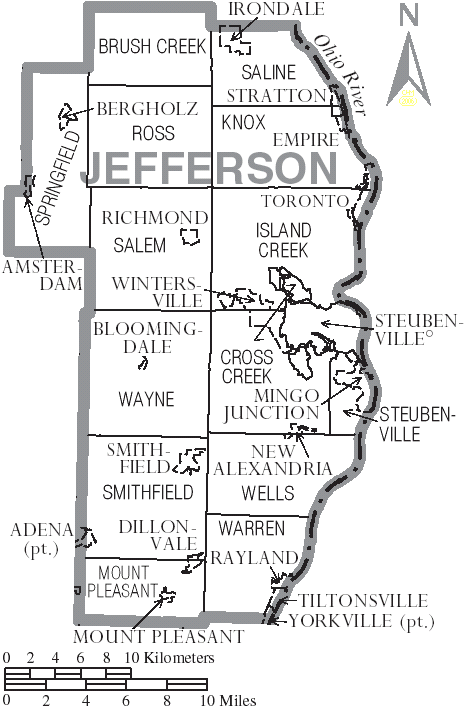
| BeschrijvingMap of Jefferson County Ohio With Municipal and Township Labels.PNG | Map of Jefferson County, Ohio, United States with township and municipal boundaries |
| Datum | |
| Bron | taken from US Census website [1] and modified by User:Ruhrfisch |
| Auteur | US Census, Ruhrfisch |
| Toestemming (Hergebruik van dit bestand) |
US Census / US Government work is public domain, my modifications licensed under the GNU Free Documentation License |

|
Toestemming wordt verleend voor het kopiëren, verspreiden en/of wijzigen van dit document onder de voorwaarden van de GNU-licentie voor vrije documentatie, versie 1.2 of enige latere versie als gepubliceerd door de Free Software Foundation; zonder Invariant Sections, zonder Front-Cover Texts, en zonder Back-Cover Texts. Een kopie van de licentie is opgenomen in de sectie GNU-licentie voor vrije documentatie.http://www.gnu.org/copyleft/fdl.htmlGFDLGNU Free Documentation Licensetruetrue |
| Dit bestand is gelicenseerd onder de Creative Commons-licentie Naamsvermelding-Gelijk delen 3.0 Unported | ||
| ||
| Deze licentietag is toegevoegd aan dit bestand in verband met de GFDL licentie-update.http://creativecommons.org/licenses/by-sa/3.0/CC BY-SA 3.0Creative Commons Attribution-Share Alike 3.0truetrue |
Bijschriften
Beschrijf in één regel wat dit bestand voorstelt
Items getoond in dit bestand
beeldt af
juli 2006
Bestandsgeschiedenis
Klik op een datum/tijd om het bestand te zien zoals het destijds was.
| Datum/tijd | Miniatuur | Afmetingen | Gebruiker | Opmerking | |
|---|---|---|---|---|---|
| huidige versie | 3 jul 2006 22:11 | | 466 × 708 (57 kB) | Ruhrfisch | {{Information| |Description= Map of Jefferson County, Ohio, United States with township and municipal boundaries |Source= taken from US Census website [http://www2.census.gov/geo/maps/general_ref/cousub_outline/cen2k_pgsz/oh_cosub.pdf] and modified by [[ |
Bestandsgebruik
Dit bestand wordt op de volgende pagina gebruikt:
Globaal bestandsgebruik
De volgende andere wiki's gebruiken dit bestand:
- Gebruikt op de.wikipedia.org
- Gebruikt op en.wikipedia.org
- Gebruikt op ja.wikipedia.org
- Gebruikt op pt.wikipedia.org
- Gebruikt op vi.wikipedia.org
- Xã Brush Creek, Quận Jefferson, Ohio
- Xã Cross Creek, Quận Jefferson, Ohio
- Xã Island Creek, Quận Jefferson, Ohio
- Xã Knox, Quận Jefferson, Ohio
- Xã Mount Pleasant, Quận Jefferson, Ohio
- Xã Ross, Quận Jefferson, Ohio
- Xã Salem, Quận Jefferson, Ohio
- Xã Saline, Quận Jefferson, Ohio
- Xã Smithfield, Quận Jefferson, Ohio
- Xã Springfield, Quận Jefferson, Ohio
- Xã Steubenville, Quận Jefferson, Ohio
- Xã Warren, Quận Jefferson, Ohio
- Xã Wayne, Quận Jefferson, Ohio
- Xã Wells, Quận Jefferson, Ohio