Bestand:Nevada_map_showing_counties.png
Uit Wikipedia, de vrije encyclopedia
Geen hogere resolutie beschikbaar.
Nevada_map_showing_counties.png (260 × 300 pixels, bestandsgrootte: 33 kB, MIME-type: image/png)
| Dit is een bestand van Wikimedia Commons. Onderstaande beschrijving komt van de beschrijving van het bestand daar. |
Beschrijving
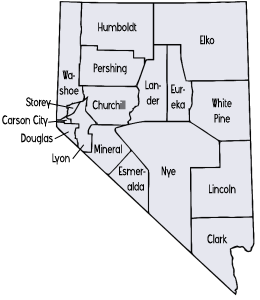
English: Counties in Nevada — annotated map.
The image was transferred from en.wiki (see en:Image:Nevada map showing counties.png) under the {{GFDL}} license tag. Wars 17:05, 28 May 2006 (UTC)
Licentie
| Dit bestand is gelicenseerd onder de Creative Commons-licentie Naamsvermelding-Gelijk delen 3.0 Unported Onderhevig aan disclaimers. | ||
| ||
| Deze licentietag is toegevoegd aan dit bestand in verband met de GFDL licentie-update.http://creativecommons.org/licenses/by-sa/3.0/CC BY-SA 3.0Creative Commons Attribution-Share Alike 3.0truetrue |

|
Toestemming wordt verleend voor het kopiëren, verspreiden en/of wijzigen van dit document onder de voorwaarden van de GNU-licentie voor vrije documentatie, versie 1.2 of enige latere versie als gepubliceerd door de Free Software Foundation; zonder Invariant Sections, zonder Front-Cover Texts, en zonder Back-Cover Texts. Een kopie van de licentie is opgenomen in de sectie GNU-licentie voor vrije documentatie. Onderhevig aan disclaimers.http://www.gnu.org/copyleft/fdl.htmlGFDLGNU Free Documentation Licensetruetrue |
Bijschriften
Beschrijf in één regel wat dit bestand voorstelt
Items getoond in dit bestand
beeldt af
Bestandsgeschiedenis
Klik op een datum/tijd om het bestand te zien zoals het destijds was.
| Datum/tijd | Miniatuur | Afmetingen | Gebruiker | Opmerking | |
|---|---|---|---|---|---|
| huidige versie | 28 mei 2006 19:05 | | 260 × 300 (33 kB) | Wars | The image was transferred from en.wiki (see en:Image:Nevada map showing counties.png) under the '''<nowiki>{{GFDL}}</nowiki>''' license tag. ~~~~ |
Bestandsgebruik
Dit bestand wordt op de volgende pagina gebruikt:
Globaal bestandsgebruik
De volgende andere wiki's gebruiken dit bestand:
- Gebruikt op ar.wikipedia.org
- Gebruikt op ca.wikipedia.org
- Gebruikt op cy.wikipedia.org
- Gebruikt op el.wikipedia.org
- Gebruikt op en.wikipedia.org
- Gebruikt op eo.wikipedia.org
- Gebruikt op es.wikipedia.org
- Gebruikt op fi.wikipedia.org
- Gebruikt op fr.wikipedia.org
- Gebruikt op he.wikipedia.org
- Gebruikt op it.wikipedia.org
- Gebruikt op ja.wikipedia.org
- Gebruikt op ko.wikipedia.org
- Gebruikt op li.wikipedia.org
- Clark County (Nevada)
- Lies vaan graofsjappe in Nevada
- Nye County
- Esmeralda County
- Mineral County (Nevada)
- Lyon County (Nevada)
- Washoe County
- Humboldt County (Nevada)
- Elko County
- White Pine County
- Lincoln County (Nevada)
- Churchill County
- Lander County
- Eureka County
- Douglas County (Nevada)
- Pershing County
- Storey County
- Gebruikt op nds.wikipedia.org
- Gebruikt op pt.wikipedia.org
- Condado de Churchill
- Condado de Clark (Nevada)
- Condado de Douglas (Nevada)
- Condado de Elko
- Condado de Esmeralda
- Condado de Humboldt (Nevada)
- Condado de Lander
- Condado de Lincoln (Nevada)
- Condado de Lyon (Nevada)
- Condado de Mineral (Nevada)
- Condado de Nye
- Condado de Pershing
- Condado de Storey
- Condado de Washoe
- Condado de White Pine
- Condado de Eureka
- Predefinição:Esboço-condado-nevada
Globaal gebruik van dit bestand bekijken.
Overgenomen van "https://nl.wikipedia.org/wiki/Bestand:Nevada_map_showing_counties.png"