Bestand:Topo_Map_Pennines.png
Uit Wikipedia, de vrije encyclopedia
Oorspronkelijk bestand (1.250 × 1.803 pixels, bestandsgrootte: 3,2 MB, MIME-type: image/png)
| Dit is een bestand van Wikimedia Commons. Onderstaande beschrijving komt van de beschrijving van het bestand daar. |
Beschrijving
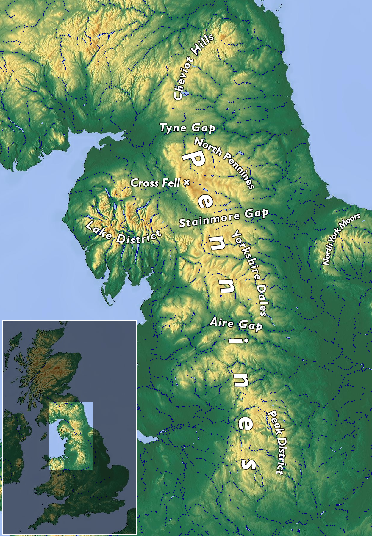
| BeschrijvingTopo Map Pennines.png |
English: Topographic map of the Pennines
Deutsch: Topographische Karte der Pennines |
|||||||||
| Datum | ||||||||||
| Bron | Eigen werk | |||||||||
| Auteur | Kreuzschnabel, basemap from maps-for-free, CC0 licensed | |||||||||
| Toestemming (Hergebruik van dit bestand) |
Ik, de auteursrechthebbende van dit werk, maak het hierbij onder de volgende licentie beschikbaar: Dit bestand is gelicenseerd onder de Creative Commons-licentie Naamsvermelding-Gelijk delen 3.0 Unported
|


Bijschriften
Items getoond in dit bestand
beeldt af
20 jun 2020
Bestandsgeschiedenis
Klik op een datum/tijd om het bestand te zien zoals het destijds was.
| Datum/tijd | Miniatuur | Afmetingen | Gebruiker | Opmerking | |
|---|---|---|---|---|---|
| huidige versie | 25 sep 2020 11:09 | | 1.250 × 1.803 (3,2 MB) | Kreuzschnabel | + North Pennines |
| 20 jun 2020 18:43 |  | 1.250 × 1.803 (3,19 MB) | Kreuzschnabel | labels readability improved | |
| 20 jun 2020 11:49 |  | 1.250 × 1.803 (3,17 MB) | Kreuzschnabel | {{Information |description ={{en|1=Topographic map of the Pennines}} {{de|1=Topographische Karte der Pennines}} |date =2020-06-20 |source ={{own}} |author =User:Kreuzschnabel, basemap from maps-for-free, CC0 licensed |permission ={{subst:User:Kreuzschnabel/Lizenz}} }} Category:Maps of the United Kingdom Category:Pennines (hills) Category:Images by Kreuzschnabel/Karten und Grafiken |
Bestandsgebruik
Dit bestand wordt op de volgende pagina gebruikt:
Globaal bestandsgebruik
De volgende andere wiki's gebruiken dit bestand:
- Gebruikt op ar.wikipedia.org
- Gebruikt op de.wikipedia.org
- Gebruikt op el.wikipedia.org
- Gebruikt op en.wikipedia.org
- Gebruikt op es.wikipedia.org
- Gebruikt op fr.wikipedia.org
- Gebruikt op gl.wikipedia.org
Metadata
Dit bestand bevat metadata met EXIF-informatie, die door een fotocamera, scanner of fotobewerkingsprogramma toegevoegd kan zijn.
| Horizontale resolutie | 118,11 dpc |
|---|---|
| Verticale resolutie | 118,11 dpc |
| Tijdstip laatste bestandswijziging | 25 sep 2020 09:08 |
| Opmerking bij PNG-bestand |
|