
Hertford (Engeland)
Engeland / Uit Wikipedia, de vrije encyclopedia
Hertford is een civil parish in het bestuurlijke gebied East Hertfordshire en vormt de bestuurszetel van het Engelse graafschap Hertfordshire. De plaats telt 26.783 inwoners (2011).
 Kasteel van Hertford
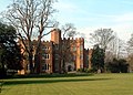
 St Andrew, Hertford


Snelle feiten Situering, Regio ...
| Civil parish in Engeland | |||
|---|---|---|---|
 | |||
| Situering | |||
| Regio | East of England | ||
| Graafschap | Hertfordshire | ||
| District | East Hertfordshire | ||
| Coördinaten | 51° 48' NB, 0° 5' WL | ||
| Algemeen | |||
| Oppervlakte | 18,1953 km² | ||
| Inwoners (2011) |
26783 (1472 inw./km²) | ||
| Overig | |||
| Postcode(s) | SG14 and SG13 | ||
| Netnummer(s) | 01992 | ||
| Grid code | TL325125 | ||
| Post town | HERTFORD | ||
| ONS-code | E04004734 | ||
| Foto's | |||
 | |||
| Parliament Square in het centrum van Hertford | |||
| |||
Sluiten