Акс:Newottawamap.png
From Wikipedia, the free encyclopedia
Акси аслӣ ((903 × 638 пиксел, ҳаҷми парванда: 165 кбайт, навъи MIME: image/png))
Ин файл аз Викианбор ва дар дигар лоиҳаҳо метавонад истифода шавад. Тафсилоти ин файл саҳифаи тафсилоти файл дар зер нишон дода шудааст.

|
This city map image could be re-created using vector graphics as an SVG file. This has several advantages; see Commons:Media for cleanup for more information. If an SVG form of this image is available, please upload it and afterwards replace this template with
{{vector version available|new image name}}.Note: Existing vector data is available from File:Ottawa map.svg. It is recommended to name the SVG file “Newottawamap.svg”—then the template Vector version available (or Vva) does not need the new image name parameter. |
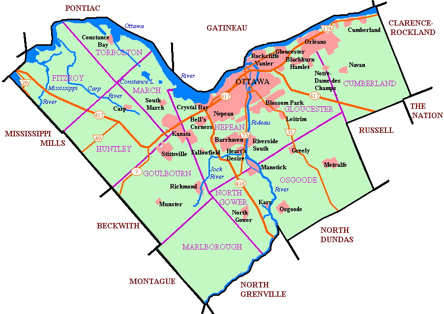
Originally uploaded to en wiki as Image:Newottawamap.png by creator en:User:Earl Andrew on March 16, 2005 Released by author to the public domain.
| Public domainPublic domainfalsefalse |
| |
This work has been released into the public domain by its author, Earl Andrew, at the Англисӣ Википедия project. This applies worldwide. In case this is not legally possible: |
Format
Captions
Items portrayed in this file
тавсифҳо
Таърихи файл
Рӯи таърихҳо клик кунед то нусхаи марбути парвандаро бубинед.
| Таърих | Бандангуштӣ | Андоза | Корбар | Тавзеҳ | |
|---|---|---|---|---|---|
| нусхаи феълӣ | 08:56, 1 май 2005 | | 903 × 638 (165 кбайт) | Peregrine981 | Originally uploaded to en wiki as Image:Newottawamap.png by creator en:User:Early Andrew on March 16, 2005 Released by author to the public domain. {{PD}} Category:Ottawa Category:Maps |
Пайвандҳо
Саҳифаҳои зерин ба ин акс пайванданд:
Истифодаи саросарии парванда
Викиҳои дигари зерин ин файлро истифода мекунанд:
- Истифода дар ang.wikipedia.org
- Истифода дар ar.wikipedia.org
- Истифода дар ay.wikipedia.org
- Истифода дар bn.wikipedia.org
- Истифода дар ca.wikipedia.org
- Истифода дар de.wikipedia.org
- Истифода дар de.wikivoyage.org
- Истифода дар en.wikipedia.org
- Ottawa
- Rockcliffe Park
- Riverview, Ottawa
- Westboro, Ottawa
- Blossom Park
- Kanata, Ontario
- Cumberland, Ontario
- New Edinburgh
- Old Ottawa South
- Richmond, Ontario
- TD Place Stadium
- Dow's Lake
- Heron Gate
- Children's Hospital of Eastern Ontario
- Orleans, Ontario
- Barrhaven
- Downtown Ottawa
- Old Ottawa East
- Cumberland, Ottawa
- Stittsville
- Constance Bay
- Ottawa Macdonald–Cartier International Airport
- Ottawa/Rockcliffe Airport
- Carp Airport
- Munster, Ontario
- City of Ottawa
- List of airports in the Ottawa area
- Kars/Rideau Valley Air Park
- Centrepointe
- Manotick
- Carp, Ontario
- Hintonburg
- Mechanicsville, Ottawa
- Ottawa station
- Tremblay station
- Osgoode, Ontario
- Lindenlea
- Metcalfe, Ontario
- Britannia, Ottawa
- Burritts Rapids
- Huntley Township, Ontario
- Torbolton Township
- Talk:Ottawa station
View more global usage of this file.