File:PIA24614-Mars-CollapsePit-20210427.jpg
維基百科,自由的 encyclopedia
原始文件 (2,880 × 1,800像素,文件大小:1.18 MB,MIME类型:image/jpeg)
摘要
| 描述PIA24614-Mars-CollapsePit-20210427.jpg |
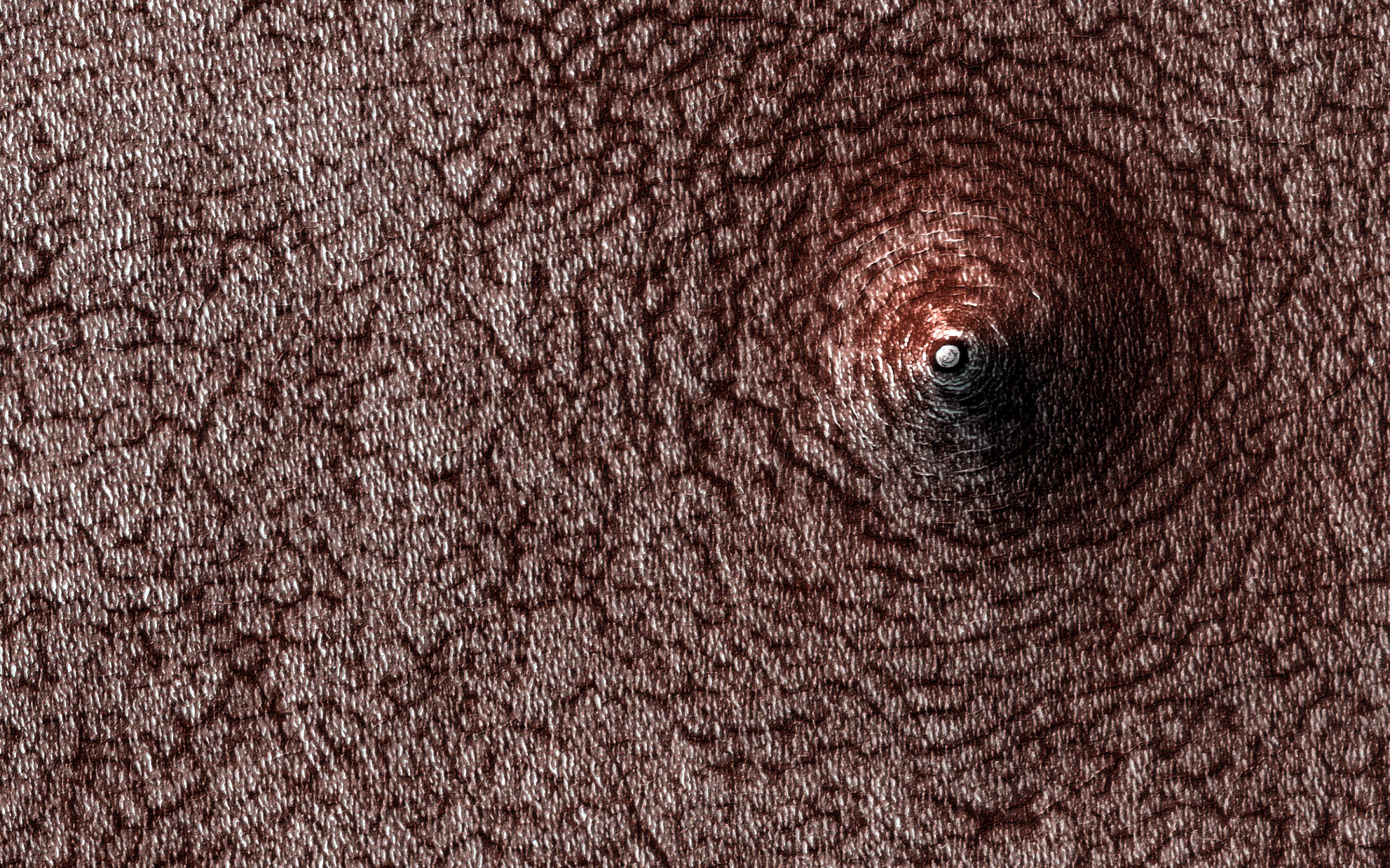
English: Mars - Collapse Pit - December 28, 2020 - uploaded April 27, 2021
PIA24614: Collapse Pit https://photojournal.jpl.nasa.gov/catalog/PIA24614 This image acquired on December 28, 2020 by NASA's Mars Reconnaissance Orbiter, shows a pit that has formed on the south polar layered deposits. Do you see a dome or a pit? Sometimes it is hard to tell! In this case, the answer is that we're looking at a pit, if the title didn't already give it away. Levity aside, we can tell this is a pit because we know what direction the sunlight is coming from and which side should be in shadow. This pit has formed on the south polar layered deposits. Why did it collapse? That is the real question to be answered. The map is projected here at a scale of 50 centimeters (19.7 inches) per pixel. (The original image scale is 49.6 centimeters [19.5 inches] per pixel [with 2 x 2 binning]; objects on the order of 149 centimeters [58.7 inches] across are resolved.) North is up. The University of Arizona, in Tucson, operates HiRISE, which was built by Ball Aerospace & Technologies Corp., in Boulder, Colorado. NASA's Jet Propulsion Laboratory, a division of Caltech in Pasadena, California, manages the Mars Reconnaissance Orbiter Project for NASA's Science Mission Directorate, Washington. |
| 日期 | |
| 来源 | https://photojournal.jpl.nasa.gov/jpeg/PIA24614.jpg |
| 作者 | NASA/JPL-Caltech/University of Arizona |
| 此标签不表示文件的著作权状态。任何文件在附有此标签的同時还需要一个有效的著作权标签。请参阅许可协议说明页面以了解更多信息。 其他语言:
العربية ∙ беларуская (тарашкевіца) ∙ български ∙ català ∙ čeština ∙ dansk ∙ Deutsch ∙ English ∙ español ∙ فارسی ∙ français ∙ galego ∙ magyar ∙ հայերեն ∙ Bahasa Indonesia ∙ italiano ∙ 日本語 ∙ македонски ∙ മലയാളം ∙ Nederlands ∙ polski ∙ português ∙ русский ∙ sicilianu ∙ slovenščina ∙ Türkçe ∙ українська ∙ 简体中文 ∙ 繁體中文 ∙ +/− |
许可协议
| Public domainPublic domainfalsefalse |
| 本文件完全由NASA创作,在美国属于公有领域。根据NASA的版权方针,NASA的材料除非另有声明否则不受版权保护。(参见Template:PD-USGov/zh、NASA版权方针页面或JPL图片使用方针。) | ||
 |
警告:
|

|
根据最有价值图像标准,这张图像被评定为在extraterrestrial collapse pits范畴内最有价值的共享资源图像。你可以在Commons:Valued image candidates/PIA24614-Mars-CollapsePit-20210427.jpg参看它的提名。 |
说明
此文件中描述的项目
描繪內容
28 12 2020
image/jpeg
文件历史
点击某个日期/时间查看对应时刻的文件。
| 日期/时间 | 缩略图 | 大小 | 用户 | 备注 | |
|---|---|---|---|---|---|
| 当前 | 2021年4月29日 (四) 11:51 | | 2,880 × 1,800(1.18 MB) | Drbogdan | Uploaded a work by NASA/JPL-Caltech/University of Arizona from https://photojournal.jpl.nasa.gov/jpeg/PIA24614.jpg with UploadWizard |
文件用途
以下页面使用本文件:
全域文件用途
以下其他wiki使用此文件:
- en.wikipedia.org上的用途