File:Map_of_Argentina_Demis.png
From Wikipedia, the free encyclopedia
Size of this preview: 317 × 600 pixels. Other resolutions: 127 × 240 pixels | 254 × 480 pixels | 727 × 1,375 pixels.
Original file (727 × 1,375 pixels, file size: 384 KB, MIME type: image/png)
| This is a file from the Wikimedia Commons. Information from its description page there is shown below. Commons is a freely licensed media file repository. You can help. |
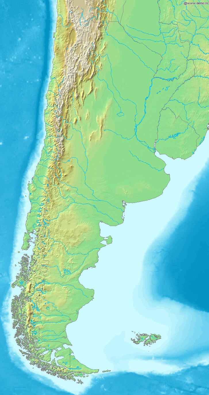
Map of Argentina
Bounding box West -77°, South -57°, East -52°, North -20°. Center at 38°30′00″S 64°30′00″W / 38.50000°S 64.50000°W / -38.50000; -64.50000.
| Public domainPublic domainfalsefalse |
This image is in the public domain because it came from the site https://www.demis.nl/products/web-map-server/examples/ and was released by the copyright holder. Permission is granted to copy, distribute and/or modify this map since it is based on free of copyright images from: www.demis.nl. See also approval email on de.wp and its clarification.
Deutsch | English | македонски | മലയാളം | Nederlands | slovenščina | +/− |
| Public domainPublic domainfalsefalse |
| This work has been released into the public domain by its copyright holder, www.demis.nl. This applies worldwide. In some countries this may not be legally possible; if so: www.demis.nl grants anyone the right to use this work for any purpose, without any conditions, unless such conditions are required by law. Public domainPublic domainfalsefalse |
Captions
Map of Argentina
Items portrayed in this file
depicts
File history
Click on a date/time to view the file as it appeared at that time.
| Date/Time | Thumbnail | Dimensions | User | Comment | |
|---|---|---|---|---|---|
| current | 19:46, 20 December 2006 | | 727 × 1,375 (384 KB) | Mats Halldin~commonswiki | Map of Argentina Bounding box West -77°, South -57°, East -52°, North -20°. Center at {{coor d|38.50000|S|64.50000|W|scale:22200000}}. {{demis-pd}} category:maps of Argentina |
File usage
The following pages on the English Wikipedia use this file (pages on other projects are not listed):
Global file usage
The following other wikis use this file:
- Usage on bs.wikipedia.org
- Usage on ca.wikipedia.org
- Usage on ckb.wikipedia.org
- Usage on cs.wikipedia.org
- Usage on eo.wikipedia.org
- Usage on es.wikipedia.org
- Usage on es.wikinews.org
- Usage on fa.wikipedia.org
- Usage on fi.wikipedia.org
- Usage on fr.wikipedia.org
- Usage on gl.wikipedia.org
- Usage on id.wikipedia.org
- Usage on ilo.wikipedia.org
- Usage on is.wikipedia.org
- Usage on it.wikipedia.org
- Usage on ja.wikipedia.org
- Usage on ka.wikipedia.org
- Usage on la.wikipedia.org
- Usage on mk.wikipedia.org
- Usage on mr.wikipedia.org
- Usage on nl.wikipedia.org
- Usage on oc.wikipedia.org
- Usage on pa.wikipedia.org
- Usage on pnb.wikipedia.org
- Usage on pt.wikipedia.org
- Usage on ru.wikipedia.org
- Usage on sh.wikipedia.org
- Usage on sv.wikipedia.org
- Usage on uk.wikipedia.org
- Usage on ur.wikipedia.org
- Usage on vi.wikipedia.org
- Usage on xmf.wikipedia.org
- Usage on zh-min-nan.wikipedia.org
- Usage on zh.wikipedia.org
Metadata
This file contains additional information, probably added from the digital camera or scanner used to create or digitize it.
If the file has been modified from its original state, some details may not fully reflect the modified file.
| File change date and time | 19:43, 20 December 2006 |
|---|
Retrieved from "https://en.wikipedia.org/wiki/File:Map_of_Argentina_Demis.png"