File:Golan_location_map_2.PNG
From Wikipedia, the free encyclopedia
Size of this preview: 759 × 599 pixels. Other resolutions: 304 × 240 pixels | 608 × 480 pixels | 936 × 739 pixels.
Original file (936 × 739 pixels, file size: 140 KB, MIME type: image/png)
| This is a file from the Wikimedia Commons. Information from its description page there is shown below. Commons is a freely licensed media file repository. You can help. |
Summary
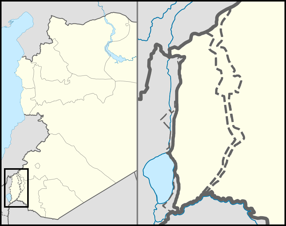
| DescriptionGolan location map 2.PNG |
English: Location map of the Golan Heights. |
| Date | |
| Source | |
| Author | |
| Permission (Reusing this file) |
Creative Commons Attribution-Share Alike 3.0 Unported |
| Other versions | File:Golan location map 3.PNG |
Licensing
This file is licensed under the Creative Commons Attribution 3.0 Unported license.
- You are free:
- to share – to copy, distribute and transmit the work
- to remix – to adapt the work
- Under the following conditions:
- attribution – You must give appropriate credit, provide a link to the license, and indicate if changes were made. You may do so in any reasonable manner, but not in any way that suggests the licensor endorses you or your use.
Captions
Add a one-line explanation of what this file represents
Items portrayed in this file
depicts
19 October 2010
File history
Click on a date/time to view the file as it appeared at that time.
| Date/Time | Thumbnail | Dimensions | User | Comment | |
|---|---|---|---|---|---|
| current | 23:07, 30 October 2012 | | 936 × 739 (140 KB) | LtPowers | Reverted to version as of 21:06, 10 November 2011 |
| 19:19, 30 October 2012 |  | 925 × 739 (146 KB) | HonorTheKing | Reverted to version as of 19:37, 10 November 2011 | |
| 21:06, 10 November 2011 |  | 936 × 739 (140 KB) | LtPowers | Reverted to version as of 18:51, 10 November 2011 | |
| 19:37, 10 November 2011 |  | 925 × 739 (146 KB) | Jiujitsuguy | Please see talk. Attempt to improve to NPOV showing territory belonging to neither side | |
| 18:51, 10 November 2011 |  | 936 × 739 (140 KB) | Nableezy | restore | |
| 18:07, 10 November 2011 |  | 925 × 739 (146 KB) | Chesdovi | "a disputed territory may not be presented in a way that supports one of the sides to the conflict" | |
| 17:00, 10 November 2011 |  | 936 × 739 (140 KB) | Nableezy | restore | |
| 10:36, 10 November 2011 |  | 925 × 739 (146 KB) | Biosketch | The image is displayed throughout Wikipedia and should be used to force a POV.. | |
| 04:17, 10 November 2011 |  | 936 × 739 (140 KB) | Supreme Deliciousness | Restore neutral map. | |
| 03:33, 10 November 2011 |  | 925 × 739 (146 KB) | Jiujitsuguy | Consistent with NPOV showing Heights controlled by neither side |
File usage
The following pages on the English Wikipedia use this file (pages on other projects are not listed):
- 'Ayn Fit
- Afik
- Al-'Al
- Al-Ahmadiyah
- Al-Rafid, Syria
- Alonei HaBashan
- Ani'am
- Avnei Eitan
- Banias
- Bariqa
- Beer Ajam
- Bethsaida
- Bnei Yehuda, Golan Heights
- Buq'ata
- Ed-Dikke synagogue
- Ein Qiniyye
- Ein Zivan
- El Rom
- Gamla
- Geshur, Golan Heights
- Ghajar
- Givat Yoav
- Had Ness
- Haspin
- Jubata ez-Zeit
- Kafr Naffakh
- Kanaf
- Katzrin ancient village and synagogue
- Kela Alon
- Keshet, Golan Heights
- Kfar Haruv
- Khishniyah
- Kidmat Tzvi
- Ma'ale Gamla
- Madinat al-Baath
- Mas'ade
- Merom Golan
- Metzar
- Mevo Hama
- Mount Bental/Tal Al-Gharam
- Mount Hermon
- Mount Hermon ski resort
- Mount Hermonit
- Mount Peres
- Natur (Israeli settlement)
- Neot Golan
- Neve Ativ
- Nimrod, Golan Heights
- Nimrod Castle
- Nov, Golan Heights
- Odem
- Ortal, Golan Heights
- Quneitra
- Ramat Magshimim
- Ramot, Golan Heights
- Rujm el-Hiri
- Saham al-Jawlan
- Sha'al
- Shayta
- Tal Saki
- Tell Hadar
- Third Battle of Mount Hermon
- Trump Heights
- Umm el-Qanatir
- Yonatan, Golan Heights
- Talk:Gamla
- Module:Location map/data/Syria Golan
- Module:Location map/data/Syria Golan/doc
Global file usage
The following other wikis use this file:
- Usage on ar.wikipedia.org
- Usage on arz.wikipedia.org
- Usage on ba.wikipedia.org
- Usage on ca.wikipedia.org
- Usage on ceb.wikipedia.org
- Usage on ckb.wikipedia.org
- Usage on da.wikipedia.org
- Usage on de.wikipedia.org
- Usage on eu.wikipedia.org
- Usage on fa.wikipedia.org
- Usage on fr.wikipedia.org
- Usage on id.wikipedia.org
- Usage on kn.wikipedia.org
- Usage on nn.wikipedia.org
- Usage on pt.wikipedia.org
- Usage on ro.wikipedia.org
- Usage on ru.wikipedia.org
View more global usage of this file.
Metadata
This file contains additional information, probably added from the digital camera or scanner used to create or digitize it.
If the file has been modified from its original state, some details may not fully reflect the modified file.
| Horizontal resolution | 35.43 dpc |
|---|---|
| Vertical resolution | 35.43 dpc |
| Software used |
Retrieved from "https://en.wikipedia.org/wiki/File:Golan_location_map_2.PNG"